Hatfield

Log in to your account

AroundUs is a community-driven map of interesting places, built by curious explorers like you. It grows with every review, story, and photo you share.
Connect to save your favorite spots, contribute locations, and create personalized routes.
Continue with Google
Continue with Apple
Continue with X
Continue with Facebook
Continue with email
By continuing, you accept our Terms and Conditions and our Privacy Policy
Create an account
Add to collection
Map
Suggest a change
Share

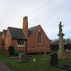
Hatfield, Administrative division in Doncaster, England

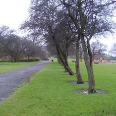
Hatfield is an administrative division in Doncaster that sits on gravel terrain surrounded by former peatland. The M18 motorway cuts through the area, connecting Yorkshire to Lincolnshire.

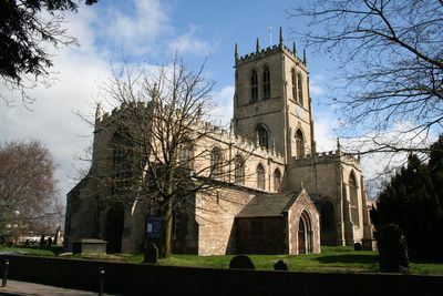
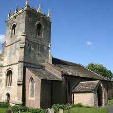
A major conflict in 633 AD reshaped the region's political landscape when rival powers clashed for control. Later, 17th-century drainage projects transformed the waterlogged terrain into productive farmland.

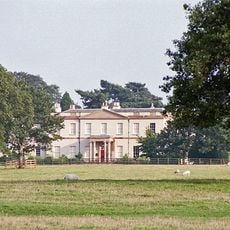
The Travis Trust, founded in 1710, supported local children's education through a substantial land endowment in the region. This charitable institution shaped the community's social fabric for generations.

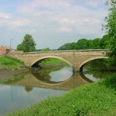
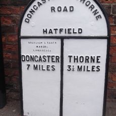
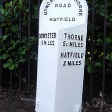
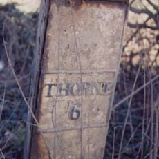
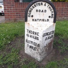
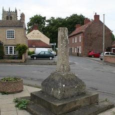
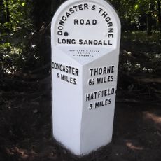
The area is accessible via the A18 road and a railway station with connections to nearby cities and towns. Its location at major transport junctions makes exploring the wider region straightforward.

A Dutch engineer oversaw an ambitious drainage scheme in the early 1600s that converted vast swampland into farmland. This transformation altered both the landscape and the economic opportunities of the entire area.

Location: Doncaster

GPS coordinates: 53.56167,-0.96827

Latest update: December 8, 2025 13:43

Photos
Around this place
Yorkshire Wildlife Park
United Kingdom

Yorkshire Wildlife Park

8 km
The Trolleybus Museum at Sandtoft
United Kingdom

The Trolleybus Museum at Sandtoft

6.5 km
Cantley Hall
United Kingdom

Cantley Hall

8.2 km
Church of St Wilfrid
United Kingdom

Church of St Wilfrid

9.1 km
St Oswald's Church, Kirk Sandall
United Kingdom

St Oswald's Church, Kirk Sandall

7.5 km
Sandall Park
United Kingdom

Sandall Park

8.2 km
Church of St Lawrence
United Kingdom

Church of St Lawrence

2.8 km
Belshaw
United Kingdom

Belshaw

8.6 km
The Trolleybus Museum
United Kingdom

The Trolleybus Museum

6.4 km
Thorne Memorial Park Miniature Railway
United Kingdom

Thorne Memorial Park Miniature Railway

5.2 km
Church of Holy Trinity and St Oswald
United Kingdom

Church of Holy Trinity and St Oswald

8.7 km
Church of St Cuthbert
United Kingdom

Church of St Cuthbert

6.1 km
Church of St Mary
United Kingdom

Church of St Mary

6.8 km
Church of St Nicholas
United Kingdom

Church of St Nicholas

5.6 km
Church of St Peter and St Paul
United Kingdom

Church of St Peter and St Paul

7.3 km
Church of St Mary
United Kingdom

Church of St Mary

7.6 km
War Memorial Immediately to East of Chapel at Stainforth Cemetery
United Kingdom

War Memorial Immediately to East of Chapel at Stainforth Cemetery

5.6 km
Stainforth Bridge
United Kingdom

Stainforth Bridge

6.2 km
Milepost Approximately 30 Metres To North Of Entrance To Hatfield Manor House
United Kingdom

Milepost Approximately 30 Metres To North Of Entrance To Hatfield Manor House

2.7 km
Coachhouse Immediately To South West Of Hatfield House Farmhouse
United Kingdom

Coachhouse Immediately To South West Of Hatfield House Farmhouse

2.7 km
Milepost Approximately 40 Metres To West Of Entrance To Wyndthorpe Hall
United Kingdom

Milepost Approximately 40 Metres To West Of Entrance To Wyndthorpe Hall

4.5 km
Wayside cross on Trundle Lane
United Kingdom

Wayside cross on Trundle Lane

6.6 km
Milepost To East Of Gatewood End Farm At Se 67830485
United Kingdom

Milepost To East Of Gatewood End Farm At Se 67830485

2.9 km
Milepost 30 Metres North Of Stonehaven
United Kingdom

Milepost 30 Metres North Of Stonehaven

6.1 km
Milepost Approximately 30 Metres To North East Of Mile End Avenue
United Kingdom

Milepost Approximately 30 Metres To North East Of Mile End Avenue

3.2 km
Wayside cross on Pinfold Lane
United Kingdom

Wayside cross on Pinfold Lane

6.2 km
Milestone, N of Hatfield Woodhouse
United Kingdom

Milestone, N of Hatfield Woodhouse

1.5 km
Milestone, Thorne Road, W of TI jct with Armthorpe Lane, Hatfield Lane
United Kingdom

Milestone, Thorne Road, W of TI jct with Armthorpe Lane, Hatfield Lane

6.1 km
Show the full map
Reviews

Visited this place? Tap the stars to rate it and share your experience / photos with the community! Try now! You can cancel it anytime.

« Hatfield - Administrative division in Doncaster, England » is provided by Around Us (aroundus.com). Images and texts are derived from Wikimedia project under a Creative Commons license. You are allowed to copy, distribute, and modify copies of this page, under the conditions set by the license, as long as this note is clearly visible.

Discover hidden gems everywhere you go!

From secret cafés to breathtaking viewpoints, skip the crowded tourist spots and find places that match your style. Our app makes it easy with voice search, smart filtering, route optimization, and insider tips from travelers worldwide. Download now for the complete mobile experience.

Around Us App Screenshot

A unique approach to discovering new places

Le Figaro

All the places worth exploring

France Info

A tailor-made excursion in just a few clicks

20 Minutes