Enable Location

We need your location to show you interesting places around you

Discover nearby places

Find interesting locations and hidden gems around you

Precise directions

Get accurate directions and distances to places

Your location is never shared with other users. It's only used when you tap the location button.

Tintagel Parish Church

Log in to your account

Start exploring — it's free

Trusted by 61,561 travelers worldwide

Continue with Google
Continue with Apple
or

We will send you a code to connect

By continuing, you accept our Terms and Conditions and our Privacy Policy

Check your inbox

We've sent a pincode in your inbox. Please enter the code below.

Tintagel Parish Church

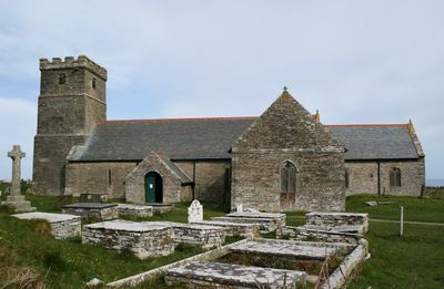
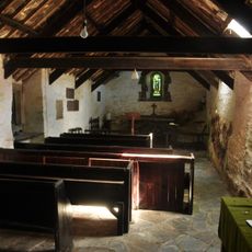
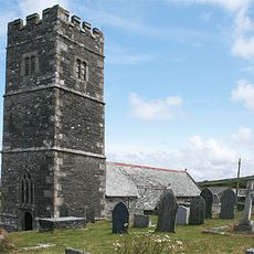
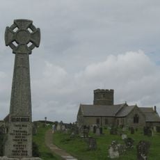
Tintagel Parish Church, Norman parish church on coastal cliffs in Tintagel, England

Description

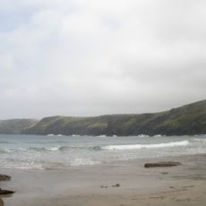
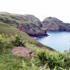
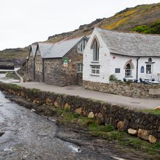
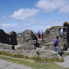
St Materiana's Church is a Norman parish church perched on high cliffs between Trevena village and Tintagel Castle, featuring Norman doorways and a 14th-century tower topped with battlements. The building offers views across the rugged coastline and preserves burial records dating back to 1546.

History

A religious site first stood here in the 6th century, while the current building dates from the late 11th century and displays Norman features. The tower was later rebuilt in the 14th century with additional Gothic details.

Culture

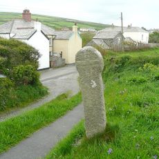
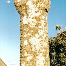
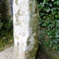
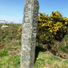
The church holds a Roman milestone from the reign of Emperor Licinius, discovered in 1889 during restoration work on the churchyard gate and now displayed in the south transept.

Practical

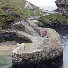
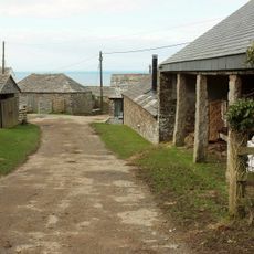
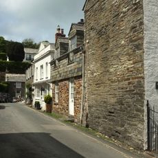
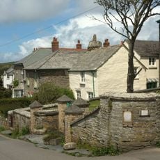
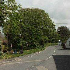
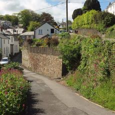
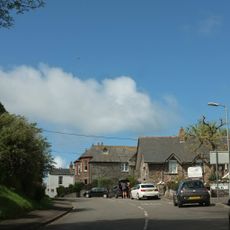
Access to the church follows a path from Tintagel village across open ground, requiring sturdy footwear due to the terrain. The building is open to visitors on most days, and visitors should be prepared for windy conditions given its exposed clifftop location.

Did you know?

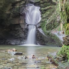
The churchyard holds a medieval brass memorial from 1430 for Joan Kelly and preserves a lifebuoy from the 1893 barque Iota shipwreck. This unexpected blend of religious and maritime history reflects the dramatic role the coastline has played in the community.

Location
Inception
11 century
Architectural style
Norman architecture
GPS coordinates
50.66300,-4.75970
Latest update
December 10, 2025 20:09

AroundUs brings together thousands of curated places, local tips, and hidden gems, enriched daily by 60,000 contributors worldwide. Discover all places nearby (Tintagel).

Around this place
Gallos
United Kingdom

Gallos

701 m
Tintagel Old Post Office
United Kingdom

Tintagel Old Post Office

562 m
King Arthur's Hall, Tintagel
United Kingdom

King Arthur's Hall, Tintagel

624 m
St Nectan's Kieve
United Kingdom

St Nectan's Kieve

3.1 km
Bossiney Haven
United Kingdom

Bossiney Haven

2 km
St Piran's Chapel
United Kingdom

St Piran's Chapel

2.7 km
Lye Cove
United Kingdom

Lye Cove

1.8 km
Church of St Petroc, Trevalga
United Kingdom

Church of St Petroc, Trevalga

3.4 km
Church of St John
United Kingdom

Church of St John

4.7 km
Church of St Symphorian
United Kingdom

Church of St Symphorian

5.1 km
King Arthur's Castle Hotel
United Kingdom

King Arthur's Castle Hotel

655 m
Tintagel Cross War Memorial
United Kingdom

Tintagel Cross War Memorial

135 m
South Harbour Pier, Quay And Walls On South West Side Of Harbour
United Kingdom

South Harbour Pier, Quay And Walls On South West Side Of Harbour

5.4 km
Rock art at Rocky Valley, 150m north of Trevillett Mill
United Kingdom

Rock art at Rocky Valley, 150m north of Trevillett Mill

2.4 km
Trevena Cross
United Kingdom

Trevena Cross

699 m
Pixie Shop
United Kingdom

Pixie Shop

5.5 km
Barn With Waterwheel And Attached Row Of Shippons Or Stables To North East Of Tregardock Farmhouse
United Kingdom

Barn With Waterwheel And Attached Row Of Shippons Or Stables To North East Of Tregardock Farmhouse

4.6 km
Forrabury Cross, 40m SSW of Forrabury church
United Kingdom

Forrabury Cross, 40m SSW of Forrabury church

5.1 km
Trevalga Cross in Trevalga churchyard
United Kingdom

Trevalga Cross in Trevalga churchyard

3.4 km
St Hugh
United Kingdom

St Hugh

5.3 km
Roman Inscribed Stone 1m South Of St Piran's
United Kingdom

Roman Inscribed Stone 1m South Of St Piran's

2.7 km
Penally Terrace
United Kingdom

Penally Terrace

5.5 km
The Glen
United Kingdom

The Glen

5.4 km
Heigh Ho
United Kingdom

Heigh Ho

5.4 km
Pillar House
United Kingdom

Pillar House

5.3 km
Barn Park
United Kingdom

Barn Park

5.1 km
Guidepost 830 Metres To North Of Condolden  Guidepost 830 Metres To North Of Condolden At Sx 091876
United Kingdom

Guidepost 830 Metres To North Of Condolden Guidepost 830 Metres To North Of Condolden At Sx 091876

4.1 km
Romano-British and early medieval settlement, medieval church, castle and associated features on Tintagel Island and adjoining m
United Kingdom

Romano-British and early medieval settlement, medieval church, castle and associated features on Tintagel Island and adjoining m

635 m
Show the full map
« Tintagel Parish Church - Norman parish church on coastal cliffs in Tintagel, England » is provided by Around Us (aroundus.com). Images and texts are derived from Wikimedia project under a Creative Commons license. You are allowed to copy, distribute, and modify copies of this page, under the conditions set by the license, as long as this note is clearly visible.

Discover hidden gems everywhere you go!

From secret cafés to breathtaking viewpoints, skip the crowded tourist spots and find places that match your style. Our app makes it easy with voice search, smart filtering, route optimization, and insider tips from travelers worldwide. Download now for the complete mobile experience.

Around Us App Screenshot

A unique approach to discovering new places

Le Figaro

All the places worth exploring

France Info

A tailor-made excursion in just a few clicks

20 Minutes

Around Us
Travel Guide & Maps
Download

Send to your phone

QR Code
1

Open the camera app on your mobile.

2

Point at the QR code with your camera. A notification will appear.

3

Tap the notification to open the link.