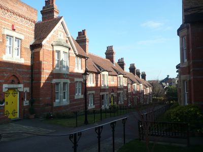
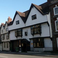
Vachel Almshouses, Grade II listed almshouse in Reading, England
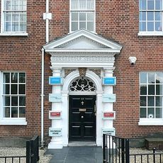
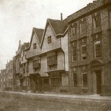
Vachel Almshouses is a two-story residential complex located on Castle Street, constructed with red brick in a traditional style that accommodates multiple households. The building displays practical Victorian architecture designed for efficient community housing.
Sir Thomas Vachel founded these residences in 1634 and allocated funds for their ongoing maintenance, establishing a charitable legacy. The current building was reconstructed in 1867 at its present location after the original land was sold.
These residences reflect a long-standing British practice of charitable individuals creating homes for those needing support, woven into the fabric of community care. Today the building stands as a reminder of how private generosity shaped local social structures.
The building is located on Castle Street in Reading and is accessible on foot from the town center. The spaces are compact and functional throughout, managed by a local charitable trust dedicated to maintaining these properties.
A plaque on the building marks its founding in 1634 and commemorates Sir Thomas Vachel's decision to fund care for six impoverished men in perpetuity. This inscription reveals a personal act of charity that extended across generations.
The community of curious travelers
AroundUs brings together thousands of curated places, local tips, and hidden gems, enriched daily by 60,000 contributors worldwide.