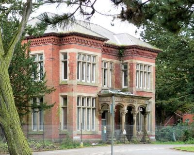
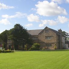
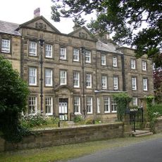
Whittingham Hospital, former hospital in Lancashire, England
Whittingham Hospital is a former psychiatric institution in Whittingham near Preston, Lancashire, composed of several large red-brick buildings from the late 1800s. The site once included long connecting corridors between ward blocks, a railway station, cemeteries, chapels, and farm areas spread across open countryside.
The hospital opened in 1873 to house people with mental illness from across Lancashire and grew over decades with added wards and sanatoriums to become one of the largest psychiatric facilities in Britain. Parts of the site served wounded soldiers during both world wars before the hospital closed permanently in 1995 and was prepared for housing development.
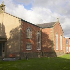
The site lies between several small villages near Preston and is mainly reached by rural roads. Most of the original buildings have been demolished or redeveloped, so access to the historic structures is limited and mainly residential streets now occupy the area.
Staff members built a working EEG machine from leftover wartime materials in the late 1940s, which was used for brain research on patients. The site also had its own railway station from 1887 into the 1950s that transported supplies and briefly carried passenger trains.
Location: Whittingham
Inception: April 1, 1873
Address: Unnamed Road, Preston, PR3 2JH, Preston PR3 2JE, UK
GPS coordinates: 53.81700,-2.65800
Latest update: December 4, 2025 13:03
Chingle Hall
1.1 km
St Mary's Church
2.2 km
St Mary's Church, Goosnargh
1.4 km
The Grapes Inn
1.3 kmChurch of St John In Grounds Of Whittingham Hospital
337 mBase Of Preaching Cross Circa 7 Metres South Of Chancel Of Church Of St Mary
1.4 km
Bushells Arms
1.3 km
Haighton Manor
890 m
Stump Cross
1.7 kmPigot House
1.8 kmSudell House Farmhouse
1.1 km
Bushells Hospital
1.3 kmWhittingham Hall
590 mHaighton Hall Farmhouse
1 kmChingle Hall moated site
1.1 kmSeamark Farmhouse
1.7 kmOutbuilding Circa 30 Metres North Of Clarkson's Fold Farm
1.9 kmSundial Circa 10 Metres South Of Church Of St Mary
1.4 kmGoosnargh (Oliverson's) Ce School
1.4 kmDixons Farmhouse
1.9 kmHaighton House
2 kmBuilding Immediately North West Of North West Corner Of Church House Farmhouse
1.2 kmBarn Circa 30 Metres North Of Haighton Hall Farmhouse
996 mBack Lane Farmhouse And Adjoining Barn
1.2 kmBase Of Wayside Cross In Hedge On West Side Of Lane
1.9 kmEaves Green Farmhouse And Wall Enclosing Front Garden
1.8 kmObelisk In Garden Circ 20 Metres West Of Bushell's Hospital
1.3 kmBottoms Farmhouse
2.1 kmVisited this place? Tap the stars to rate it and share your experience / photos with the community! Try now! You can cancel it anytime.
Discover hidden gems everywhere you go!
From secret cafés to breathtaking viewpoints, skip the crowded tourist spots and find places that match your style. Our app makes it easy with voice search, smart filtering, route optimization, and insider tips from travelers worldwide. Download now for the complete mobile experience.
A unique approach to discovering new places❞
— Le Figaro
All the places worth exploring❞
— France Info
A tailor-made excursion in just a few clicks❞
— 20 Minutes