Tinto, Mountain summit and scenic viewpoint in South Lanarkshire, Great Britain.
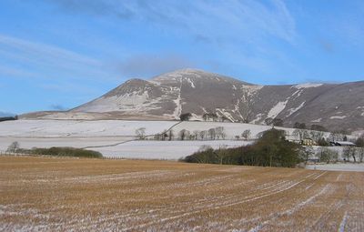
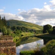
Tinto is a 711-meter-high mountain in the Southern Uplands with a distinctive shape visible from surrounding valleys and hills. The peak rises prominently above the landscape and offers access through established routes from the northern approach.
The mountain took shape around 420 million years ago during the Caledonian period when landmasses collided and shaped the landscape. This ancient geological event left its mark on the entire region's structure.
Local hiking groups regularly meet at this summit for walks and outdoor activities, making it a gathering place for the community. The mountain has become woven into the rhythm of outdoor life in the region.
The northern approach starts from a car park near M74 junction 13, with a well-maintained path leading directly to the summit. The route is straightforward and accessible for visitors of various skill levels.
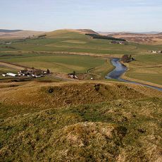
A large stone cairn marks the summit and provides unobstructed views across the Clyde Valley toward the Culter Hills on clear days. This feature has made it a favored spot for photographers and those seeking wide vistas.
The community of curious travelers
AroundUs brings together thousands of curated places, local tips, and hidden gems, enriched daily by 60,000 contributors worldwide.