Enable Location

We need your location to show you interesting places around you

Discover nearby places

Find interesting locations and hidden gems around you

Precise directions

Get accurate directions and distances to places

Your location is never shared with other users. It's only used when you tap the location button.

Sound Heath

Log in to your account

Start exploring — it's free

Trusted by 61,654 travelers worldwide

Continue with Google
Continue with Apple
or

We will send you a code to connect

By continuing, you accept our Terms and Conditions and our Privacy Policy

Check your inbox

We've sent a pincode in your inbox. Please enter the code below.

Sound Heath, Common land and nature reserve in Sound, England.

Description

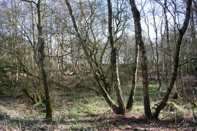
Sound Heath is a nature reserve spanning about 8 square kilometers with heathland, grassland, scrub, and woodland areas interspersed with several ponds and small water features. The site forms a mosaic of different habitat types, each supporting its own plant and animal communities.

History

The site gained formal protection in 1959 when local authorities implemented regulations based on the Commons Act of 1899. This designation followed a period when England was securing many natural areas for long-term conservation.

Culture

This common land represents a working example of shared English land management, where different habitat zones are openly accessible to visitors. The site demonstrates how traditional forms of community ownership continue to function in the modern landscape.

Practical

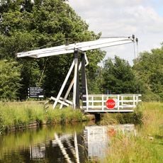
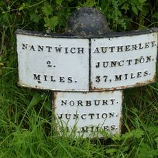
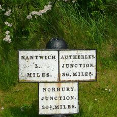
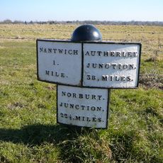
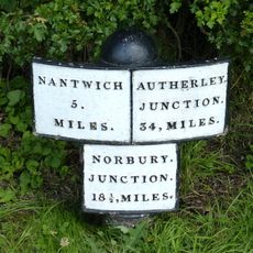
The site is accessible via minor roads and footpaths, located roughly 8 kilometers southwest of Nantwich. Different habitat areas have varying ground conditions, with wetter sections requiring extra care during winter months.

Did you know?

The wetland areas support rare species including bog St John's-wort, floating club rush, and the Enochrus isotae water beetle. Visitors interested in unusual plants and insects can encounter species that are scarce or absent in most other English reserves.

Location
GPS coordinates
53.02700,-2.56700
Latest update
December 14, 2025 14:42

AroundUs brings together thousands of curated places, local tips, and hidden gems, enriched daily by 60,000 contributors worldwide. Discover all places nearby (Sound).

Around this place
St Michael's Church, Baddiley
United Kingdom

St Michael's Church, Baddiley

2.9 km
St Margaret's Church
United Kingdom

St Margaret's Church

2.7 km
Hack Green Secret Nuclear Bunker
United Kingdom

Hack Green Secret Nuclear Bunker

2.4 km
Baddiley Hall
United Kingdom

Baddiley Hall

2.9 km
Baddington Lane Bridge No.88
United Kingdom

Baddington Lane Bridge No.88

2.5 km
Shropshire Union Canal Main Line. Edleston Bridge Number 89
United Kingdom

Shropshire Union Canal Main Line. Edleston Bridge Number 89

3.3 km
Green Lane Bridge Number 90
United Kingdom

Green Lane Bridge Number 90

3.9 km
Burrows Bridge No.85
United Kingdom

Burrows Bridge No.85

2.2 km
Wrenbury wooden lifting bridge
United Kingdom

Wrenbury wooden lifting bridge

3.1 km
Bennetts Bridge (No 80) At SJ652452
United Kingdom

Bennetts Bridge (No 80) At SJ652452

4.2 km
Mickley Bridge No.84
United Kingdom

Mickley Bridge No.84

2.6 km
Wrenbury Church Bridge
United Kingdom

Wrenbury Church Bridge

2.6 km
Milepost c 175m south of Mickley Bridge (No. 84)
United Kingdom

Milepost c 175m south of Mickley Bridge (No. 84)

2.8 km
Baddiley Lock Number 2
United Kingdom

Baddiley Lock Number 2

2.1 km
Baddiley Lock Number 3
United Kingdom

Baddiley Lock Number 3

2.4 km
Milepost c 100m north of Baddington Lane Bridge
United Kingdom

Milepost c 100m north of Baddington Lane Bridge

2.6 km
Canal mile post 30m north of Hack Green Bridge
United Kingdom

Canal mile post 30m north of Hack Green Bridge

2.1 km
Wrenbury Frith Bridge
United Kingdom

Wrenbury Frith Bridge

3.6 km
Hawk House
United Kingdom

Hawk House

2.6 km
Hack Green Lock No.2
United Kingdom

Hack Green Lock No.2

2.1 km
Shropshire Union canal milepost circa 75 metres south of Marsh Lane Bridge (Number 91) At Sj 641 515
United Kingdom

Shropshire Union canal milepost circa 75 metres south of Marsh Lane Bridge (Number 91) At Sj 641 515

4.2 km
Hack Green Bridge No.86
United Kingdom

Hack Green Bridge No.86

2.1 km
Hack Green Lock No.1
United Kingdom

Hack Green Lock No.1

2.1 km
Baddiley Lock Number 1
United Kingdom

Baddiley Lock Number 1

1.9 km
Church House Farmhouse
United Kingdom

Church House Farmhouse

4 km
Milepost Circa 230 Metres North Of Bennett's Bridge (No 80) At Sj 652 455
United Kingdom

Milepost Circa 230 Metres North Of Bennett's Bridge (No 80) At Sj 652 455

3.9 km
Elm House
United Kingdom

Elm House

2.7 km
Milepost, Sound; N of Sound School
United Kingdom

Milepost, Sound; N of Sound School

970 m
Show the full map
« Sound Heath - Common land and nature reserve in Sound, England » is provided by Around Us (aroundus.com). Images and texts are derived from Wikimedia project under a Creative Commons license. You are allowed to copy, distribute, and modify copies of this page, under the conditions set by the license, as long as this note is clearly visible.

Discover hidden gems everywhere you go!

From secret cafés to breathtaking viewpoints, skip the crowded tourist spots and find places that match your style. Our app makes it easy with voice search, smart filtering, route optimization, and insider tips from travelers worldwide. Download now for the complete mobile experience.

Around Us App Screenshot

A unique approach to discovering new places

Le Figaro

All the places worth exploring

France Info

A tailor-made excursion in just a few clicks

20 Minutes

Around Us
Travel Guide & Maps
Download

Send to your phone

QR Code
1

Open the camera app on your mobile.

2

Point at the QR code with your camera. A notification will appear.

3

Tap the notification to open the link.