Town Moor, Urban grassland in Newcastle upon Tyne, United Kingdom.
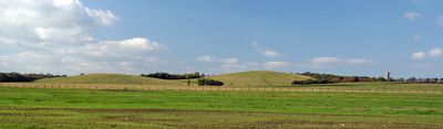
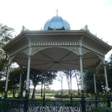
Town Moor is an open grassland spanning 1,000 acres, extending from Spital Tongues and the city center to the Gosforth and Jesmond areas. The space features wide-open terrain with paths and connections to nearby neighborhoods at several points.
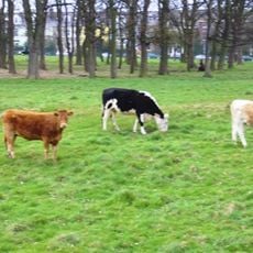
The land has maintained grazing rights for the Freemen of Newcastle since the 12th century, with rental income managed by the Town Moor Money Charity. This centuries-old arrangement continues to shape how the land is governed and used today.
Every June, the land transforms into the site of The Hoppings, Europe's largest traveling fair. This annual event shapes the city's summer calendar and draws visitors from across the region.
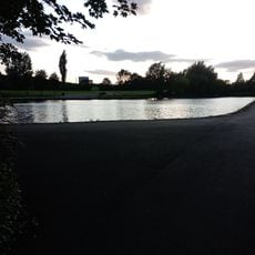
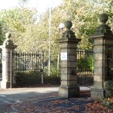
Access is available from multiple entry points that connect the moor to nearby residential areas. The space works for running, cycling, and outdoor activities year-round with plenty of room and open paths.
The land surpasses the combined size of London's Hyde Park and Hampstead Heath, as well as New York's Central Park. This extraordinary scale makes it one of Britain's most expansive open spaces.
Location: Newcastle upon Tyne
GPS coordinates: 54.99036,-1.62320
Latest update: December 8, 2025 19:53
Exhibition Park
742 m
Castle Leazes
890 m
Jesmond Synagogue
1.2 km
Holy Name parish, Jesmond
1.3 km
Jesmond Library
1.1 km
Jesmond Church Of St Hilda
1 km
Church of St George
1.4 km
8-13, Brandling Park
1.1 km
Sunday School Attached To Church Of St Hilda
994 m
Akhurst School (Jesmond Cottage) And Gas Lamp At Door
1.5 km
Fleming Memorial Hospital
860 m
21, Brandling Park
998 m
33, Brandling Park
954 m
The Former Phillipson Memorial Orphanage At Princess Mary Maternity Hospital
825 m
Lodge To South Of Fleming Memorial Hospital
874 m
Bandstand In Exhibition Park
908 m
Town Moor Boundary Stone Opposite Number 73
1.1 km
Pillar Box North Of Number 4
1.3 km
Palace of Arts
614 m
Gates And Gate Piers To South Of Fleming Memorial Hospital
862 m
Wall In Front Of Number 33
936 m
34-46, Brandling Place South
1.1 km
Drinking Fountain At Corner Of Clayton Road
856 m
Jesmond United Reformed Church
995 m
Boundary Mark In Wall At Junction With South Side Of Moorfield
1.3 km
2, The Drive
1.1 km
22-28, Brandling Place South
1 km
31, 32 And 33, Brandling Place South
1.1 kmVisited this place? Tap the stars to rate it and share your experience / photos with the community! Try now! You can cancel it anytime.
Discover hidden gems everywhere you go!
From secret cafés to breathtaking viewpoints, skip the crowded tourist spots and find places that match your style. Our app makes it easy with voice search, smart filtering, route optimization, and insider tips from travelers worldwide. Download now for the complete mobile experience.
A unique approach to discovering new places❞
— Le Figaro
All the places worth exploring❞
— France Info
A tailor-made excursion in just a few clicks❞
— 20 Minutes