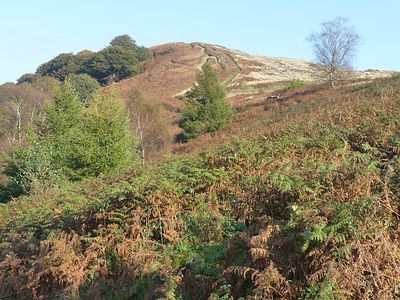
Mynydd Machen, Mountain summit in Caerphilly County Borough, Wales.
Mynydd Machen is a hilltop in Wales rising to 362 meters, with a distinctive survey point and transmitter mast crowning its peak. These structures mark the southeastern boundary of South Wales and are visible from surrounding areas.
The mountain was shaped during the Carboniferous Period with steeply tilted rock strata containing coal deposits. These mineral resources drove the industrial growth of South Wales over many generations.
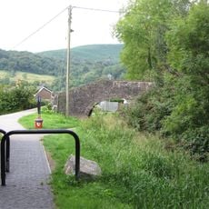
The mountain acts as a meeting point for different walking routes, including the Rhymney Valley Ridgeway Walk, linking communities through paths that have been used for generations. These trails bring people together across the Welsh landscape in a shared experience.
The summit can be reached via several footpaths, with parking areas near the transmitter mast and along the approach road. Visitors should prepare for changing ground conditions and bring suitable weather gear.
The rock formations display northeast-southwest aligned bands, including the Warwickshire Group and Pennant Sandstone Formation, creating a natural study site. This geological arrangement reveals layers that tell the story of ancient environmental changes.
Location: Wales
Location: Caerphilly County Borough
Elevation above the sea: 362 m
GPS coordinates: 51.60360,-3.12220
Latest update: December 14, 2025 12:24
Machen House
2 km
St Mary and St Mercurius Coptic Orthodox Church
1.7 km
Church of St Mary Risca
1.7 km
Risca Library
1.6 km
Bethany English Baptist Church and attached Sunday School
1.6 km
Moriah Baptist Church
1.6 km
St Michael's Church
2 km
Churchyard gates and piers to the Church of St Michael
2 km
Parkfield House
2 km
Former Risca Collieries Workmen's Institute
1.6 km
Palace Cinema
1.5 km
Machen Library
1.7 km
Canal Bridge over Monmouthshire and Brecon Canal by Moriah Hill
1.8 km
Railings and gate to Parkfield House
2 km
Jubilee Statue in Tredegar Grounds
1.6 km
War Memorial within Railed Enclosure
1.4 km
Canal Bridge over Monmouthshire and Brecon Canal W of Penrhiw
1.9 km
Canal Bridge over Monmouthshire and Brecon Canal at Darren Road
1.9 km
Former Penllwyn Tramroad Viaduct at Nine Mile Point
2.3 km
Entrance Gateway at Churchyard of St Mary Risca
1.7 km
The Old Post
2.1 km
Canal Bridge over Monmouthshire and Brecon Canal E of Cwmbyr
1.9 km
Gatepiers, gate and garden walls to Machen House
2.1 km
Corner House
2.1 km
Entrance to Tredegar Grounds
1.6 km
The Toll House
2.1 km
Garden walls to S, W and N of Nantygarth
2 km
Churchyard cross at the Church of St Michael
2 kmVisited this place? Tap the stars to rate it and share your experience / photos with the community! Try now! You can cancel it anytime.
Discover hidden gems everywhere you go!
From secret cafés to breathtaking viewpoints, skip the crowded tourist spots and find places that match your style. Our app makes it easy with voice search, smart filtering, route optimization, and insider tips from travelers worldwide. Download now for the complete mobile experience.
A unique approach to discovering new places❞
— Le Figaro
All the places worth exploring❞
— France Info
A tailor-made excursion in just a few clicks❞
— 20 Minutes