Mynydd Twyn-glas, Mountain summit in Caerphilly County Borough, United Kingdom
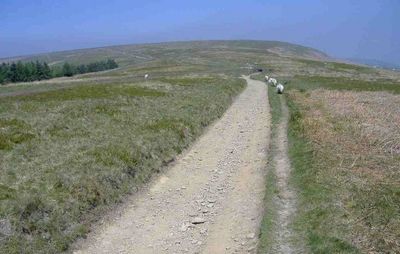
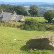
Mynydd Twyn-glas is a mountain in Caerphilly rising to about 472 meters with steep slopes covered by conifer forests and a broad summit plateau. The peak sits between two distinct knolls that are higher than the surveyor's marker at the top.
This peak formed during the late Carboniferous Period when coal seams were deposited along its eastern slopes. The geological processes that shaped it over millions of years remain visible in the rock and terrain you walk across today.
The Welsh name means 'hill of the blue knoll', reflecting how local communities named landmarks based on what they saw in the landscape. Walking across the summit reveals this connection between language and the physical features that surround you.
The hill is connected to neighboring towns by several public footpaths and is easily reached from surrounding areas. Watch for slippery slopes after rain and plan for changing weather conditions, as the summit can be exposed to strong winds.
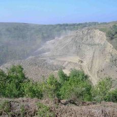
A significant landslip on the Mynydd Henllys side of the mountain shows the dynamic geological forces still shaping this place. This movement of earth beneath the surface reminds you that the land itself continues to shift and change over time.
Location: Caerphilly County Borough
Elevation above the sea: 472 m
GPS coordinates: 51.67420,-3.07160
Latest update: December 14, 2025 18:40
Pontypool Park
4 km
Griffithstown Railway Museum
4 km
Town Hall
3.7 km
Torfaen Museum
4 km
St Hilda's Church, Griffithstown
3.2 km
St. Alban's R.C. Church
3.9 km
Hafod quarry
3.5 km
Church of the Holy Trinity
3.1 km
Capel-llwyd
1.8 km
Upper Trosnant Baptist Church
3.6 km
Pontypool Library
3.8 km
Midland Bank
3.8 km
Canal Bridge No 47 on Monmouthshire and Brecon Canal
3.1 km
Bridge 53 at Pontymoile Basin, Monmouthshire and Brecon Canal
4 km
Canal Bridge at Coed-y-Gric
3.7 km
The George
3.8 km
The Greyhound PH
3.8 km
Old railway bridge at Coed-y-Gric
3.7 km
Barclay's Bank
3.8 km
Glyn Bran Farmhouse
1.6 km
Canal Tunnel between Sebastopol and Cwmbran, including attached revetment walls
2.8 km
Barn at Glyn Bran Farm
1.6 km
Outside kitchen at Glyn Bran Farm
1.6 km
Manchester House, including Mayberry Pharmacy and the Good Job Club
3.7 km
Old Market House (Second Thoughts)
3.8 km
Crane Street Baptist Chapel
3.8 km
Milepost on Monmouthshire and Brecon Canal
2.8 km
Tir-brychiad
3.3 kmVisited this place? Tap the stars to rate it and share your experience / photos with the community! Try now! You can cancel it anytime.
Discover hidden gems everywhere you go!
From secret cafés to breathtaking viewpoints, skip the crowded tourist spots and find places that match your style. Our app makes it easy with voice search, smart filtering, route optimization, and insider tips from travelers worldwide. Download now for the complete mobile experience.
A unique approach to discovering new places❞
— Le Figaro
All the places worth exploring❞
— France Info
A tailor-made excursion in just a few clicks❞
— 20 Minutes