Enable Location

We need your location to show you interesting places around you

Discover nearby places

Find interesting locations and hidden gems around you

Precise directions

Get accurate directions and distances to places

Your location is never shared with other users. It's only used when you tap the location button.

Castle Rings

Log in to your account

Start exploring — it's free

Trusted by 62,050 travelers worldwide

Continue with Google
Continue with Apple
or

We will send you a code to connect

By continuing, you accept our Terms and Conditions and our Privacy Policy

Check your inbox

We've sent a pincode in your inbox. Please enter the code below.

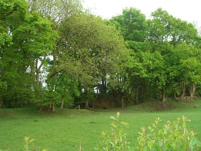
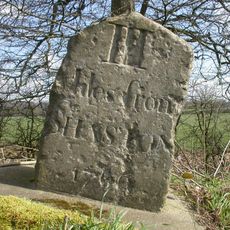
Castle Rings, Iron Age hillfort in Donhead St Mary, England.

Castle Rings is an Iron Age hillfort located on elevated sandstone ground in Donhead St Mary. The fort is enclosed by a single defensive bank and ditch that form its main structural elements.

The fort was built during the Iron Age and is now protected as a scheduled monument. Archaeological discoveries from the site have revealed evidence of settlement and activity from that period.

Metal detectorists discovered stater coins from the Durotriges tribe within the fort's confines during the 1980s, indicating ancient occupation patterns.

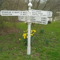
The site can be walked around to see the earthwork features from different angles. Visitors should wear sturdy footwear since the ground can become muddy depending on recent weather.

Ancient coins from the Durotriges tribe were discovered on the site during metal detecting activities. These finds show that people here participated in wider trade networks of the time.

The community of curious travelers

AroundUs brings together thousands of curated places, local tips, and hidden gems, enriched daily by 60,000 contributors worldwide.

Start exploring
Location
GPS coordinates
51.02506,-2.16151
Latest update
December 14, 2025 12:23
Around this place
Shute House
United Kingdom

Shute House

1.8 km
Shaftesbury Town Hall
United Kingdom

Shaftesbury Town Hall

3.3 km
Church of St Peter
United Kingdom

Church of St Peter

3.3 km
Church of St Andrew
United Kingdom

Church of St Andrew

2.7 km
Church of St Leonard
United Kingdom

Church of St Leonard

1.8 km
Church of St John the Baptist
United Kingdom

Church of St John the Baptist

2.9 km
Church of St Mary
United Kingdom

Church of St Mary

2 km
The Ship Inn
United Kingdom

The Ship Inn

3.3 km
Shaftsbury Congregational Church
United Kingdom

Shaftsbury Congregational Church

3.1 km
The Mitre Inn
United Kingdom

The Mitre Inn

3.3 km
Pender Monument In The Churchyard, About 10 Metres South Of The Church Of St Andrew
United Kingdom

Pender Monument In The Churchyard, About 10 Metres South Of The Church Of St Andrew

2.7 km
The Kings Arms Public House
United Kingdom

The Kings Arms Public House

3.3 km
Donhead House
United Kingdom

Donhead House

2.7 km
Entrance To Oldmarket Playhouse And Arts Centre
United Kingdom

Entrance To Oldmarket Playhouse And Arts Centre

3.2 km
Milestone About 200 Metres North Of Junction With Street Lane
United Kingdom

Milestone About 200 Metres North Of Junction With Street Lane

3.2 km
Mile Post Outside No 56
United Kingdom

Mile Post Outside No 56

3.1 km
King Alfred's Kitchen
United Kingdom

King Alfred's Kitchen

3.3 km
9, High Street
United Kingdom

9, High Street

3.3 km
Carpenters
United Kingdom

Carpenters

1.5 km
16, 18 And 18A, High Street
United Kingdom

16, 18 And 18A, High Street

3.3 km
The Old Parsonage
United Kingdom

The Old Parsonage

3.3 km
The Croft
United Kingdom

The Croft

2 km
Premises Occupied By The Midland Bank  The Butt Of Sherry Wine Bar
United Kingdom

Premises Occupied By The Midland Bank The Butt Of Sherry Wine Bar

3.3 km
Guide Post Opposite North West Entrance To Churchyard Of Church Of St Leonard
United Kingdom

Guide Post Opposite North West Entrance To Churchyard Of Church Of St Leonard

1.9 km
Milepost, Ludwell; E of village next to jcn Dennis Lane
United Kingdom

Milepost, Ludwell; E of village next to jcn Dennis Lane

3.3 km
Milepost Opposite Coombe Corner
United Kingdom

Milepost Opposite Coombe Corner

2.8 km
Milepost, Landsley Farm; 100m W entrance St Mary's School opp. Mile End Cottage
United Kingdom

Milepost, Landsley Farm; 100m W entrance St Mary's School opp. Mile End Cottage

2.8 km
Milestone, Semley Road, Shaftesbury; 30m N lay-by outside reservoir
United Kingdom

Milestone, Semley Road, Shaftesbury; 30m N lay-by outside reservoir

1.9 km
Show the full map
« Castle Rings - Iron Age hillfort in Donhead St Mary, England » is provided by Around Us (aroundus.com). Images and texts are derived from Wikimedia project under a Creative Commons license. You are allowed to copy, distribute, and modify copies of this page, under the conditions set by the license, as long as this note is clearly visible.

Discover hidden gems everywhere you go!

From secret cafés to breathtaking viewpoints, skip the crowded tourist spots and find places that match your style. Our app makes it easy with voice search, smart filtering, route optimization, and insider tips from travelers worldwide. Download now for the complete mobile experience.

Around Us App Screenshot

A unique approach to discovering new places

Le Figaro

All the places worth exploring

France Info

A tailor-made excursion in just a few clicks

20 Minutes

Around Us
Travel Guide & Maps
Download

Send to your phone

QR Code
1

Open the camera app on your mobile.

2

Point at the QR code with your camera. A notification will appear.

3

Tap the notification to open the link.