Sarre Windmill

Log in to your account

AroundUs is a community-driven map of interesting places, built by curious explorers like you. It grows with every review, story, and photo you share.
Connect to save your favorite spots, contribute locations, and create personalized routes.
Continue with Google
Continue with Apple
Continue with X
Continue with Facebook
Continue with email
By continuing, you accept our Terms and Conditions and our Privacy Policy
Create an account
Add to collection
Map
Suggest a change
Share

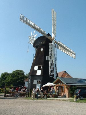
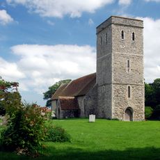
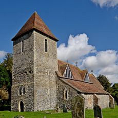
Sarre Windmill, Smock mill in Sarre, England.

Sarre Windmill is a white smock mill built on a two-story brick foundation, with the main wooden structure rising above in an octagonal shape. It features four double patent sails attached to a cast iron shaft and a fantail mechanism for automatic wind orientation.

The mill was built in 1820 by Canterbury millwright John Holman and underwent major reconstruction in 1856 when its base was raised and strengthened. This modification reflected changing needs and technical improvements in milling technology during that period.

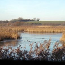
The mill represents how wind power supported grain processing and rural life in Kent for many decades. Walking around it today, you can sense the connection between the local landscape and the work that once happened here.

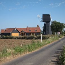
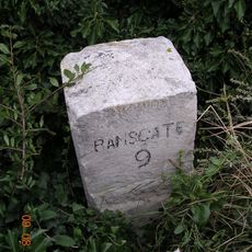
The mill sits at the junction of Ramsgate Road and the A28 in Kent, making it easy to spot from the road. The surrounding countryside offers walking paths and the chance to explore the rural landscape on foot.

In 1861 this mill became the first in Kent to use a steam engine alongside wind power for milling operations. This hybrid approach shows how millers adapted to new technology while keeping their traditional windmill structures.

Location: Sarre

GPS coordinates: 51.33984,1.24294

Latest update: December 12, 2025 16:40

Photos
Around this place
Chislet Windmill
United Kingdom

Chislet Windmill

4.5 km
Stodmarsh National Nature Reserve
United Kingdom

Stodmarsh National Nature Reserve

5 km
All Saints Church, West Stourmouth
United Kingdom

All Saints Church, West Stourmouth

2.2 km
The Grove Ferry Inn
United Kingdom

The Grove Ferry Inn

3.1 km
Elmstone Church
United Kingdom

Elmstone Church

4.8 km
Church of Saint Mary Magdalene, Monkton
United Kingdom

Church of Saint Mary Magdalene, Monkton

1.9 km
Church of St Mildred
United Kingdom

Church of St Mildred

4.9 km
Church of Saint Nicholas
United Kingdom

Church of Saint Nicholas

1.7 km
Church of St Mary the Virgin
United Kingdom

Church of St Mary the Virgin

3.6 km
The Crown Inn
United Kingdom

The Crown Inn

235 m
The Bell Inn
United Kingdom

The Bell Inn

5.1 km
Railed Tomb Chests And Memorial Cross About 5 Metres South Of Nave Of Saint Mary's Church
United Kingdom

Railed Tomb Chests And Memorial Cross About 5 Metres South Of Nave Of Saint Mary's Church

5.2 km
Kings Head Inn
United Kingdom

Kings Head Inn

320 m
Walsingham House
United Kingdom

Walsingham House

5.2 km
Milestone, Sarre Wall causeway, half way along a slight bend
United Kingdom

Milestone, Sarre Wall causeway, half way along a slight bend

1.6 km
Gateway To North East Of Brook Farmhouse
United Kingdom

Gateway To North East Of Brook Farmhouse

5 km
Inglewood
United Kingdom

Inglewood

5.1 km
No 11 And The Old Jezard's Bakery
United Kingdom

No 11 And The Old Jezard's Bakery

5.2 km
Thanet House
United Kingdom

Thanet House

5.1 km
Monkton War Memorial
United Kingdom

Monkton War Memorial

2 km
Westmarsh and Ware War Memorial
United Kingdom

Westmarsh and Ware War Memorial

4.6 km
14, 16 And 18, High Street
United Kingdom

14, 16 And 18, High Street

5.1 km
Cast Iron Lamp Standard
United Kingdom

Cast Iron Lamp Standard

5.1 km
Milestone, Island Road, end of straight between Lakesview Business Park and Upstreet
United Kingdom

Milestone, Island Road, end of straight between Lakesview Business Park and Upstreet

4.7 km
Milestone, Canterbury Road West, 400m E of A299 roundabout
United Kingdom

Milestone, Canterbury Road West, 400m E of A299 roundabout

3.1 km
Milestone, E of Gore Street (200m from small group of isolated buildings)
United Kingdom

Milestone, E of Gore Street (200m from small group of isolated buildings)

1.6 km
Milestone, Ramsgate Road, by Rose Bungalow, just W of old turnpike cottage and Sarre Windmill
United Kingdom

Milestone, Ramsgate Road, by Rose Bungalow, just W of old turnpike cottage and Sarre Windmill

98 m
Milestone, Island Road, Upstreet, by No.145 on E edge of village
United Kingdom

Milestone, Island Road, Upstreet, by No.145 on E edge of village

3.2 km
Show the full map
Reviews

Visited this place? Tap the stars to rate it and share your experience / photos with the community! Try now! You can cancel it anytime.

« Sarre Windmill - Smock mill in Sarre, England » is provided by Around Us (aroundus.com). Images and texts are derived from Wikimedia project under a Creative Commons license. You are allowed to copy, distribute, and modify copies of this page, under the conditions set by the license, as long as this note is clearly visible.

Discover hidden gems everywhere you go!

From secret cafés to breathtaking viewpoints, skip the crowded tourist spots and find places that match your style. Our app makes it easy with voice search, smart filtering, route optimization, and insider tips from travelers worldwide. Download now for the complete mobile experience.

Around Us App Screenshot

A unique approach to discovering new places

Le Figaro

All the places worth exploring

France Info

A tailor-made excursion in just a few clicks

20 Minutes