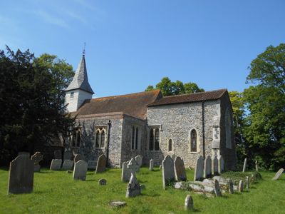
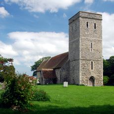
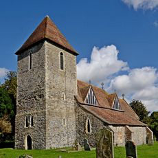
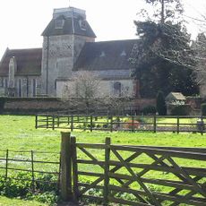
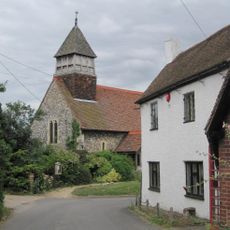
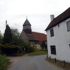
All Saints Church, West Stourmouth, Medieval church in West Stourmouth, England.
All Saints Church in West Stourmouth is a medieval church built with flint walls and stone accents, topped with a shingled spire. The structure features brick buttresses that support the walls and give it solid, sturdy proportions.
Building of this church started around 1050 as a major religious structure for the area. An earthquake in 1382 damaged it severely, leading to major repairs and modifications that you can still see today.
Inside, you can see an octagonal pulpit from the 17th century and box pews that show how worship and seating arrangements changed over time. These furnishings reveal how communities gathered and worshipped across different centuries in this same space.
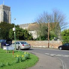
This church sits a few miles north of Wingham village and you can reach it by the B2046 road. Parking is available near the building, making it accessible for visitors who want to stop and explore.
The chancel holds a brass memorial dating to 1472 and preserves fragments of 15th-century stained glass in its windows. These rare medieval glass pieces tell a story of craftsmanship and survival across the centuries.
Location: Stourmouth
Inception: 11 century
Website: http://visitchurches.org.uk/findachurch/all-saints-west-stourmouth/?region=Kent&offset=1
GPS coordinates: 51.32030,1.23650
Latest update: December 14, 2025 18:45
Wingham Wildlife Park
4.4 km
Sarre Windmill
2.2 km
Stodmarsh National Nature Reserve
3.6 km
The Grove Ferry Inn
2.1 km
Elmstone Church
2.7 km
Church of Saint Mary Magdalene, Monkton
3.3 km
Church of St Mildred
2.8 km
Church of Saint Nicholas
3.9 km
Church of St Mary the Virgin
3.5 km
Church of St Mary
4.3 km
The Crown Inn
2.1 km
The Chequer Inn
5.3 km
Kings Head Inn
2.1 km
Milestone, Sarre Wall causeway, half way along a slight bend
1.6 km
Cornerways Old Post Office Stores
4.3 km
The Anchor Inn And Rear Courtyard
5.4 km
Wickham House
5.4 km
Monkton War Memorial
3.3 km
Westmarsh and Ware War Memorial
3 km
Nash Court
3.9 km
Milestone, Island Road, end of straight between Lakesview Business Park and Upstreet
3.7 km
Milestone, W of Shatterling, Gobery Hill, E of car park entrance
4.8 km
Milestone, Canterbury Road West, 400m E of A299 roundabout
4.4 km
Milestone, Island Road, Hersden, by Dunelm
5.3 km
Milestone, Shatterling, nr the Frog & Orange restaurant, by Milestone Cottage
4.7 km
Milestone, The Street, at jct with Molland Lane
5.3 km
Milestone, E of Gore Street (200m from small group of isolated buildings)
3 km
Milestone, Island Road, Upstreet, by No.145 on E edge of village
2.4 kmVisited this place? Tap the stars to rate it and share your experience / photos with the community! Try now! You can cancel it anytime.
Discover hidden gems everywhere you go!
From secret cafés to breathtaking viewpoints, skip the crowded tourist spots and find places that match your style. Our app makes it easy with voice search, smart filtering, route optimization, and insider tips from travelers worldwide. Download now for the complete mobile experience.
A unique approach to discovering new places❞
— Le Figaro
All the places worth exploring❞
— France Info
A tailor-made excursion in just a few clicks❞
— 20 Minutes