St James' Church, Dover
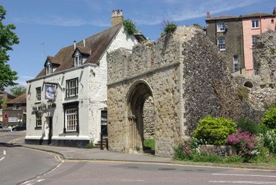
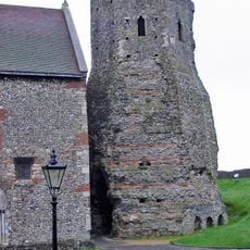
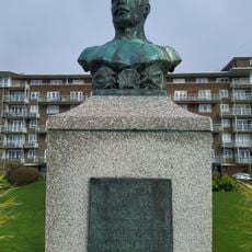
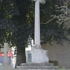
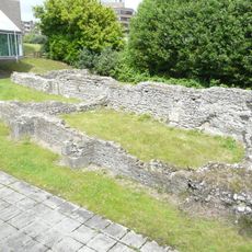
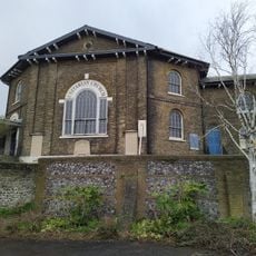
St James' Church, Dover, Medieval church ruin in Dover, England
St James' Church is a stone ruin displaying Norman architecture with rounded arches and decorative carved patterns on its weathered surfaces. The building sits at the base of Castle Hill and reveals the sturdy construction typical of a medieval parish church.
Construction began around 1070 in the Norman period and the building later served as a meeting place for regional barons. Wartime damage in the 20th century altered the structure significantly and led to its current ruined state.
The church reflects how Dover's medieval community gathered for worship and civic functions in Norman times. Today, walking around the ruins shows visitors the scale and importance this building once held in local life.
The ruin is easily accessible on foot and open for visitors to walk around and examine the Norman remains up close. Sturdy footwear is advisable since the ground is uneven and you need to move carefully around the old stonework.
The ruin suffered severe damage from German artillery fire during World War II and then experienced another major blow when the tower collapsed in 1950. Locals now refer to this site as Dover's Tidy Ruin, a name reflecting how the damaged structure has been carefully maintained.
Location: Dover
Inception: 1070
Architectural style: Norman architecture
GPS coordinates: 51.12615,1.31792
Latest update: December 12, 2025 16:41
Dover Castle
456 m
Dubris
442 m
Dover Bronze Age Boat
386 m
Dover Museum
353 m
St Mary sub Castro, Dover
483 m
St Mary's Church, Dover
353 m
St Paul's Church, Dover
403 m
Dubris Pharos
434 m
Charles Stewart Rolls memorial
292 m
Matthew Webb statue
262 m
Matthew Webb memorial
220 m
War Memorial in the Churchyard of the Parish Church of St Mary the Virgin, Dover
368 m
Castle Inn
174 m
St Martin's Church
388 m
60th Rifles Memorial To Indian Mutiny
422 m
Queen Elizabeths Pocket Pistol
308 m
Unitarian Church And Vestry Adjoining
458 m
Nos 1 To 9 Including Basement Area Railings
422 m
Officers Barracks And Attached Basement Area Walls And Rails
479 m
Former Regimental Institute
313 m
1-30, Waterloo Crescent
423 m
Castle Hill House, Including Attached Garden Wall With Gatepiers To South-East
45 m
Connaught Pumping Station
554 m
The Market Hall
367 m
K6 Telephone Kiosk
401 m
House Adjoining Peverells Tower
359 m
On the Crest of a Wave
454 m
New Bridge House
395 mVisited this place? Tap the stars to rate it and share your experience / photos with the community! Try now! You can cancel it anytime.
Discover hidden gems everywhere you go!
From secret cafés to breathtaking viewpoints, skip the crowded tourist spots and find places that match your style. Our app makes it easy with voice search, smart filtering, route optimization, and insider tips from travelers worldwide. Download now for the complete mobile experience.
A unique approach to discovering new places❞
— Le Figaro
All the places worth exploring❞
— France Info
A tailor-made excursion in just a few clicks❞
— 20 Minutes