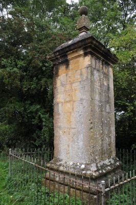
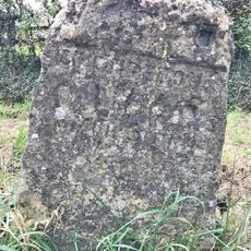
Four shire stone, Boundary marker near Moreton-in-Marsh, England
The Four Shire Stone is a limestone obelisk with a ball finial standing at a road junction, marking where multiple county boundaries meet. The structure features typical English boundary marker design and holds protected heritage status.
Built in the 18th century, the monument originally marked where four counties met before boundary changes in 1931 altered the arrangement. This administrative shift left the stone as a physical reminder of earlier territorial divisions.
The stone inspired J.R.R. Tolkien's fictional Three-Farthing Stone in The Lord of the Rings, marking territorial divisions in the Shire. This literary connection draws readers who recognize the monument's influence on the author's imaginary world.
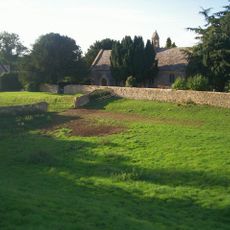
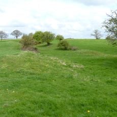
The stone sits at a road junction and is easily visible from the road, though traffic safety requires attention when approaching. The countryside setting makes it accessible for walking routes through the surrounding farmland.
Five parish boundaries actually converge at this single spot, rather than just the four county boundaries most people know about. This extra layer of administrative overlap makes it a rare geographical anomaly in the English landscape.
Location: Little Compton
Location: Evenlode
Location: Moreton-in-Marsh
Location: Great Wolford
Location: Chastleton
Part of: political border
GPS coordinates: 51.98748,-1.66577
Latest update: December 9, 2025 18:42
Chastleton House
3.6 km
Redesdale Hall (Town Hall)
2.6 km
Moreton-in-Marsh and Batsford War Memorial
2.6 km
Church of St Leonard
2.6 km
Church of St David
2.4 km
Church of St Lawrence
2.6 km
Church of St Edward
3.3 km
Church of St Michael
3.1 km
Bell Inn
2.6 km
Congregational Church
2.5 km
The Wellington Inn
1.9 km
The White Hart Royal Hotel
2.6 km
The Black Bear Public House
2.6 km
Redesdale Arms Hotel
2.6 km
Mann Memorial Hall
2.5 km
Manor House Hotel
2.6 km
Curfew Tower
2.6 km
Premises Of Horne And Sons The Gateway The Steps
2.6 km
Lemington House And Boundary Wall To East And Railings To North
2.5 km
Barton House
2.6 km
Moated site, Great Wolford
3.1 km
Milestone At Ngr Sp 2327 3199
279 m
The Old Bank (Midland Bank) And House Adjoining
2.6 km
The Old Parsonage
2.5 km
Leigh House
2.6 km
Gatehouse Lodge
2.2 km
RAF Moreton-in-Marsh Memorial
770 m
Milestone, London Road; 50m E of Cotswolds Business Village
1.3 kmVisited this place? Tap the stars to rate it and share your experience / photos with the community! Try now! You can cancel it anytime.
Discover hidden gems everywhere you go!
From secret cafés to breathtaking viewpoints, skip the crowded tourist spots and find places that match your style. Our app makes it easy with voice search, smart filtering, route optimization, and insider tips from travelers worldwide. Download now for the complete mobile experience.
A unique approach to discovering new places❞
— Le Figaro
All the places worth exploring❞
— France Info
A tailor-made excursion in just a few clicks❞
— 20 Minutes