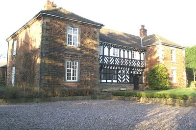
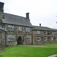
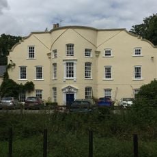
Mawdesley Hall, Grade I listed house in Mawdesley, England.
Mawdesley Hall is a Grade I listed house in Mawdesley, England, set on an elevated sandstone outcrop and featuring a central timber-framed structure with sandstone and brick wings. The building stands roughly 18 metres from the main road and is accessed through a garden with an integrated viewing platform.
The central structure originated in the 17th century as shown by period inscriptions, while the east and west wings were added during the late 18th century. This gradual expansion reflects the growing importance and prosperity of the family across generations.
The hall shows characteristics of English country house design through its H-shaped form, timber framing, and stone-colored roof typical of Lancashire estates. The style reflects the tastes of the wealthy families who made their homes in this region.
The property is straightforward to reach from nearby roads, though it sits back from the main route and can only be approached through the garden area. A visit works best during daylight hours when sufficient light reveals the architectural details clearly.
The upper floor uses plaster and paint to create the look of timber framing, while the lower level retains the original timber structure underneath. This contrast reveals different construction methods and repairs applied across different periods.
The community of curious travelers
AroundUs brings together thousands of curated places, local tips, and hidden gems, enriched daily by 60,000 contributors worldwide.