Enable Location

We need your location to show you interesting places around you

Discover nearby places

Find interesting locations and hidden gems around you

Precise directions

Get accurate directions and distances to places

Your location is never shared with other users. It's only used when you tap the location button.

The Mynde

Log in to your account

Start exploring — it's free

Trusted by 61,463 travelers worldwide

Continue with Google
Continue with Apple
or

We will send you a code to connect

By continuing, you accept our Terms and Conditions and our Privacy Policy

Check your inbox

We've sent a pincode in your inbox. Please enter the code below.

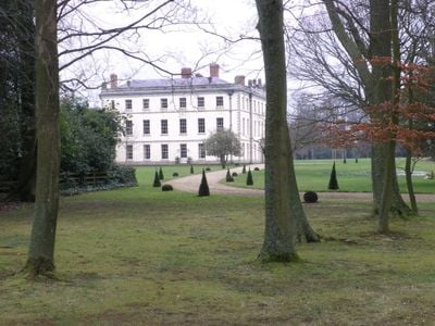
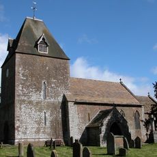
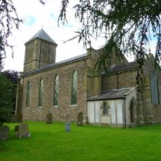
The Mynde, Country house in Much Dewchurch, England.

Description

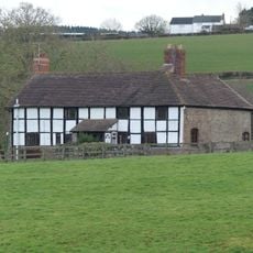
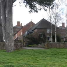
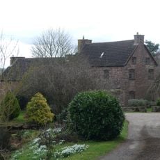
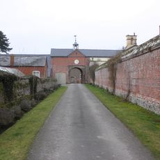
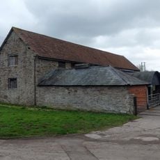
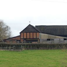
The Mynde is a country house with nine bays across its main front, built from sandstone rubble and rising three storeys high. The structure is topped with a slate roof that completes its substantial appearance.

History

The Pye family held the estate for centuries, starting from Norman times and continuing through the medieval period. Walter Pye I and Walter Pye II were notable keepers of this substantial holding.

Culture

The Kings Hall features elaborate plasterwork created by skilled craftsmen during the tenure of the Duke of Chandos. These rooms showcase the wealth and taste of its former inhabitants.

Practical

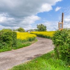
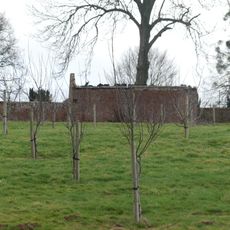
The house sits on an estate of around 1,180 acres (480 hectares) accessible via a mile-long (1.6 km) private drive. It can be reached from both the A465 and B4348 roads.

Did you know?

The building underwent major restoration work between 1997 and 2001 under Audley Twiston-Davies. This work preserved its architectural character through contemporary conservation methods.

Location
Part of
Mynde Estate
GPS coordinates
51.96350,-2.77180
Latest update
December 12, 2025 17:42

AroundUs brings together thousands of curated places, local tips, and hidden gems, enriched daily by 60,000 contributors worldwide. Discover all places nearby (Much Dewchurch).

Around this place
Church of St Mary and St David, Kilpeck
United Kingdom

Church of St Mary and St David, Kilpeck

2.7 km
Kilpeck Castle
United Kingdom

Kilpeck Castle

2.7 km
Church of St Dubricius, at St Devereux, Herefordshire
United Kingdom

Church of St Dubricius, at St Devereux, Herefordshire

3.3 km
Church of St David
United Kingdom

Church of St David

1.8 km
Church of Ss Mary and Thomas A Becket
United Kingdom

Church of Ss Mary and Thomas A Becket

3.4 km
Milestone At So 449322
United Kingdom

Milestone At So 449322

3.2 km
Orcop War Memorial
United Kingdom

Orcop War Memorial

3 km
William Price Memorial approximately 2 meters south of chancel of Church of St Mary and St David
United Kingdom

William Price Memorial approximately 2 meters south of chancel of Church of St Mary and St David

2.7 km
Much Dewchurch War Memorial
United Kingdom

Much Dewchurch War Memorial

1.8 km
The Priory Farmhouse
United Kingdom

The Priory Farmhouse

2.4 km
Ha ha about 30 yards to east of The Mynde
United Kingdom

Ha ha about 30 yards to east of The Mynde

146 m
Didley Court Farmhouse
United Kingdom

Didley Court Farmhouse

3.1 km
Barn about 50 yards south-west of Newhouse Farmhouse
United Kingdom

Barn about 50 yards south-west of Newhouse Farmhouse

2.1 km
Outbuilding attached to north west of The Mynde
United Kingdom

Outbuilding attached to north west of The Mynde

42 m
Stables and outbuildings attached to south-west of The Mynde
United Kingdom

Stables and outbuildings attached to south-west of The Mynde

39 m
Newhouse Farmhouse and enclosing walls to north-west
United Kingdom

Newhouse Farmhouse and enclosing walls to north-west

2 km
K6 Telephone Kiosk
United Kingdom

K6 Telephone Kiosk

2.5 km
Milepost At Ngr So 495279
United Kingdom

Milepost At Ngr So 495279

3.1 km
Churchyard cross in St David's churchyard
United Kingdom

Churchyard cross in St David's churchyard

1.8 km
Kitchen garden walls to north of The Mynde
United Kingdom

Kitchen garden walls to north of The Mynde

93 m
Garden walls to south of The Mynde
United Kingdom

Garden walls to south of The Mynde

59 m
Kilpeck Court Farmhouse
United Kingdom

Kilpeck Court Farmhouse

2.6 km
Barn approximately 30 meters north-east of Kilpeck Court Farmhouse
United Kingdom

Barn approximately 30 meters north-east of Kilpeck Court Farmhouse

2.6 km
Milepost, SE Wormelow Tump
United Kingdom

Milepost, SE Wormelow Tump

2.5 km
Milepost, Church View
United Kingdom

Milepost, Church View

1.8 km
Group of two adjoining barns approximately 50 meters west of Priory Farmhouse
United Kingdom

Group of two adjoining barns approximately 50 meters west of Priory Farmhouse

2.4 km
Milepost, Top Hill
United Kingdom

Milepost, Top Hill

2 km
Milepost, Church View, The Rhydd (ruined property)
United Kingdom

Milepost, Church View, The Rhydd (ruined property)

3.4 km
Show the full map
« The Mynde - Country house in Much Dewchurch, England » is provided by Around Us (aroundus.com). Images and texts are derived from Wikimedia project under a Creative Commons license. You are allowed to copy, distribute, and modify copies of this page, under the conditions set by the license, as long as this note is clearly visible.

Discover hidden gems everywhere you go!

From secret cafés to breathtaking viewpoints, skip the crowded tourist spots and find places that match your style. Our app makes it easy with voice search, smart filtering, route optimization, and insider tips from travelers worldwide. Download now for the complete mobile experience.

Around Us App Screenshot

A unique approach to discovering new places

Le Figaro

All the places worth exploring

France Info

A tailor-made excursion in just a few clicks

20 Minutes

Around Us
Travel Guide & Maps
Download

Send to your phone

QR Code
1

Open the camera app on your mobile.

2

Point at the QR code with your camera. A notification will appear.

3

Tap the notification to open the link.