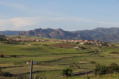
Perfugas, Italian comune
Location: Province of Sassari
Capital city: Perfugas
Elevation above the sea: 90 m
Shares border with: Bortigiadas, Bulzi, Chiaramonti, Erula, Martis, Santa Maria Coghinas, Laerru, Tempio Pausania
Website: http://comune.perfugas.ss.it
GPS coordinates: 40.83222,8.88444
Latest update: March 23, 2025 08:07
Castello di Santa Maria Coghinas
7.3 km
San Pietro delle Immagini
2.8 km
Pozzo sacro di Predio Canopoli
420 m
Necropolis of Su Murrone
5.8 km
Chiesa di San Giorgio
1.6 km
Chiesa di Santa Maria degli Angeli
381 m
Santa Vittoria de su Sassu
4.4 km
Fonte nuragica di Niedda
2.5 km
Nuraghe Ispiene
6.4 km
San Pietro di Sa Sia
10.3 km
Chiesa di San Giovanni Battista (Perfugas)
90 m
San Giuseppe di Oloitti
7.5 km
Cuore Immacolato di Maria
6.6 km
Chiesa di San Giovanni Battista
8 km
MAP di Perfugas
397 m
Chiesa dello Spirito Santo
5.1 km
MAP - Museo Archeologico e Paleobotanico di Perfugas
415 m
Sant'Antonio
3.9 km
Chiesa nuova del Cuore Immacolato di Maria
6.8 km
Chiesa di San Pietro di Sa Sia
10.3 km
Santa Margherita
4.7 km
Casa cantoniera di Femina Morta
12.4 km
Santa Croce
4.6 km
Nuraghe San Giorgio
1.5 km
Casa cantoniera di Perfugas
360 m
Lago di Casteldoria
5 km
Casa cantoniera di Coghinas
6.5 km
Foresta fossile
2.7 kmReviews
Visited this place? Tap the stars to rate it and share your experience / photos with the community! Try now! You can cancel it anytime.
Discover hidden gems everywhere you go!
From secret cafés to breathtaking viewpoints, skip the crowded tourist spots and find places that match your style. Our app makes it easy with voice search, smart filtering, route optimization, and insider tips from travelers worldwide. Download now for the complete mobile experience.
A unique approach to discovering new places❞
— Le Figaro
All the places worth exploring❞
— France Info
A tailor-made excursion in just a few clicks❞
— 20 Minutes