
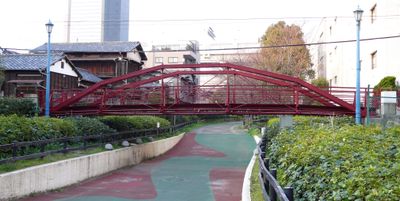
Hachiman Bridge, Historic pedestrian bridge in Koto, Japan
The Hachiman Bridge spans a length of 15.7 meters with a steel truss construction, connecting the Tomioka districts in Koto ward.
Originally constructed as the Danjo Bridge in Hocho district, this structure was relocated to its current position in Koto ward in 1964.
The bridge takes its name from the nearby Tomioka Hachiman Shrine, a significant religious site that influences local community traditions.
The bridge measures 2 meters in width and accommodates pedestrian traffic, linking residential areas while offering access to local waterfront paths.
This iron bridge incorporates distinctive chrysanthemum-patterned joint decorations and combines cast iron arch materials with wrought iron tension elements.
Location: Kōtō-ku
GPS coordinates: 35.67187,139.80064
Latest update: March 8, 2025 22:22
Fukagawa Fudōson
239 m
Fukagawa Gatharia
625 m
Kiba Park
856 m
Eitai-ji
234 m
Yokozuna Stone
58 m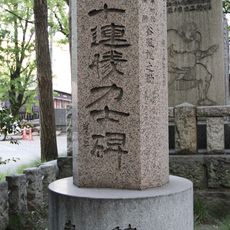
超五十連勝力士碑
58 m
Edo Sanjūsangen-dō
81 m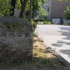
深川公園
309 m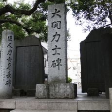
Ōzeki Stone
153 m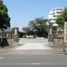
Jōshin-ji
738 m
心行寺
571 m
Enen-ji
588 m
Mantoku-in
793 m
正覚寺
616 m
増林寺
625 m
Shōrin-in
887 m
Enryū-in
853 m
Ichijō-in
806 m
Honryū-in
808 m
Chōkō-in
919 m
Gyokusen-in
836 m
Hosshō-ji
882 m
Enju-in
751 m
Zennō-in
795 m
Shōgyō-in
832 m
Entsū-ji
871 m
Seishi-in
841 m
Jōtō-in
931 mReviews
Visited this place? Tap the stars to rate it and share your experience / photos with the community! Try now! You can cancel it anytime.
Discover hidden gems everywhere you go!
From secret cafés to breathtaking viewpoints, skip the crowded tourist spots and find places that match your style. Our app makes it easy with voice search, smart filtering, route optimization, and insider tips from travelers worldwide. Download now for the complete mobile experience.

A unique approach to discovering new places❞
— Le Figaro
All the places worth exploring❞
— France Info
A tailor-made excursion in just a few clicks❞
— 20 Minutes