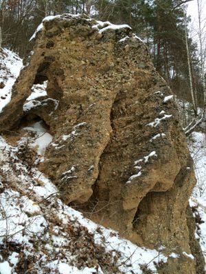
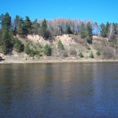
Ožkų pečius conglomerate, Geological outcrop in Jieznas eldership, Lithuania.
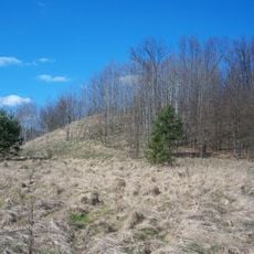
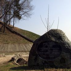
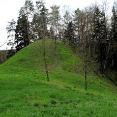
Ožkų pečius is a geological outcrop near the Verknė River that rises about 7 meters high, composed of rounded stones bonded together by natural cementing minerals. The formation displays layers of varying grain sizes and mineral compositions that become visible when observed closely from different angles.
The formation developed through sedimentary processes and glacial activities over millions of years, as layers of weathered rock and river deposits accumulated. The Verknė River played a key role in transporting and depositing these materials, which later solidified into a conglomerate through natural cementing.
The name Ožkų pečius comes from a Lithuanian word meaning Goat's Stove, connected to the animals that inhabit the surrounding area. Locals use this name to describe the formation as part of their landscape, linking the rock outcrop to their everyday environment and natural surroundings.
The best view of the formation is from the banks of the Verknė River, though the terrain there can be steep and slippery in places. Wear sturdy shoes and allow time to navigate safely and examine the different layers of the rock face from various points along the riverbank.
Researchers study this conglomerate to understand the geological processes that occurred during different climate periods in Lithuania's past. This work reveals how river landscapes and regional climate patterns shifted over vast timescales.
The community of curious travelers
AroundUs brings together thousands of curated places, local tips, and hidden gems, enriched daily by 60,000 contributors worldwide.