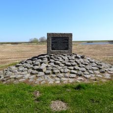
Vlieter, Surface water body in Hollands Kroon, Netherlands.
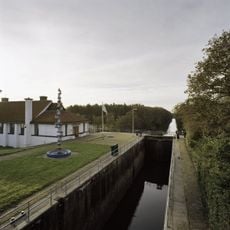
Vlieter is a surface water body in Hollands Kroon that forms part of the Wadden Sea ecosystem. The water is shaped by agricultural runoff, salt from maritime influences, and natural tidal currents that flow through the region.
This water body came under regular monitoring by Dutch authorities in the 20th century as part of a national program. The oversight developed from growing concerns about water quality changes in coastal and tidal areas.
The water management of Vlieter reflects the Dutch commitment to maintaining ecological standards through systematic monitoring and environmental protection measures.
Water quality is monitored regularly and changes with the seasons due to various environmental factors. Conditions in the area can vary significantly depending on the time of year and weather patterns.
The surface water composition varies throughout the year due to the interaction between agricultural runoff, maritime influences, and changing ecological conditions.
Location: Hollands Kroon
Part of: Wadden Sea
GPS coordinates: 52.98326,5.08598
Latest update: December 14, 2025 11:24
Afsluitdijk and Stevinsluizen in Den Oever
6.1 km
Nederlands Hervormde Kerk, Den Oever
7.7 km
Vlietermonument
2.2 km
Zendmast Wieringermeer
8.5 km
Stelling bij Den Oever
6.2 km
Den Oever Lighthouse
6.1 km
Gemaal Leemans
7.6 km
De Hoop
6.7 km
Heidense Kapel
9 km
Stroeërweg 39, Stroe
9 km
Monument op de Noorderdijkweg
10.5 km
Villa Nieuwland
7.6 km
Leemans: schutsluis met brug
7.6 km
Standbeeld Cornelis Lely (Afsluitdijk)
2.2 km
Steenzetter
2.2 km
Stroeërweg 29, Stroe
9.3 km
Tower of Michaëlskerk
7.7 km
Leemans: dieselolietanks
7.6 km
Leemans: machinegebouw
7.6 km
Vrijstaande villa met garage
11.1 km
Stroeërweg 7, Hippolytushoef
9.9 km
Hoge Elft 1, Hippolytushoef
10.9 km
Provinciegrenspaal
5.7 km
Ingenieurswoning, vrijstaand woonhuis, gebouwd in het kader van de Zuiderzeewerken ten behoeve van de huisvesting van hoger personeel
7.7 km
Peilschaalgebouw
6.3 km
Stelling bij Den Oever: XII (machinekamer en hulpverbandplaats)
6.1 km
Stelling bij Den Oever: Kazemat II (enkele mitrailleurkazemat)
5.4 km
Oorlogsmonument
10.8 kmVisited this place? Tap the stars to rate it and share your experience / photos with the community! Try now! You can cancel it anytime.
Discover hidden gems everywhere you go!
From secret cafés to breathtaking viewpoints, skip the crowded tourist spots and find places that match your style. Our app makes it easy with voice search, smart filtering, route optimization, and insider tips from travelers worldwide. Download now for the complete mobile experience.
A unique approach to discovering new places❞
— Le Figaro
All the places worth exploring❞
— France Info
A tailor-made excursion in just a few clicks❞
— 20 Minutes