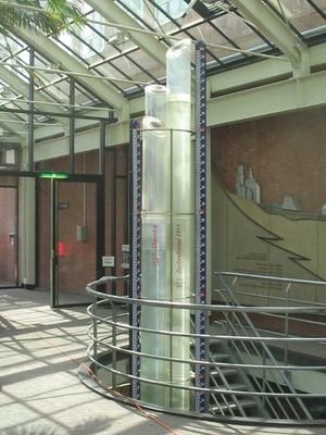
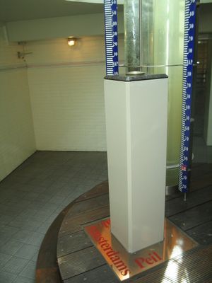
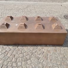
Amsterdam Ordnance Datum, Reference elevation point in Dam Square, Amsterdam, Netherlands.
The Amsterdam Ordnance Datum is a fixed elevation benchmark beneath Dam Square that serves as the starting point for measuring heights throughout the Netherlands and neighboring regions. A metal marker rests on a deep foundation below the plaza, providing the stable reference from which all land elevations and water levels across the country are calculated.
Mayor Johannes Hudde established the reference point in 1684 after measuring water levels in Het IJ and city canals following the 1675 flood. The system expanded during the 19th century and later became the foundation for European elevation networks that were standardized in the 1990s.
The name reflects the Latin word for order, highlighting the Dutch commitment to precise water measurement in a country where daily life depends on understanding elevation. Engineers and surveyors still refer to this reference when planning construction projects throughout the Netherlands and neighboring countries, maintaining a link to centuries of water management tradition.
A replica of the marker is on display at the Stopera building, where historical measuring instruments and explanations about how the system works are also shown. The actual benchmark beneath Dam Square is not accessible, but the exhibit provides a clear sense of the technical importance of this reference point.
The benchmark is one of the oldest continuously used elevation reference points in the world, remaining in active service for more than three centuries. Its position beneath the central square was deliberately chosen because the ground there is stable enough to minimize subsidence over time.
The community of curious travelers
AroundUs brings together thousands of curated places, local tips, and hidden gems, enriched daily by 60,000 contributors worldwide.