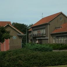
De Ginkel, Nature reserve and rural settlement in Ede, Netherlands.
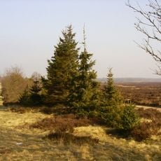
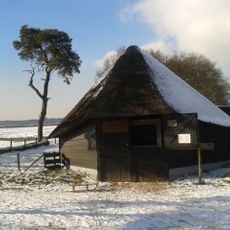
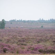
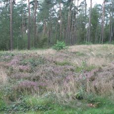
De Ginkel is a nature reserve near Ede that combines open heathland with grassfields, woodlands, and wetland areas forming a diverse landscape. Walking paths wind through these different habitats, allowing visitors to experience the changing scenery and observe local wildlife throughout their visit.
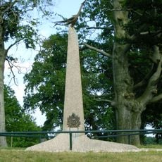
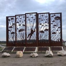
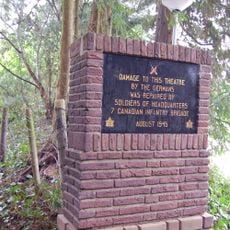
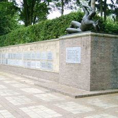
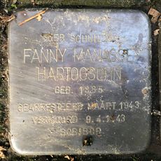
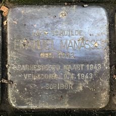
This location served as a landing site in 1944 when Allied paratroopers were deployed during a major airborne operation. A memorial monument now marks this significant wartime event and honors those involved in the operation.
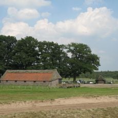
Sheep farming remains an active practice here, with herds grazing across the landscape to maintain the natural vegetation and support local land management. This farming tradition shapes how the area looks and functions for visitors today.
The area is best explored on foot using marked walking routes of varying lengths, with parking available near the Natuurcentrum Veluwe visitor center. Wear sturdy shoes suitable for natural terrain, especially if you plan to walk through the wetter meadow areas.
The heathland transforms dramatically in late summer when thousands of heather plants bloom together, turning wide areas purple for a few weeks. This seasonal display happens around August and draws visitors specifically looking to see the landscape at its most colorful.
Location: Ede
GPS coordinates: 52.03890,5.73000
Latest update: December 14, 2025 13:01
Ginkel Heath
972 mBelgenmonument Ede
525 m
Ede Memorial Cemetery
3.6 km
Airborne Monument
354 m
Openluchttheater Ede
3.5 km
Canadian tank on de Langenberg
2.6 km
Van Essenkazerne
3.6 km
Vensters op het verleden
562 m
Bevrijdingsmonument Ede
3.6 km
Monument in het Openluchttheater
3.6 km
Schaapskooi De Kreel
959 m
Schaapskooi De Ginkel
1.4 km
Terrein waarin vijf grafheuvels
1.9 km
De Eder Kuil: toeschouwerstribune
3.5 km
De Eder Kuil: speelveld en toneelgebouw
3.5 km
Grafheuvel 45412, Bennekom
3.2 km
Mausoleum
3.6 km
Stolperstein dedicated to Fanny Manasse-Hartogsohn
3.3 km
In een natuurreservaat gelegen eenvoudige, witgepleisterde boerenwoning onder rieten wolfdak
3.5 km
Stolperstein dedicated to Emanuel (Maantje) Manasse
3.3 km
Kazernegebouw
3.1 km
Elias Beeckmankazerne: kazernecomplex
3.1 km
De Eder Kuil: kaartverkoopgebouw (westelijk)
3.5 km
De Eder Kuil: kaartverkoopgebouw (oostelijk)
3.5 km
De Eder Kuil: kleedgebouw
3.5 km
De Eder Kuil: orkestbak
3.5 km
Gedenksteen in de gevel van herberg ‘Zuid-Ginkel’
353 m
Stolperstein dedicated to Samuel Bromberg
3.3 kmVisited this place? Tap the stars to rate it and share your experience / photos with the community! Try now! You can cancel it anytime.
Discover hidden gems everywhere you go!
From secret cafés to breathtaking viewpoints, skip the crowded tourist spots and find places that match your style. Our app makes it easy with voice search, smart filtering, route optimization, and insider tips from travelers worldwide. Download now for the complete mobile experience.
A unique approach to discovering new places❞
— Le Figaro
All the places worth exploring❞
— France Info
A tailor-made excursion in just a few clicks❞
— 20 Minutes