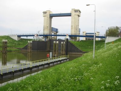
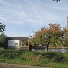
St. Andries, Navigation lock in Maasdriel, Netherlands.
St. Andries is a navigation lock in Maasdriel that connects the Maas and Waal rivers for water traffic. The facility includes a spacious lock chamber designed to handle both commercial barges and recreational vessels moving between these two waterways.
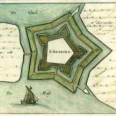
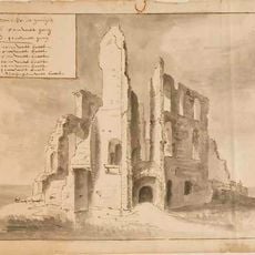
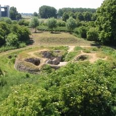
A military fort bearing this name was established in 1599 at this location during the Eighty Years' War to secure control of the waterway. The modern lock developed later as a key infrastructure project to facilitate ship movement between the two rivers.
Local boat operators and barge captains rely on this crossing as a key point in their regular routes along the Dutch waterways. For them, the lock is a familiar landmark that marks the junction between two important river systems.
You can watch the lock in operation from the riverside path when boats are passing through, with more activity visible on weekdays than weekends. Morning and early afternoon hours tend to offer the best chances to see vessels moving through the chamber.
The lock was constructed at a location where a military fortification once stood during a historical conflict, blending centuries of strategic importance. This overlap of military history and modern infrastructure makes the site interesting for understanding how this region evolved from defense to transportation.
The community of curious travelers
AroundUs brings together thousands of curated places, local tips, and hidden gems, enriched daily by 60,000 contributors worldwide.