Brämhult 4:1, stenkammargrav i Västergötland
Location: Borås Municipality
GPS coordinates: 57.75439,13.01688
Latest update: November 21, 2025 04:26
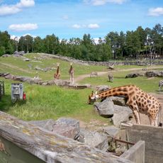
Borås djurpark
4.4 km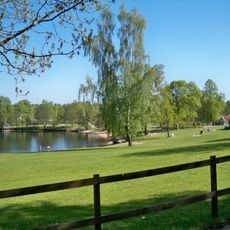
Almenäs, public beach
4.7 km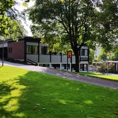
Hässleholmen Church
3.4 km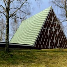
Sjöbo Church
4.3 km
Kypegårdens frilufts- och rekreationsområde
3.8 km
Ödeberg
3.7 km
Frufällans församlingshem
3.5 km
Norrmalms kyrka och församlingshem
4.6 km
Tosseryd 1:2
2.1 km
Brämhult 3:2
1.9 km
Rångedala 34:1
4.6 km
Långesten
3.5 km
Rångedala 132:1
4.4 km
Fristad 174
4.2 km
Brämhult 3:1
1.9 km
Brämhult 5:1
489 m
Brämhult 2:1
2 km
Altaret
2.7 km
Brämhult 3:3
1.8 km
Gingri 11:1
2.7 km
Fristad 173
4.2 km
Fristad 175
4.2 km
Brämhult 55
1.8 km
Rångedala 27:1
4.6 km
Fristad 172
4.2 km
Gingri 56:1
4.1 km
Brämhult 9:1
2.3 km
Brämhult 8:1
617 mReviews
Visited this place? Tap the stars to rate it and share your experience / photos with the community! Try now! You can cancel it anytime.
Discover hidden gems everywhere you go!
From secret cafés to breathtaking viewpoints, skip the crowded tourist spots and find places that match your style. Our app makes it easy with voice search, smart filtering, route optimization, and insider tips from travelers worldwide. Download now for the complete mobile experience.

A unique approach to discovering new places❞
— Le Figaro
All the places worth exploring❞
— France Info
A tailor-made excursion in just a few clicks❞
— 20 Minutes