En grupp granar Maunu, naturminne i Kiruna kommun
Location: Kiruna Municipality
Inception: July 25, 1955
GPS coordinates: 68.46967,22.11270
Latest update: November 5, 2025 02:07

Sturmbock
4.8 km
Ropi
39.2 km
Stuorrahanoaivi
35 km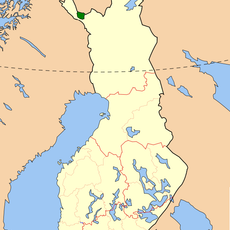
Tarvantovaara Wilderness Area
27.1 km
Mannakoski
9.8 km
Antipaikanenkoski
35.4 km
Isokurkkio
18.8 km
Kentakoski
33.1 km
Kurrakalinka
36.1 km
Matkakoski
25.1 km
Markkinan kirkonpaikka
7.8 km
Peerakoski
27.3 km
Čáhppesgeađgi
32.5 km
Karesuando 468:1
33.8 km
Karesuando 851
37.4 km
Karesuando 580:1
23.9 km
Karesuando 575:2
31.6 km
Archaeological site
34 km
Kalkkoivi autiotupa
28.7 km
Memorial
7.8 km
Laestadii pörte
15.1 km
Archaeological site
33.9 km
Archaeological site
33.9 km
Archaeological site
33.7 km
Archaeological site
33.2 km
Archaeological site
33.2 km
Archaeological site
33.1 km
Gruppe Bryhn
15.5 kmReviews
Visited this place? Tap the stars to rate it and share your experience / photos with the community! Try now! You can cancel it anytime.
Discover hidden gems everywhere you go!
From secret cafés to breathtaking viewpoints, skip the crowded tourist spots and find places that match your style. Our app makes it easy with voice search, smart filtering, route optimization, and insider tips from travelers worldwide. Download now for the complete mobile experience.

A unique approach to discovering new places❞
— Le Figaro
All the places worth exploring❞
— France Info
A tailor-made excursion in just a few clicks❞
— 20 Minutes