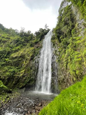
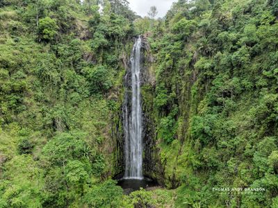
Materuni Waterfalls, Rainforest waterfall near Mount Kilimanjaro, Tanzania
Materuni Waterfalls is a natural drop on the slopes of Mount Kilimanjaro that falls into a deep basin surrounded by dense forest and vegetation. The area features coffee plantations and fruit gardens that extend to the edges of the woodland.
The site lies in the traditional territory of the Chagga people, who have farmed the fertile mountain slopes for centuries. The region's character was shaped by this long-term settlement and connection to Mount Kilimanjaro.
The local people grow coffee and fruit on the slopes around this waterfall using farming methods passed down through generations. These practices shape daily life in the region and show how closely the community is tied to the fertile land.
The site is reached by a walking path of about 30 minutes from Materuni Village, and visitors should wear sturdy shoes and bring water. Guided tours are available and include transport from nearby towns along with traditional meals.
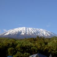
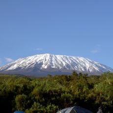
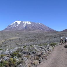
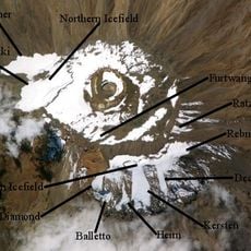
On clear days, visitors can see the Kibo crater and distant views toward Moshi from this location. This wide perspective makes it a rare viewpoint where several major features of the region are visible together.
The community of curious travelers
AroundUs brings together thousands of curated places, local tips, and hidden gems, enriched daily by 60,000 contributors worldwide.