Enable Location

We need your location to show you interesting places around you

Discover nearby places

Find interesting locations and hidden gems around you

Precise directions

Get accurate directions and distances to places

Your location is never shared with other users. It's only used when you tap the location button.

Cheesequake State Park

Log in to your account

Start exploring — it's free

Trusted by 62,420 travelers worldwide

Continue with Google
Continue with Apple
or

We will send you a code to connect

By continuing, you accept our Terms and Conditions and our Privacy Policy

Check your inbox

We've sent a pincode in your inbox. Please enter the code below.

Cheesequake State Park

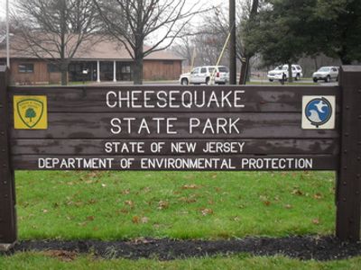
Cheesequake State Park, Nature reserve in Matawan, United States.

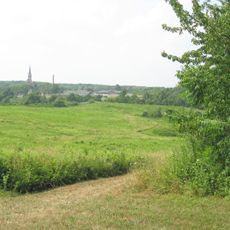
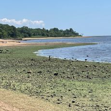
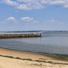
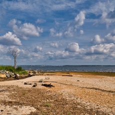
Cheesequake State Park covers around 1,569 acres with varied landscapes including saltwater marshes, cedar swamps, pine forests, and hardwood stands at sea level. Five marked trails run through the grounds, each offering different routes for exploring the terrain.

The state established the park in 1940 as a protected natural area. Long before its creation, Native Americans inhabited this region, and later European colonists settled along the New Jersey coast.

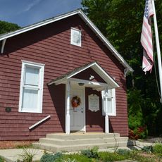
The Interpretive Center displays exhibits about regional wildlife and natural habitats found in the area. These displays help visitors understand the ecological diversity of the landscape.

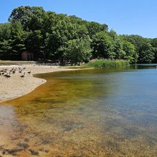
The grounds have fifty tent sites with fire rings and offer access to trails of varying length and difficulty. The nearby Hooks Creek Lake provides swimming opportunities during the warmer months for visitors.

The area sits at a rare ecological boundary where northern hardwood forests meet southern pine forests. This unusual mixture of different forest types is found in few places across the region.

The community of curious travelers

AroundUs brings together thousands of curated places, local tips, and hidden gems, enriched daily by 60,000 contributors worldwide.

Start exploring
Location
Inception
1940
GPS coordinates
40.43500,-74.27028
Latest update
December 7, 2025 20:41
Around this place
Conference House
United States of America

Conference House

7.7 km
Driscoll Bridge
United States of America

Driscoll Bridge

8.7 km
Starland Ballroom
United States of America

Starland Ballroom

7.2 km
Mount Loretto Unique Area
United States of America

Mount Loretto Unique Area

9.3 km
Proprietary House
United States of America

Proprietary House

7.6 km
Victory Bridge
United States of America

Victory Bridge

8.3 km
Edison Bridge
United States of America

Edison Bridge

8.6 km
Ward's Point
United States of America

Ward's Point

7.3 km
Perth Amboy Ferry Slip
United States of America

Perth Amboy Ferry Slip

8 km
Raritan Bay Drawbridge
United States of America

Raritan Bay Drawbridge

6.9 km
Perth Amboy City Hall
United States of America

Perth Amboy City Hall

8 km
Great Beds Light
United States of America

Great Beds Light

5.9 km
St. Peter's Episcopal Church
United States of America

St. Peter's Episcopal Church

7.7 km
Sayre & Fisher Reading Room
United States of America

Sayre & Fisher Reading Room

8.2 km
St. Euphrosynia Belarusian Orthodox Church
United States of America

St. Euphrosynia Belarusian Orthodox Church

8.1 km
Princes Bay Light
United States of America

Princes Bay Light

9.4 km
Maj. John Burrowes Mansion
United States of America

Maj. John Burrowes Mansion

4 km
Kearny Cottage
United States of America

Kearny Cottage

8 km
Angelina's
United States of America

Angelina's

8.9 km
Памятник «Борцам за свободную Беларусь»
United States of America

Памятник «Борцам за свободную Беларусь»

8.1 km
Cedar Grove School
United States of America

Cedar Grove School

3 km
Robinsons Beach
United States of America

Robinsons Beach

7.8 km
Laurence Harbor Beach
United States of America

Laurence Harbor Beach

3.4 km
Old Church of St. Joachim and St. Anne
United States of America

Old Church of St. Joachim and St. Anne

9.5 km
Perth Amboy Ferry Slip
United States of America

Perth Amboy Ferry Slip

8 km
Seidler Beach
United States of America

Seidler Beach

3.8 km
Hooks Creek Lake Beach
United States of America

Hooks Creek Lake Beach

508 m
Raritan Bay Beach
United States of America

Raritan Bay Beach

4 km
Show the full map
« Cheesequake State Park - Nature reserve in Matawan, United States » is provided by Around Us (aroundus.com). Images and texts are derived from Wikimedia project under a Creative Commons license. You are allowed to copy, distribute, and modify copies of this page, under the conditions set by the license, as long as this note is clearly visible.

Discover hidden gems everywhere you go!

From secret cafés to breathtaking viewpoints, skip the crowded tourist spots and find places that match your style. Our app makes it easy with voice search, smart filtering, route optimization, and insider tips from travelers worldwide. Download now for the complete mobile experience.

Around Us App Screenshot

A unique approach to discovering new places

Le Figaro

All the places worth exploring

France Info

A tailor-made excursion in just a few clicks

20 Minutes

Around Us
Travel Guide & Maps
Download

Send to your phone

QR Code
1

Open the camera app on your mobile.

2

Point at the QR code with your camera. A notification will appear.

3

Tap the notification to open the link.