Grand Glaize Bridge, Road bridge at Osage Beach, United States
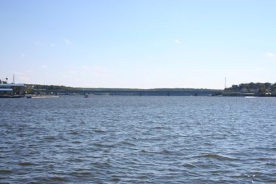
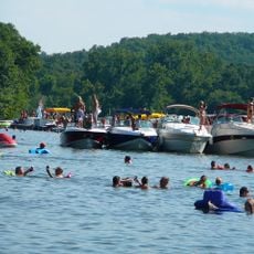
The Grand Glaize Bridge is a road bridge that spans the Lake of the Ozarks, connecting two sections of Osage Beach along U.S. Route 54 in Missouri. The structure includes multiple lanes for through traffic and provides access to recreational areas around the lake.
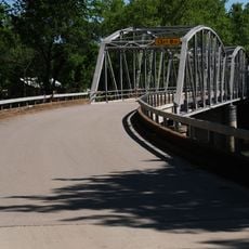
The original bridge was built in 1931 during the Bagnell Dam project and served the community until being replaced in 1995. This replacement improved traffic flow for a growing recreational region.
This bridge marks a significant point in Missouri infrastructure development, representing the growth of transportation networks in the Ozarks region.
Traffic on the bridge is typically heaviest during weekends and recreational seasons when visitors head to the lake. Drivers should expect busier conditions during peak times.
The original structure featured an innovative design with support systems positioned below the deck rather than above, which provided unobstructed views of the lake. This unusual arrangement earned it the nickname 'Upside-Down Bridge' among locals and engineers.
Location: Missouri
Inception: January 1931
Official opening: January 1931
GPS coordinates: 38.13370,-92.64370
Latest update: December 11, 2025 11:07
Lake of the Ozarks
8 km
Party Cove
3.7 km
Ha Ha Tonka State Park
20.9 km
Uranus Missouri
58.2 km
Bennett Spring State Park
50.1 km
Lake of the Ozarks State Park
3.7 km
Bridal Cave
15.4 km
508th Missile Squadron
54.8 km
Old Stagecoach Stop
51.6 km
Ralph E. Burley House
50.6 km
Wallace House
50 km
Calloway Manes Homestead
35.4 km
Ploger-Moneymaker Place
49.9 km
Fiery Fork Conservation Area
27.8 km
Zion Lutheran Church
56.3 km
Morgan County Courthouse
37.9 km
Finke Opera House
56.3 km
Pulaski County Courthouse
51.5 km
Gray-Wood Buildings
56.5 km
Moniteau County Courthouse Square
56.4 km
Lewis and Elizabeth Bolton House
54.3 km
Bennett Spring Dining Lodge
49.1 km
Joseph and Elizabeth Wallendorf House
60 km
Camden County Historical Society
12.6 km
Uranus
58.1 km
Lake of the Ozarks State Park Highway 134 Historic District
7.2 km
Bennett Spring State Park Shelter House and Water Gauge Station
50 km
Devils Elbow Bridge
60.1 kmVisited this place? Tap the stars to rate it and share your experience / photos with the community! Try now! You can cancel it anytime.
Discover hidden gems everywhere you go!
From secret cafés to breathtaking viewpoints, skip the crowded tourist spots and find places that match your style. Our app makes it easy with voice search, smart filtering, route optimization, and insider tips from travelers worldwide. Download now for the complete mobile experience.
A unique approach to discovering new places❞
— Le Figaro
All the places worth exploring❞
— France Info
A tailor-made excursion in just a few clicks❞
— 20 Minutes