Chest opened
+${chestReward.xp} XP
Explorer
NOUVEAU ×${chestReward.collectible.quantity}
tapez pour fermer
Chest locked

Open chests in the app

Around Us is built for your phone — chests unlock when you walk, explore and capture nearby places.

Enable Location

We need your location to show you interesting places around you

Discover nearby places

Find interesting locations and hidden gems around you

Precise directions

Get accurate directions and distances to places

Your location is never shared with other users. It's only used when you tap the location button.

Log in to your account

Start exploring — it's free

Trusted by 72,988 travelers worldwide

Continue with Google
Continue with Apple
or

We will send you a code to connect

By continuing, you accept our Terms and Conditions and our Privacy Policy

Check your inbox

We've sent a pincode in your inbox. Please enter the code below.

Keweenaw Underwater Preserve
Discussion Reviews Photo
1.5k Popularity

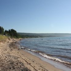
Keweenaw Underwater Preserve, Protected underwater area in Keweenaw Peninsula, Michigan.

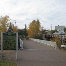
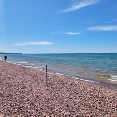
The Keweenaw Underwater Preserve is a protected underwater area along Lake Superior's shore containing multiple shipwrecks and maritime artifacts in shallow waters. The site stretches across a large expanse and offers divers access to numerous historical wreck locations throughout its boundaries.

The preserve was established to protect a collection of shipwrecks that span Michigan's copper mining boom era and the region's subsequent maritime expansion. These wrecks document different periods of Lake Superior's shipping history.

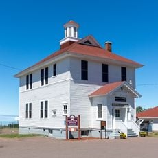
The underwater sites reflect Michigan's maritime heritage through preserved vessels, machinery, and artifacts from the region's copper mining and shipping era. Visitors can still sense how shipping and mining shaped life along Lake Superior's shore.

Divers must locate wreck sites on their own since the preserve does not mark locations with buoys, requiring careful navigation and planning. Thorough preparation before each dive is essential for a safe and successful visit.

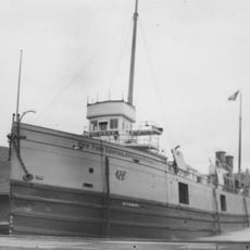
The former Coast Guard cutter Mesquite has rested on the lake bottom since 1989 and is now one of the most accessible diving destinations within the preserve. This relatively recent wreck provides an interesting contrast to the older shipwreck sites in the area.

The community of curious travelers

AroundUs brings together thousands of curated places, local tips, and hidden gems, enriched daily by 60,000 contributors worldwide.

Start exploring
Location
GPS coordinates
47.38500,-88.37200
Latest update
December 14, 2025 14:40
Around this place
Calumet Theatre
United States of America

Calumet Theatre

16.5 km
Sand Hills Light
United States of America

Sand Hills Light

817 m
SS Hudson
United States of America

SS Hudson

15.5 km
Eagle River Timber Bridge
United States of America

Eagle River Timber Bridge

6.4 km
Calumet Downtown Historic District
United States of America

Calumet Downtown Historic District

16.5 km
Calumet Fire Station
United States of America

Calumet Fire Station

16.5 km
Eagle River Light
United States of America

Eagle River Light

6.4 km
Central Mine Historic District
United States of America

Central Mine Historic District

13.2 km
Church of the Assumption
United States of America

Church of the Assumption

7.2 km
Lake Shore Drive Bridge
United States of America

Lake Shore Drive Bridge

6.4 km
Black Creek Nature Sanctuary
United States of America

Black Creek Nature Sanctuary

9.2 km
Central Mine Methodist Church
United States of America

Central Mine Methodist Church

12.9 km
Smith-Dengler House
United States of America

Smith-Dengler House

14 km
Calumet Public Library
United States of America

Calumet Public Library

16.8 km
Eagle River Historic District
United States of America

Eagle River Historic District

6.5 km
Great Sand Bay Conservation and Recreation Area
United States of America

Great Sand Bay Conservation and Recreation Area

13.4 km
Keweenaw County Courthouse
United States of America

Keweenaw County Courthouse

6.6 km
Lake Shore Drive Bridge Historical Marker
United States of America

Lake Shore Drive Bridge Historical Marker

6.4 km
Houghton Township Community Center
United States of America

Houghton Township Community Center

6.5 km
Eagle River Beach
United States of America

Eagle River Beach

6.7 km
United States of America

Sandy Pebbles Golf Course

8.4 km
United States of America

Jacobs Falls

11.2 km
United States of America

WPA Stone Boat

13.4 km
United States of America

Rock Shop

11.8 km
United States of America

Scenic viewpoint

13.2 km
United States of America

Eagle River Falls

6.4 km
United States of America

Fenners Falls

6.3 km
United States of America

Ten-Foot Falls

7.9 km
Show the full map
Reviews
Share your experience

No review yet

Discussions
Start a discussion...

No discussion yet

« Keweenaw Underwater Preserve - Protected underwater area in Keweenaw Peninsula, Michigan » is provided by Around Us (aroundus.com). Images and texts are derived from Wikimedia project under a Creative Commons license. You are allowed to copy, distribute, and modify copies of this page, under the conditions set by the license, as long as this note is clearly visible.

Discover hidden gems everywhere you go!

From secret cafés to breathtaking viewpoints, skip the crowded tourist spots and find places that match your style. Our app makes it easy with voice search, smart filtering, route optimization, and insider tips from travelers worldwide. Download now for the complete mobile experience.

Around Us App Screenshot

A unique approach to discovering new places

Le Figaro

All the places worth exploring

France Info

A tailor-made excursion in just a few clicks

20 Minutes

Around Us
Travel Guide & Maps
Download

Send to your phone

QR Code
1

Open the camera app on your mobile.

2

Point at the QR code with your camera. A notification will appear.

3

Tap the notification to open the link.