Enable Location

We need your location to show you interesting places around you

Discover nearby places

Find interesting locations and hidden gems around you

Precise directions

Get accurate directions and distances to places

Your location is never shared with other users. It's only used when you tap the location button.

Central Mine Historic District

Log in to your account

Start exploring — it's free

Trusted by 61,456 travelers worldwide

Continue with Google
Continue with Apple
or

We will send you a code to connect

By continuing, you accept our Terms and Conditions and our Privacy Policy

Check your inbox

We've sent a pincode in your inbox. Please enter the code below.

Central Mine Historic District, Historic mining district in Central, Michigan.

Description

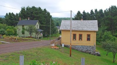
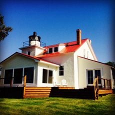
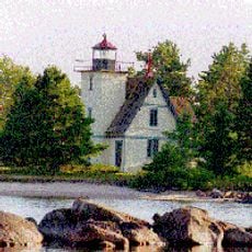
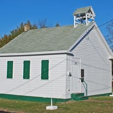
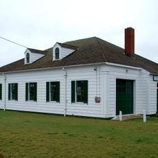
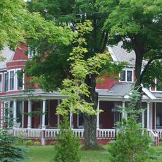
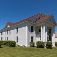
The Central Mine Historic District is a former mining settlement with approximately 20 remaining wood-frame buildings that survive from an original 130 structures, featuring gable roofs, porches, and stone foundations. The scattered buildings show how this community was laid out during the copper mining era.

History

Copper mining operations ran here from 1854 to 1898, drawing roughly 1,200 residents to the settlement at its height. When the mining industry declined, most of the community dispersed and many buildings were lost over time.

Culture

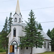
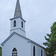
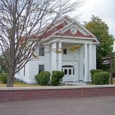
The Methodist church from 1868 shows how Cornish mining families shaped this community's spiritual and social life, and it remains a gathering place for descendants and local events. You can see how immigrant traditions became woven into the everyday rhythms of village life.

Practical

A visitor center operates from mid-June through early October with exhibits and information for exploring the site on your own. Self-guided walking routes let you move through the district at your pace and see the buildings and landscape as they are today.

Did you know?

Two woodland trails reveal hidden house foundations and the location where the old schoolhouse once stood, showing visitors how much larger the original settlement was. Walking these paths connects you to the landscape that families once shaped and lived in.

Location
GPS coordinates
47.40583,-88.19944
Latest update
December 14, 2025 16:42

AroundUs brings together thousands of curated places, local tips, and hidden gems, enriched daily by 60,000 contributors worldwide. Discover all places nearby (Michigan).

Around this place
Estivant Pines
United States of America

Estivant Pines

24.7 km
SS S.R. Kirby
United States of America

SS S.R. Kirby

18 km
Sand Hills Light
United States of America

Sand Hills Light

12.7 km
SS Hudson
United States of America

SS Hudson

11.1 km
Eagle Harbor Light
United States of America

Eagle Harbor Light

6.7 km
Eagle River Timber Bridge
United States of America

Eagle River Timber Bridge

7.4 km
Keweenaw Mountain Lodge and Golf Course Complex
United States of America

Keweenaw Mountain Lodge and Golf Course Complex

22.7 km
Eagle River Light
United States of America

Eagle River Light

7.5 km
Mendota Light
United States of America

Mendota Light

17.9 km
Church of the Assumption
United States of America

Church of the Assumption

6.1 km
Big Traverse Bay Historic District
United States of America

Big Traverse Bay Historic District

23.8 km
Eagle Harbor Schoolhouse
United States of America

Eagle Harbor Schoolhouse

6.3 km
Eagle Harbor Coast Guard Station Boathouse
United States of America

Eagle Harbor Coast Guard Station Boathouse

7 km
Lake Shore Drive Bridge
United States of America

Lake Shore Drive Bridge

7.4 km
Black Creek Nature Sanctuary
United States of America

Black Creek Nature Sanctuary

21.7 km
US 41–Fanny Hooe Creek Bridge
United States of America

US 41–Fanny Hooe Creek Bridge

25.6 km
Central Mine Methodist Church
United States of America

Central Mine Methodist Church

354 m
Holy Redeemer Church
United States of America

Holy Redeemer Church

6.2 km
M-26–Silver River Culvert
United States of America

M-26–Silver River Culvert

11.5 km
M-26–Cedar Creek Culvert
United States of America

M-26–Cedar Creek Culvert

6.7 km
Smith-Dengler House
United States of America

Smith-Dengler House

23.2 km
Klipfel
United States of America

Klipfel

19.4 km
Eagle River Historic District
United States of America

Eagle River Historic District

7.4 km
Keweenaw County Courthouse
United States of America

Keweenaw County Courthouse

7.2 km
Lake Shore Drive Bridge Historical Marker
United States of America

Lake Shore Drive Bridge Historical Marker

7.4 km
Houghton Township Community Center
United States of America

Houghton Township Community Center

7.3 km
Eagle Harbor House Historical Marker
United States of America

Eagle Harbor House Historical Marker

6.3 km
Historic School at Gay
United States of America

Historic School at Gay

20.1 km
Show the full map
« Central Mine Historic District - Historic mining district in Central, Michigan » is provided by Around Us (aroundus.com). Images and texts are derived from Wikimedia project under a Creative Commons license. You are allowed to copy, distribute, and modify copies of this page, under the conditions set by the license, as long as this note is clearly visible.

Discover hidden gems everywhere you go!

From secret cafés to breathtaking viewpoints, skip the crowded tourist spots and find places that match your style. Our app makes it easy with voice search, smart filtering, route optimization, and insider tips from travelers worldwide. Download now for the complete mobile experience.

Around Us App Screenshot

A unique approach to discovering new places

Le Figaro

All the places worth exploring

France Info

A tailor-made excursion in just a few clicks

20 Minutes

Around Us
Travel Guide & Maps
Download

Send to your phone

QR Code
1

Open the camera app on your mobile.

2

Point at the QR code with your camera. A notification will appear.

3

Tap the notification to open the link.