Enable Location

We need your location to show you interesting places around you

Discover nearby places

Find interesting locations and hidden gems around you

Precise directions

Get accurate directions and distances to places

Your location is never shared with other users. It's only used when you tap the location button.

Eagle Harbor Coast Guard Station Boathouse

Log in to your account

Start exploring — it's free

Trusted by 62,417 travelers worldwide

Continue with Google
Continue with Apple
or

We will send you a code to connect

By continuing, you accept our Terms and Conditions and our Privacy Policy

Check your inbox

We've sent a pincode in your inbox. Please enter the code below.

Eagle Harbor Coast Guard Station Boathouse

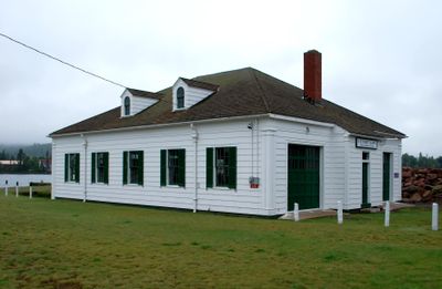
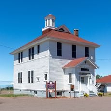
Eagle Harbor Coast Guard Station Boathouse, building in Michigan, United States

The Eagle Harbor Coast Guard Station Boathouse is a one-story wooden structure with wide board walls and a shingled roof, located near the water in Michigan. The rectangular building measures about 58 feet by 44 feet and features five large rolling doors designed to move rescue boats and equipment efficiently.

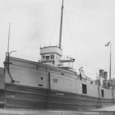
The original station was built between 1910 and 1912 by the United States Life-Saving Service and played a key role in rescuing sailors in distress. The current boathouse was constructed in 1938 to replace the earlier structure and served rescue operations until the station closed in 1950.

The boathouse represents the community's commitment to maritime safety and rescue efforts over many decades. Today it serves as a museum that keeps alive the memory of those who dedicated their work to helping sailors in trouble.

The boathouse sits beside the harbor and is easily accessible on foot, with open access through the large door areas for visitors to explore. The site covers about an acre and is positioned directly along the water, making it easy to walk around and view the structure from different angles.

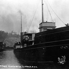
The boathouse displays restored wooden rescue boats, including a fully restored 26-foot pulling surfboat that shows visitors how rescue operations were actually carried out in earlier times. The exhibits also feature old tools and photographs documenting the demanding work of the rescue teams.

The community of curious travelers

AroundUs brings together thousands of curated places, local tips, and hidden gems, enriched daily by 60,000 contributors worldwide.

Start exploring
Location
GPS coordinates
47.45889,-88.14944
Latest update
February 9, 2026 11:06
Around this place
Brockway Mountain Drive
United States of America

Brockway Mountain Drive

13.6 km
Fort Wilkins Historic State Park
United States of America

Fort Wilkins Historic State Park

21.1 km
Estivant Pines
United States of America

Estivant Pines

20.5 km
SS S.R. Kirby
United States of America

SS S.R. Kirby

13.1 km
Copper Harbor Light
United States of America

Copper Harbor Light

21.8 km
Sand Hills Light
United States of America

Sand Hills Light

18 km
SS Hudson
United States of America

SS Hudson

9 km
Eagle Harbor Light
United States of America

Eagle Harbor Light

738 m
Eagle River Timber Bridge
United States of America

Eagle River Timber Bridge

12.3 km
Keweenaw Mountain Lodge and Golf Course Complex
United States of America

Keweenaw Mountain Lodge and Golf Course Complex

18.2 km
Eagle River Light
United States of America

Eagle River Light

12.3 km
Mendota Light
United States of America

Mendota Light

16.7 km
Central Mine Historic District
United States of America

Central Mine Historic District

7 km
Church of the Assumption
United States of America

Church of the Assumption

12.3 km
Eagle Harbor Schoolhouse
United States of America

Eagle Harbor Schoolhouse

1 km
Lake Shore Drive Bridge
United States of America

Lake Shore Drive Bridge

12.2 km
US 41–Fanny Hooe Creek Bridge
United States of America

US 41–Fanny Hooe Creek Bridge

20.9 km
Central Mine Methodist Church
United States of America

Central Mine Methodist Church

7.1 km
Holy Redeemer Church
United States of America

Holy Redeemer Church

1.2 km
M-26–Silver River Culvert
United States of America

M-26–Silver River Culvert

5.8 km
M-26–Cedar Creek Culvert
United States of America

M-26–Cedar Creek Culvert

373 m
Klipfel
United States of America

Klipfel

14.5 km
Eagle River Historic District
United States of America

Eagle River Historic District

12.2 km
Keweenaw County Courthouse
United States of America

Keweenaw County Courthouse

12 km
Lake Shore Drive Bridge Historical Marker
United States of America

Lake Shore Drive Bridge Historical Marker

12.3 km
Houghton Township Community Center
United States of America

Houghton Township Community Center

12.2 km
Eagle Harbor House Historical Marker
United States of America

Eagle Harbor House Historical Marker

901 m
Hunter's Point Park
United States of America

Hunter's Point Park

19.3 km
Show the full map
« Eagle Harbor Coast Guard Station Boathouse - building in Michigan, United States » is provided by Around Us (aroundus.com). Images and texts are derived from Wikimedia project under a Creative Commons license. You are allowed to copy, distribute, and modify copies of this page, under the conditions set by the license, as long as this note is clearly visible.

Discover hidden gems everywhere you go!

From secret cafés to breathtaking viewpoints, skip the crowded tourist spots and find places that match your style. Our app makes it easy with voice search, smart filtering, route optimization, and insider tips from travelers worldwide. Download now for the complete mobile experience.

Around Us App Screenshot

A unique approach to discovering new places

Le Figaro

All the places worth exploring

France Info

A tailor-made excursion in just a few clicks

20 Minutes

Around Us
Travel Guide & Maps
Download

Send to your phone

QR Code
1

Open the camera app on your mobile.

2

Point at the QR code with your camera. A notification will appear.

3

Tap the notification to open the link.