Enable Location

We need your location to show you interesting places around you

Discover nearby places

Find interesting locations and hidden gems around you

Precise directions

Get accurate directions and distances to places

Your location is never shared with other users. It's only used when you tap the location button.

Fort Wilkins Historic State Park

Log in to your account

Start exploring — it's free

Trusted by 61,452 travelers worldwide

Continue with Google
Continue with Apple
or

We will send you a code to connect

By continuing, you accept our Terms and Conditions and our Privacy Policy

Check your inbox

We've sent a pincode in your inbox. Please enter the code below.

Fort Wilkins Historic State Park, Military heritage site in Keweenaw County, United States.

Description

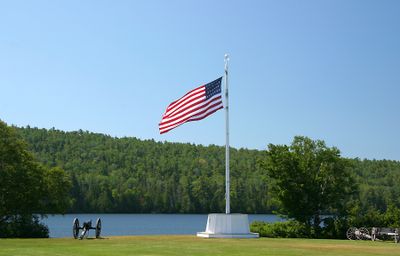
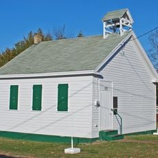
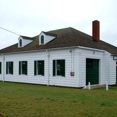
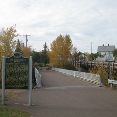
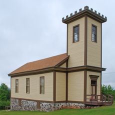
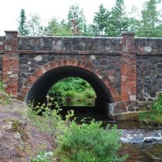
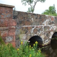
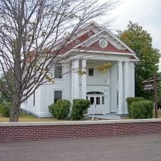
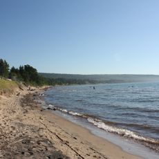
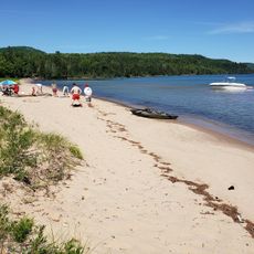
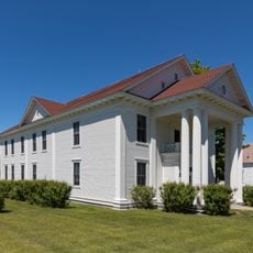
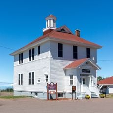
Fort Wilkins Historic State Park is a 360-acre site along Lake Superior's shore with restored military buildings and woodland trails in Michigan's Upper Peninsula. The grounds include 19 preserved structures from the original post and offer fishing, camping, and exploration opportunities.

History

The Army built the post in 1844 to keep order during the copper mining boom and protect government interests in the region. The fort served as a key base during the period of rapid resource development in the north.

Culture

Seasonal interpretive programs show military drills and daily work like cooking that reflect how soldiers lived during the 1840s garrison period. Visitors can walk through the buildings and understand the routines and skills of that time.

Practical

The grounds are open spring through fall and offer camping spots, hiking paths, and fishing areas around the buildings and shoreline. Visitors should know that lakeside weather can be unpredictable and trail conditions vary depending on the season.

Did you know?

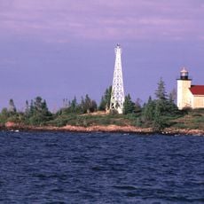
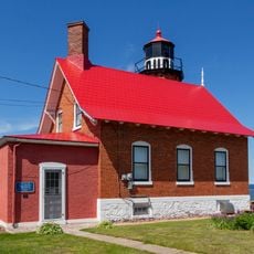
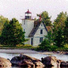
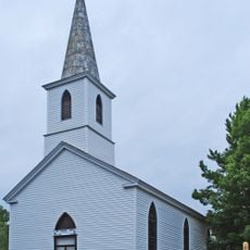
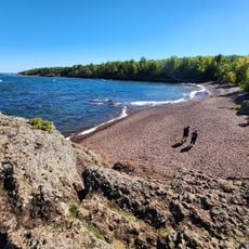
Two lighthouses from the 1860s stand on the park grounds and mark the northern shoreline of the Keweenaw Peninsula. These towers are rare remnants of the region's early shipping history.

Location
Inception
1923
Operator
Michigan Department of Natural Resources
Address
U.S. Highway 41
GPS coordinates
47.46722,-87.86972
Latest update
December 8, 2025 20:00

AroundUs brings together thousands of curated places, local tips, and hidden gems, enriched daily by 60,000 contributors worldwide. Discover all places nearby (Keweenaw County).

Around this place
Estivant Pines
United States of America

Estivant Pines

2.4 km
SS S.R. Kirby
United States of America

SS S.R. Kirby

28.4 km
Copper Harbor Light
United States of America

Copper Harbor Light

1.1 km
SS Hudson
United States of America

SS Hudson

29.1 km
Eagle Harbor Light
United States of America

Eagle Harbor Light

21.8 km
Gull Rock Light Station
United States of America

Gull Rock Light Station

16.5 km
Keweenaw Mountain Lodge and Golf Course Complex
United States of America

Keweenaw Mountain Lodge and Golf Course Complex

3 km
Manitou Island Light Station
United States of America

Manitou Island Light Station

21.9 km
Mendota Light
United States of America

Mendota Light

12.7 km
Central Mine Historic District
United States of America

Central Mine Historic District

25.8 km
Church of the Assumption
United States of America

Church of the Assumption

31.8 km
Eagle Harbor Schoolhouse
United States of America

Eagle Harbor Schoolhouse

22.1 km
Eagle Harbor Coast Guard Station Boathouse
United States of America

Eagle Harbor Coast Guard Station Boathouse

21.1 km
Lake Shore Drive Bridge
United States of America

Lake Shore Drive Bridge

32.7 km
US 41–Fanny Hooe Creek Bridge
United States of America

US 41–Fanny Hooe Creek Bridge

150 m
Central Mine Methodist Church
United States of America

Central Mine Methodist Church

26 km
Holy Redeemer Church
United States of America

Holy Redeemer Church

22.3 km
M-26–Silver River Culvert
United States of America

M-26–Silver River Culvert

15.2 km
M-26–Cedar Creek Culvert
United States of America

M-26–Cedar Creek Culvert

21.1 km
Klipfel
United States of America

Klipfel

6.6 km
Eagle River Historic District
United States of America

Eagle River Historic District

32.7 km
Great Sand Bay Conservation and Recreation Area
United States of America

Great Sand Bay Conservation and Recreation Area

26.3 km
Bete Grise North Public Beach
United States of America

Bete Grise North Public Beach

11.5 km
Horseshoe Harbor Beach
United States of America

Horseshoe Harbor Beach

5.2 km
Keweenaw County Courthouse
United States of America

Keweenaw County Courthouse

32.5 km
Houghton Township Community Center
United States of America

Houghton Township Community Center

32.7 km
Eagle Harbor House Historical Marker
United States of America

Eagle Harbor House Historical Marker

21.9 km
Hunter's Point Park
United States of America

Hunter's Point Park

2 km
Show the full map
« Fort Wilkins Historic State Park - Military heritage site in Keweenaw County, United States » is provided by Around Us (aroundus.com). Images and texts are derived from Wikimedia project under a Creative Commons license. You are allowed to copy, distribute, and modify copies of this page, under the conditions set by the license, as long as this note is clearly visible.

Discover hidden gems everywhere you go!

From secret cafés to breathtaking viewpoints, skip the crowded tourist spots and find places that match your style. Our app makes it easy with voice search, smart filtering, route optimization, and insider tips from travelers worldwide. Download now for the complete mobile experience.

Around Us App Screenshot

A unique approach to discovering new places

Le Figaro

All the places worth exploring

France Info

A tailor-made excursion in just a few clicks

20 Minutes

Around Us
Travel Guide & Maps
Download

Send to your phone

QR Code
1

Open the camera app on your mobile.

2

Point at the QR code with your camera. A notification will appear.

3

Tap the notification to open the link.