Enable Location

We need your location to show you interesting places around you

Discover nearby places

Find interesting locations and hidden gems around you

Precise directions

Get accurate directions and distances to places

Your location is never shared with other users. It's only used when you tap the location button.

Gull Rock Light Station

Log in to your account

Start exploring — it's free

Trusted by 63,397 travelers worldwide

Continue with Google
Continue with Apple
or

We will send you a code to connect

By continuing, you accept our Terms and Conditions and our Privacy Policy

Check your inbox

We've sent a pincode in your inbox. Please enter the code below.

Discussion Reviews 1 Photos
2.2k Popularity

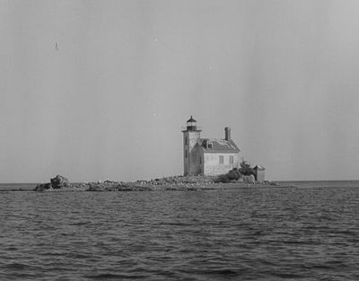
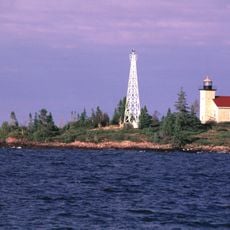
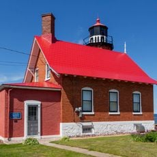
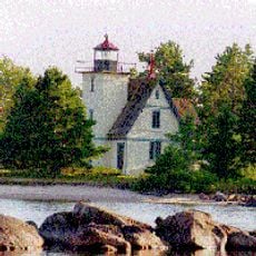
Gull Rock Light Station, Historic lighthouse in Keweenaw County, United States

Gull Rock Light Station is a brick lighthouse tower standing on a small rocky island in Lake Superior, with white walls and a black lantern chamber at its top. The structure reaches about 14 meters in height and sits on one of the lake's most isolated locations.

This lighthouse was built in 1867 near Manitou Island to guide ships through hazardous waters. Its construction followed several vessel losses in this region due to poor navigation conditions.

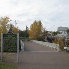
This station on a tiny island serves as a symbol of Great Lakes maritime heritage for visitors. It represents how lighthouse keepers risked their lives to guide ships safely through treacherous waters.

Reaching this island requires a private boat or participation in a scheduled lighthouse tour. Planning ahead is necessary since weather and lake conditions control when visits are actually possible.

During powerful storms, waves completely cover the rocky island, leaving only the lighthouse tower visible above the water. This extreme environment made it one of the most demanding postings for lighthouse keepers in the Great Lakes region.

The community of curious travelers

AroundUs brings together thousands of curated places, local tips, and hidden gems, enriched daily by 60,000 contributors worldwide.

Start exploring
Location
Inception
1867
Height
14 m
GPS coordinates
47.41720,-87.66388
Latest update
December 13, 2025 17:10
Around this place
Stannard Rock Light
United States of America

Stannard Rock Light

42.1 km
Fort Wilkins Historic State Park
United States of America

Fort Wilkins Historic State Park

16.5 km
Estivant Pines
United States of America

Estivant Pines

16.4 km
SS S.R. Kirby
United States of America

SS S.R. Kirby

44.9 km
Copper Harbor Light
United States of America

Copper Harbor Light

16.1 km
SS Hudson
United States of America

SS Hudson

45.3 km
Eagle Harbor Light
United States of America

Eagle Harbor Light

37.6 km
Eagle River Timber Bridge
United States of America

Eagle River Timber Bridge

47.7 km
Keweenaw Mountain Lodge and Golf Course Complex
United States of America

Keweenaw Mountain Lodge and Golf Course Complex

18.9 km
Manitou Island Light Station
United States of America

Manitou Island Light Station

5.8 km
Mendota Light
United States of America

Mendota Light

23.3 km
Central Mine Historic District
United States of America

Central Mine Historic District

40.4 km
Church of the Assumption
United States of America

Church of the Assumption

46.2 km
Eagle Harbor Schoolhouse
United States of America

Eagle Harbor Schoolhouse

37.8 km
Eagle Harbor Coast Guard Station Boathouse
United States of America

Eagle Harbor Coast Guard Station Boathouse

36.9 km
Lake Shore Drive Bridge
United States of America

Lake Shore Drive Bridge

47.7 km
US 41–Fanny Hooe Creek Bridge
United States of America

US 41–Fanny Hooe Creek Bridge

16.6 km
Central Mine Methodist Church
United States of America

Central Mine Methodist Church

40.7 km
Holy Redeemer Church
United States of America

Holy Redeemer Church

38 km
M-26–Silver River Culvert
United States of America

M-26–Silver River Culvert

31.2 km
M-26–Cedar Creek Culvert
United States of America

M-26–Cedar Creek Culvert

36.9 km
Klipfel
United States of America

Klipfel

22.8 km
Eagle River Historic District
United States of America

Eagle River Historic District

47.7 km
Keweenaw County Courthouse
United States of America

Keweenaw County Courthouse

47.5 km
Lake Shore Drive Bridge Historical Marker
United States of America

Lake Shore Drive Bridge Historical Marker

47.7 km
Houghton Township Community Center
United States of America

Houghton Township Community Center

47.6 km
Eagle Harbor House Historical Marker
United States of America

Eagle Harbor House Historical Marker

37.7 km
Historic School at Gay
United States of America

Historic School at Gay

43.2 km
Show the full map
Reviews
Share your experience

No review yet

Discussions
Start a discussion...

No discussion yet

« Gull Rock Light Station - Historic lighthouse in Keweenaw County, United States » is provided by Around Us (aroundus.com). Images and texts are derived from Wikimedia project under a Creative Commons license. You are allowed to copy, distribute, and modify copies of this page, under the conditions set by the license, as long as this note is clearly visible.

Discover hidden gems everywhere you go!

From secret cafés to breathtaking viewpoints, skip the crowded tourist spots and find places that match your style. Our app makes it easy with voice search, smart filtering, route optimization, and insider tips from travelers worldwide. Download now for the complete mobile experience.

Around Us App Screenshot

A unique approach to discovering new places

Le Figaro

All the places worth exploring

France Info

A tailor-made excursion in just a few clicks

20 Minutes

Around Us
Travel Guide & Maps
Download

Send to your phone

QR Code
1

Open the camera app on your mobile.

2

Point at the QR code with your camera. A notification will appear.

3

Tap the notification to open the link.