Enable Location

We need your location to show you interesting places around you

Discover nearby places

Find interesting locations and hidden gems around you

Precise directions

Get accurate directions and distances to places

Your location is never shared with other users. It's only used when you tap the location button.

Marietta Historic District

Log in to your account

Start exploring — it's free

Trusted by 61,413 travelers worldwide

Continue with Google
Continue with Apple
or

We will send you a code to connect

By continuing, you accept our Terms and Conditions and our Privacy Policy

Check your inbox

We've sent a pincode in your inbox. Please enter the code below.

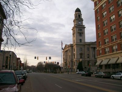
Marietta Historic District, Historic district in Marietta, Ohio, United States.

Description

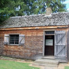
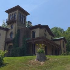
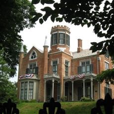
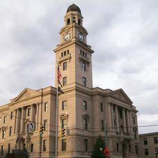
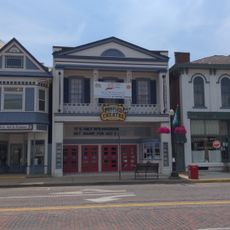
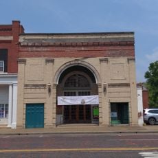
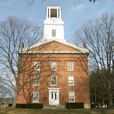
Marietta Historic District is a neighborhood with buildings dating from the late 1700s through the early 1900s, showing Federal, Greek Revival, and Victorian architectural styles. The structures cluster together within a compact area, creating a cohesive mix of homes, shops, and public buildings.

History

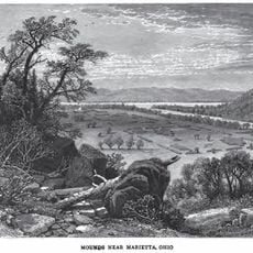
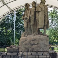
The district emerged in the late 1700s as one of the first permanent settlements in the Northwest Territory during westward expansion. Most surviving buildings date from the decades that followed, as the community grew and different industries became established.

Culture

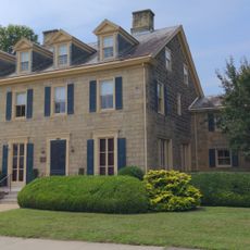
The district displays building styles and craftsmanship that reveal how residents lived across different social ranks. Walking through, you notice handmade architectural details and how commercial and residential spaces stood side by side in daily life.

Practical

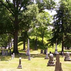
It is best to walk through the district and view the buildings from public pathways. Information about individual structures is available at local museums and visitor centers, and some routes have informational signs along the streets.

Did you know?

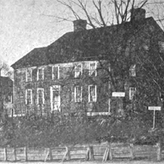
The district preserves several structures connected to Ephraim Cutler, an early resident who shaped settlement policies for the region. His personal influence remains visible in the surviving buildings and the ways they reflect choices made during founding years.

Location
GPS coordinates
39.41806,-81.45528
Latest update
December 14, 2025 16:42

AroundUs brings together thousands of curated places, local tips, and hidden gems, enriched daily by 60,000 contributors worldwide. Discover all places nearby (Marietta).

Around this place
Mound Cemetery
United States of America

Mound Cemetery

359 m
Marietta Earthworks
United States of America

Marietta Earthworks

362 m
Rufus Putnam House
United States of America

Rufus Putnam House

615 m
Campus Martius Museum
United States of America

Campus Martius Museum

634 m
Ohio Company Land Office
United States of America

Ohio Company Land Office

649 m
The Anchorage
United States of America

The Anchorage

880 m
Start Westward Memorial
United States of America

Start Westward Memorial

338 m
The Castle
United States of America

The Castle

279 m
Washington County Courthouse
United States of America

Washington County Courthouse

31 m
David Putnam House
United States of America

David Putnam House

684 m
First Unitarian Church of Marietta
United States of America

First Unitarian Church of Marietta

289 m
The Castle
United States of America

The Castle

244 m
Peoples Bank Theatre
United States of America

Peoples Bank Theatre

312 m
Ohio River Museum
United States of America

Ohio River Museum

706 m
Mid-Ohio Valley Players Theatre
United States of America

Mid-Ohio Valley Players Theatre

246 m
Putnam Street Bridge
United States of America

Putnam Street Bridge

541 m
Muskingum Academy, 1797 - Birth of Higher Education in Ohio
United States of America

Muskingum Academy, 1797 - Birth of Higher Education in Ohio

387 m
Marietta Branch Library
United States of America

Marietta Branch Library

707 m
Erwin Hall
United States of America

Erwin Hall

439 m
Putnam Street Bridge
United States of America

Putnam Street Bridge

514 m
Peoples Mortuary Museum
United States of America

Peoples Mortuary Museum

215 m
Harmar Bridge
United States of America

Harmar Bridge

715 m
Ohio National Guard Armory
United States of America

Ohio National Guard Armory

522 m
C. William O'Neill (1916-1978)
United States of America

C. William O'Neill (1916-1978)

144 m
Old Muskingum Lockhouse
United States of America

Old Muskingum Lockhouse

538 m
Muskingum River Underground Railroad
United States of America

Muskingum River Underground Railroad

681 m
The Towboat W. P. Snyder Jr.
United States of America

The Towboat W. P. Snyder Jr.

707 m
The Towboat of W.P. Snyder Jr.
United States of America

The Towboat of W.P. Snyder Jr.

717 m
Show the full map
« Marietta Historic District - Historic district in Marietta, Ohio, United States » is provided by Around Us (aroundus.com). Images and texts are derived from Wikimedia project under a Creative Commons license. You are allowed to copy, distribute, and modify copies of this page, under the conditions set by the license, as long as this note is clearly visible.

Discover hidden gems everywhere you go!

From secret cafés to breathtaking viewpoints, skip the crowded tourist spots and find places that match your style. Our app makes it easy with voice search, smart filtering, route optimization, and insider tips from travelers worldwide. Download now for the complete mobile experience.

Around Us App Screenshot

A unique approach to discovering new places

Le Figaro

All the places worth exploring

France Info

A tailor-made excursion in just a few clicks

20 Minutes

Around Us
Travel Guide & Maps
Download

Send to your phone

QR Code
1

Open the camera app on your mobile.

2

Point at the QR code with your camera. A notification will appear.

3

Tap the notification to open the link.