Enable Location

We need your location to show you interesting places around you

Discover nearby places

Find interesting locations and hidden gems around you

Precise directions

Get accurate directions and distances to places

Your location is never shared with other users. It's only used when you tap the location button.

Martín Peña Bridge

Log in to your account

Start exploring — it's free

Trusted by 61,598 travelers worldwide

Continue with Google
Continue with Apple
or

We will send you a code to connect

By continuing, you accept our Terms and Conditions and our Privacy Policy

Check your inbox

We've sent a pincode in your inbox. Please enter the code below.

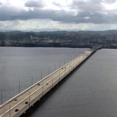
Martín Peña Bridge, Road bridge and National Register of Historic Places site in Santurce, Puerto Rico.

Description

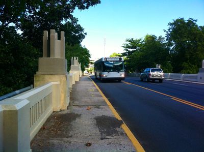
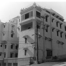
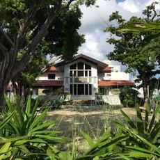
The Martín Peña Bridge is an Art Deco road bridge that spans the Martín Peña Channel and connects several neighborhoods across San Juan. The structure runs along the Juan Ponce de León Avenue and Carretera Central, carrying vehicle traffic over the waterway.

History

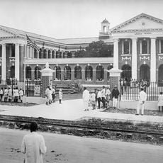
The site began as a stone causeway in the 1500s, which was replaced by a brick bridge in 1784 as the city grew. Engineer Cecilio Delgado designed the current Art Deco structure in 1939, representing the modern transformation of the infrastructure.

Culture

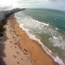
The bridge takes its name from a fisherman whose livelihood depended on these waters, honoring the maritime traditions that shaped the area before urban growth. The structure itself marks a transition point where the city meets the waterway, visible in how traffic flows across it daily.

Practical

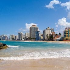
The bridge connects the districts of Santurce, Hato Rey Norte, and Hato Rey Central, making it a key traffic point in the city. The structure is primarily designed for vehicles, but pedestrians can also cross it during normal traffic hours.

Did you know?

The structure was added to the National Register of Historic Places in 2008, acknowledging its role in the city's development. This recognition shows that the infrastructure represents more than just a transportation link, embodying a key phase of urban growth.

Location
Inception
1939
GPS coordinates
18.43342,-66.05906
Latest update
December 14, 2025 16:42

AroundUs brings together thousands of curated places, local tips, and hidden gems, enriched daily by 60,000 contributors worldwide. Discover all places nearby (San Juan).

Around this place
Hiram Bithorn Stadium
Puerto Rico

Hiram Bithorn Stadium

2.4 km
Roberto Clemente Coliseum
United States of America

Roberto Clemente Coliseum

2.6 km
Teodoro Moscoso Bridge
United States of America

Teodoro Moscoso Bridge

3.8 km
San Juan Marriott Resort & Stellaris Casino
United States of America

San Juan Marriott Resort & Stellaris Casino

2.8 km
Condado Beach
United States of America

Condado Beach

3.6 km
United States of America

Puerto Rico Firefighters Corps

2.8 km
Puerto Rico Museum of Art
United States of America

Puerto Rico Museum of Art

1.8 km
Puerto Rico Museum of Contemporary Art
United States of America

Puerto Rico Museum of Contemporary Art

2.5 km
Ocean Park Beach
United States of America

Ocean Park Beach

2.4 km
Miami Building
United States of America

Miami Building

3.8 km
United States of America

Roosevelt Tower

3.5 km
Playita del Condado
United States of America

Playita del Condado

3.6 km
Episcopal Cathedral of St. John the Baptist
United States of America

Episcopal Cathedral of St. John the Baptist

2.1 km
Church of San Mateo de Cangrejos of Santurce
United States of America

Church of San Mateo de Cangrejos of Santurce

1.3 km
Residencia Aboy-Lompré
United States of America

Residencia Aboy-Lompré

3.5 km
La Giralda
United States of America

La Giralda

3.7 km
Dr. Concha Meléndez Ramírez House
United States of America

Dr. Concha Meléndez Ramírez House

2.3 km
Edificio Victory Garden
United States of America

Edificio Victory Garden

3.1 km
Edificio Aboy
United States of America

Edificio Aboy

3.5 km
Museo de Historia, Antropología y Arte
United States of America

Museo de Historia, Antropología y Arte

3.3 km
Luis A. Ferré Performing Arts Center
United States of America

Luis A. Ferré Performing Arts Center

1.9 km
Museum of Art and Design in Miramar
United States of America

Museum of Art and Design in Miramar

3.5 km
Teatro Emilio S. Belaval
United States of America

Teatro Emilio S. Belaval

988 m
Union Church
United States of America

Union Church

2.7 km
Rafael María de Labra Graded School
United States of America

Rafael María de Labra Graded School

2.5 km
Museo de Historia, Antropología y Arte (Universidad de Puerto Rico)
Puerto Rico

Museo de Historia, Antropología y Arte (Universidad de Puerto Rico)

3.4 km
Our Lady of the Pillar Church
United States of America

Our Lady of the Pillar Church

4 km
William Korber House
United States of America

William Korber House

3.3 km
Show the full map
« Martín Peña Bridge - Road bridge and National Register of Historic Places site in Santurce, Puerto Rico » is provided by Around Us (aroundus.com). Images and texts are derived from Wikimedia project under a Creative Commons license. You are allowed to copy, distribute, and modify copies of this page, under the conditions set by the license, as long as this note is clearly visible.

Discover hidden gems everywhere you go!

From secret cafés to breathtaking viewpoints, skip the crowded tourist spots and find places that match your style. Our app makes it easy with voice search, smart filtering, route optimization, and insider tips from travelers worldwide. Download now for the complete mobile experience.

Around Us App Screenshot

A unique approach to discovering new places

Le Figaro

All the places worth exploring

France Info

A tailor-made excursion in just a few clicks

20 Minutes

Around Us
Travel Guide & Maps
Download

Send to your phone

QR Code
1

Open the camera app on your mobile.

2

Point at the QR code with your camera. A notification will appear.

3

Tap the notification to open the link.