Chest opened
+${chestReward.xp} XP
Explorer
NOUVEAU ×${chestReward.collectible.quantity}
tapez pour fermer

See the monuments around you in AR Open chests in the app

Around Us is built for your phone — point your camera at the streets and discover the monuments and places around you in augmented reality. Around Us is built for your phone — chests unlock when you walk, explore and capture nearby places.

Enable Location

We need your location to show you interesting places around you

Discover nearby places

Find interesting locations and hidden gems around you

Precise directions

Get accurate directions and distances to places

Your location is never shared with other users. It's only used when you tap the location button.

Log in to your account

Start exploring — it's free

Trusted by 82,397 travelers worldwide

Continue with Google
Continue with Apple
or

We will send you a code to connect

By continuing, you accept our Terms and Conditions and our Privacy Policy

Check your inbox

We've sent a pincode in your inbox. Please enter the code below.

Mount Furuhelm
Discussion Reviews Photo
1k Popularity

Mount Furuhelm, Mountain summit on Baranof Island, Alaska, United States.

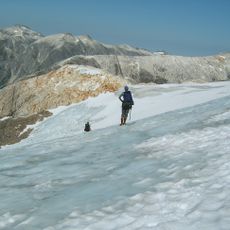
Mount Furuhelm is a mountain summit located on Baranof Island that rises approximately 2,520 feet above sea level. Dense forests cover the lower elevations, while the upper reaches transition to exposed rock outcrops and open views.

The summit was officially named as a navigational reference point by the United States Coast and Geodetic Survey during mapping expeditions in the 1940s. This designation reflected its importance as a landmark for maritime navigation in the region.

The Tlingit peoples maintain traditional connections to the mountain's surroundings through seasonal hunting and gathering practices in the Tongass National Forest.

Visitors should bring sturdy footwear and navigation tools, as weather can change rapidly and rain is frequent in this region. Proper equipment for wet conditions and temperature swings is essential for any ascent attempt.

From the summit area, there are unobstructed views across Chatham Strait and the surrounding islands of the Inside Passage. This vantage point offers visitors a perspective on the broader coastal landscape and neighboring island formations.

The community of curious travelers

AroundUs brings together thousands of curated places, local tips, and hidden gems, enriched daily by 60,000 contributors worldwide.

Start exploring
Location
GPS coordinates
57.04960,-134.93132
Latest update
July 25, 2026 07:20
Around this place
Sitka National Historical Park
United States of America

Sitka National Historical Park

23.3 km
Blue Lake
United States of America

Blue Lake

14.3 km
Baranof Cross-Island Trail
United States of America

Baranof Cross-Island Trail

2.9 km
Sitka National Cemetery
United States of America

Sitka National Cemetery

23.8 km
United States of America

Baranof Warm Springs

6.8 km
United States of America

Graystone Cliff

21.4 km
United States of America

Raven/Shark Pole

23.4 km
United States of America

Mosquito Legend Pole

23.2 km
United States of America

K’alyáan Pole

23.1 km
United States of America

Yaadaas Crest Corner Pole—First Twin

23.4 km
United States of America

Wolf Pole

23.4 km
United States of America

Cormorant Memorial / Mortuary Column

23.4 km
United States of America

Trader Legend Pole

23.3 km
United States of America

Yaadaas Crest Corner Pole—Second Twin

23.3 km
United States of America

White Cliff

16.4 km
United States of America

Gaanax.ádi /Raven Crest Pole

23.3 km
United States of America

Raven Memorial Pole

23.3 km
United States of America

Sitka National Historical Park

23.5 km
United States of America

Saanaheit Pole

23.5 km
United States of America

Frog/Raven Pole

23.5 km
United States of America

Wooch Jin Dul Shat Kooteeya

23.5 km
United States of America

Lakich’inei Pole

23.2 km
United States of America

Saanaheit House Posts

23.5 km
United States of America

Totem Conservation Exhibit

23.5 km
United States of America

Yaadaas Crest Corner Pole Fragments

23.5 km
United States of America

Bear Mountain Waterfall

15.6 km
United States of America

Waterfall

19 km
United States of America

Indian River Falls

19 km
Show the full map
Reviews
Share your experience

No review yet

Discussions
Start a discussion...

No discussion yet

« Mount Furuhelm - Mountain summit on Baranof Island, Alaska, United States » is provided by Around Us (aroundus.com). Images and texts are derived from Wikimedia project under a Creative Commons license. You are allowed to copy, distribute, and modify copies of this page, under the conditions set by the license, as long as this note is clearly visible.

Discover hidden gems everywhere you go!

From secret cafés to breathtaking viewpoints, skip the crowded tourist spots and find places that match your style. Our app makes it easy with voice search, smart filtering, route optimization, and insider tips from travelers worldwide. Download now for the complete mobile experience.

Around Us App Screenshot

A unique approach to discovering new places

Le Figaro

All the places worth exploring

France Info

A tailor-made excursion in just a few clicks

20 Minutes

Around Us
Travel Guide & Maps
Download

Send to your phone

QR Code
1

Open the camera app on your mobile.

2

Point at the QR code with your camera. A notification will appear.

3

Tap the notification to open the link.