Enable Location

We need your location to show you interesting places around you

Discover nearby places

Find interesting locations and hidden gems around you

Precise directions

Get accurate directions and distances to places

Your location is never shared with other users. It's only used when you tap the location button.

Frederick County Poor Farm

Log in to your account

Start exploring — it's free

Trusted by 63,129 travelers worldwide

Continue with Google
Continue with Apple
or

We will send you a code to connect

By continuing, you accept our Terms and Conditions and our Privacy Policy

Check your inbox

We've sent a pincode in your inbox. Please enter the code below.

Discussion Reviews 1 Photos
1.8k Popularity

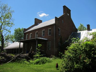
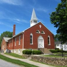
Frederick County Poor Farm, Poor farm in Round Hill, Frederick County, Virginia, US.

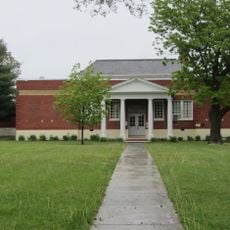
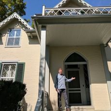
Frederick County Poor Farm is a Federal-style complex featuring a two-story brick main building with one-story side wings and supporting structures. The property spans 24 acres and includes a spring house, blacksmith shop, storage buildings, and a poultry house arranged across the grounds.

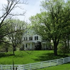
The complex was founded in 1820 and operated until 1947 as a shelter for people without financial means. It played an important role in early American institutional care systems.

The property includes multiple structures such as a brick spring house, blacksmith shop, storage building, and poultry house that reflect early American institutional design.

The site is located on the east side of Poorhouse Road, just south of where it intersects with Indian Hollow Road. The surrounding area offers good visibility and access for viewing the property from public vantage points.

This building shares its architectural design with an identical structure at Shenandoah County Farm. This rare pair of institutional buildings demonstrates a unified planning approach for poor farms across the region.

The community of curious travelers

AroundUs brings together thousands of curated places, local tips, and hidden gems, enriched daily by 60,000 contributors worldwide.

Start exploring
Location
GPS coordinates
39.21220,-78.22330
Latest update
December 14, 2025 12:26
Around this place
John Handley High School
United States of America

John Handley High School

5.6 km
Patsy Cline House
United States of America

Patsy Cline House

6.3 km
Stonewall Jackson's Headquarters Museum
United States of America

Stonewall Jackson's Headquarters Museum

5.5 km
Museum of the Shenandoah Valley
United States of America

Museum of the Shenandoah Valley

4.8 km
Handley Library
United States of America

Handley Library

5.7 km
Winchester National Cemetery
United States of America

Winchester National Cemetery

6.5 km
The George Washington Hotel
United States of America

The George Washington Hotel

6 km
Abram's Delight
United States of America

Abram's Delight

7.2 km
Winchester Coca-Cola Bottling Works
United States of America

Winchester Coca-Cola Bottling Works

6.1 km
Glen Burnie
United States of America

Glen Burnie

4.8 km
Hexagon House
United States of America

Hexagon House

4.9 km
Fort Loudoun
United States of America

Fort Loudoun

5.7 km
Mount Hebron Cemetery and Gatehouse
United States of America

Mount Hebron Cemetery and Gatehouse

6.3 km
Douglas School
United States of America

Douglas School

6 km
Daniel Morgan House
United States of America

Daniel Morgan House

5.5 km
Winchester Historic District
United States of America

Winchester Historic District

5.8 km
Christ Episcopal Church
United States of America

Christ Episcopal Church

5.6 km
Adam Kurtz House
United States of America

Adam Kurtz House

5.8 km
Museum of the Shenandoah Valley
United States of America

Museum of the Shenandoah Valley

4.3 km
Hawthorne and Old Town Spring
United States of America

Hawthorne and Old Town Spring

4.9 km
Fair Mount
United States of America

Fair Mount

5.4 km
Fort Colvin
United States of America

Fort Colvin

8 km
Homespun
United States of America

Homespun

5.8 km
Opequon Historic District
United States of America

Opequon Historic District

6.5 km
Northside Lanes
United States of America

Northside Lanes

5.7 km
Stonewall Jackson's Headquarters
United States of America

Stonewall Jackson's Headquarters

5.6 km
Taylor Pavilion
United States of America

Taylor Pavilion

5.8 km
Long Meadow
United States of America

Long Meadow

6.8 km
Show the full map
Reviews
Share your experience

No review yet

Discussions
Start a discussion...

No discussion yet

« Frederick County Poor Farm - Poor farm in Round Hill, Frederick County, Virginia, US » is provided by Around Us (aroundus.com). Images and texts are derived from Wikimedia project under a Creative Commons license. You are allowed to copy, distribute, and modify copies of this page, under the conditions set by the license, as long as this note is clearly visible.

Discover hidden gems everywhere you go!

From secret cafés to breathtaking viewpoints, skip the crowded tourist spots and find places that match your style. Our app makes it easy with voice search, smart filtering, route optimization, and insider tips from travelers worldwide. Download now for the complete mobile experience.

Around Us App Screenshot

A unique approach to discovering new places

Le Figaro

All the places worth exploring

France Info

A tailor-made excursion in just a few clicks

20 Minutes

Around Us
Travel Guide & Maps
Download

Send to your phone

QR Code
1

Open the camera app on your mobile.

2

Point at the QR code with your camera. A notification will appear.

3

Tap the notification to open the link.