Chest opened
+${chestReward.xp} XP
Explorer
NOUVEAU ×${chestReward.collectible.quantity}
tapez pour fermer

See the monuments around you in AR Open chests in the app

Around Us is built for your phone — point your camera at the streets and discover the monuments and places around you in augmented reality. Around Us is built for your phone — chests unlock when you walk, explore and capture nearby places.

Enable Location

We need your location to show you interesting places around you

Discover nearby places

Find interesting locations and hidden gems around you

Precise directions

Get accurate directions and distances to places

Your location is never shared with other users. It's only used when you tap the location button.

Log in to your account

Start exploring — it's free

Trusted by 87,166 travelers worldwide

Continue with Google
Continue with Apple
or

We will send you a code to connect

By continuing, you accept our Terms and Conditions and our Privacy Policy

Check your inbox

We've sent a pincode in your inbox. Please enter the code below.

Purple Tunnel of Doom
Discussion Reviews Photo
10.8k Popularity

Purple Tunnel of Doom, Tunnel section under Interstate 395 in Washington DC, United States

The Purple Tunnel of Doom is a tunnel section beneath Interstate 395 connecting Washington DC's southern neighborhoods to the downtown area. The passage contains multiple lanes for vehicle traffic flowing between different parts of the city.

The tunnel gained unexpected attention during Barack Obama's first inauguration in 2009 when thousands of ticket holders became trapped inside for hours. The incident prompted authorities to rethink how they manage large crowds during major public events.

The tunnel is part of the daily commute for residents and workers crossing between neighborhoods. Most people pass through without knowing about its complicated history with large gatherings.

The tunnel is heavily used by traffic daily and serves as a main route between Virginia and New York Avenue. Visitors to the area should expect congestion during peak hours and consider using alternative routes around it.

People who experienced the 2009 event created an online community called Survivors of the Purple Tunnel of Doom to share their experiences. This informal group keeps alive an unusual memory of the day when an everyday location briefly became a part of national history.

The community of curious travelers

AroundUs brings together thousands of curated places, local tips, and hidden gems, enriched daily by 60,000 contributors worldwide.
Start exploring
GPS coordinates
38.88975,-77.01438
Latest update
September 12, 2026 10:03
Around this place
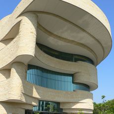
National Museum of the American Indian
United States of America

National Museum of the American Indian

0.2 mi
Ulysses S. Grant Memorial
United States of America

Ulysses S. Grant Memorial

420 ft
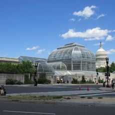
United States Botanic Garden
United States of America

United States Botanic Garden

0.2 mi
Peace Monument
United States of America

Peace Monument

0.1 mi
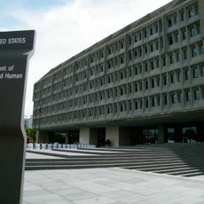
Hubert H. Humphrey Building
United States of America

Hubert H. Humphrey Building

0.2 mi
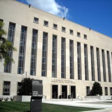
E. Barrett Prettyman United States Courthouse
United States of America

E. Barrett Prettyman United States Courthouse

0.2 mi
James A. Garfield Monument
United States of America

James A. Garfield Monument

0.1 mi
American Veterans Disabled for Life Memorial
United States of America

American Veterans Disabled for Life Memorial

0.2 mi
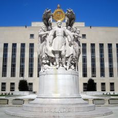
George Gordon Meade Memorial
United States of America

George Gordon Meade Memorial

0.2 mi
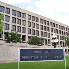
Frances Perkins Building
United States of America

Frances Perkins Building

0.3 mi
Bartholdi Fountain
United States of America

Bartholdi Fountain

0.2 mi
Labor Hall of Honor
United States of America

Labor Hall of Honor

0.3 mi
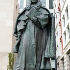
Sir William Blackstone
United States of America

Sir William Blackstone

0.2 mi
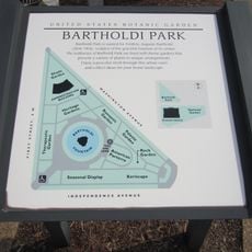
Bartholdi Park
United States of America

Bartholdi Park

0.1 mi
United States of America

Always Becoming

0.2 mi
Moondog
United States of America

Moondog

0.5 mi
Cubi XI
United States of America

Cubi XI

0.2 mi
National Gallery of Art - East Building
United States of America

National Gallery of Art - East Building

0.2 mi
Glass Pyramids
United States of America

Glass Pyramids

0.2 mi
United States of America

Heroic Shorepoints I

0.2 mi
East Wing National Gallery of Art
United States of America

East Wing National Gallery of Art

0.2 mi
Olmsted Drinking Fountain
United States of America

Olmsted Drinking Fountain

0.2 mi
United States of America

Totem Poles

0.2 mi
United States of America

National Garden Amphitheater

0.1 mi
United States of America

American Veterans Disabled for Life Memorial

0.2 mi
United States of America

Sculpture

0.1 mi
United States of America

Sculpture

0.2 mi
United States of America

Sculpture

0.2 mi
Show the full map
Reviews
Share your experience

No review yet

Discussions
Start a discussion...

No discussion yet

« Purple Tunnel of Doom - Tunnel section under Interstate 395 in Washington DC, United States » is provided by Around Us (aroundus.com). Images and texts are derived from Wikimedia project under a Creative Commons license. You are allowed to copy, distribute, and modify copies of this page, under the conditions set by the license, as long as this note is clearly visible.

Discover hidden gems everywhere you go!

From secret cafés to breathtaking viewpoints, skip the crowded tourist spots and find places that match your style. Our app makes it easy with voice search, smart filtering, route optimization, and insider tips from travelers worldwide. Download now for the complete mobile experience.

Around Us App Screenshot

A unique approach to discovering new places

Le Figaro

All the places worth exploring

France Info

A tailor-made excursion in just a few clicks

20 Minutes

Around Us
Travel Guide & Maps
Download

Send to your phone

QR Code
1

Open the camera app on your mobile.

2

Point at the QR code with your camera. A notification will appear.

3

Tap the notification to open the link.