Chest opened
+${chestReward.xp} XP
Explorer
NOUVEAU ×${chestReward.collectible.quantity}
tapez pour fermer
Chest locked

Open chests in the app

Around Us is built for your phone — chests unlock when you walk, explore and capture nearby places.

Enable Location

We need your location to show you interesting places around you

Discover nearby places

Find interesting locations and hidden gems around you

Precise directions

Get accurate directions and distances to places

Your location is never shared with other users. It's only used when you tap the location button.

Log in to your account

Start exploring — it's free

Trusted by 72,880 travelers worldwide

Continue with Google
Continue with Apple
or

We will send you a code to connect

By continuing, you accept our Terms and Conditions and our Privacy Policy

Check your inbox

We've sent a pincode in your inbox. Please enter the code below.

Charlestown Neck
Discussion Reviews Photo
4.5k Popularity

Charlestown Neck, Peninsula at the confluence of Charles and Mystic rivers in Massachusetts, United States.

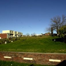
Charlestown Neck is a narrow strip of land that connects the original Charlestown settlement to the mainland between the Charles River and Mystic River. The peninsula has low-lying terrain shaped by these two major waterways on either side.

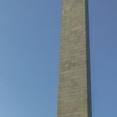
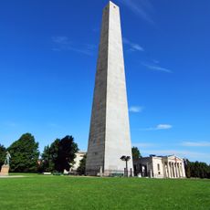
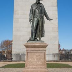
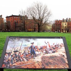
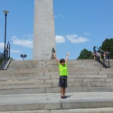
The area was where British forces advanced during the Battle of Bunker Hill in 1775 and colonial settlements were destroyed. This strategic location played a central role in early military conflicts of the American Revolution.

The area shaped the growth of maritime commerce and naval operations that made Charlestown a key port during America's early years.

The area has several public transportation options, including Orange Line stations and bus routes that connect downtown Boston to northern suburbs. Good accessibility makes it easy to explore the area and surrounding neighborhoods.

The natural geography of the peninsula influenced where the Charlestown Navy Yard was built, and it operated there from 1800 to 1974. These geographical boundaries made it an ideal location for naval facilities through much of American maritime history.

The community of curious travelers

AroundUs brings together thousands of curated places, local tips, and hidden gems, enriched daily by 60,000 contributors worldwide.

Start exploring
GPS coordinates
42.38370,-71.07230
Latest update
December 10, 2025 20:09
Around this place
Bunker Hill Monument
United States of America

Bunker Hill Monument

1.3 km
Breed's Hill
United States of America

Breed's Hill

1.3 km
Legoland Discovery Center Boston
United States of America

Legoland Discovery Center Boston

1.4 km
Phipps Street Burying Ground
United States of America

Phipps Street Burying Ground

895 m
Charles Williams Jr. House
United States of America

Charles Williams Jr. House

823 m
Statue of William Prescott
United States of America

Statue of William Prescott

1.3 km
Monument Square Historic District
United States of America

Monument Square Historic District

1.3 km
Francis B. Austin House
United States of America

Francis B. Austin House

1 km
Bunker Hill School
United States of America

Bunker Hill School

219 m
Mount Vernon Street Historic District
United States of America

Mount Vernon Street Historic District

644 m
Charlestown Heights
United States of America

Charlestown Heights

536 m
Charlestown Five Cent Savings Bank
United States of America

Charlestown Five Cent Savings Bank

1.2 km
House at 81 Pearl Street
United States of America

House at 81 Pearl Street

1.1 km
Daniel Worthen House
United States of America

Daniel Worthen House

548 m
Gustavus G. Prescott House
United States of America

Gustavus G. Prescott House

567 m
House at 29 Mt. Vernon Street
United States of America

House at 29 Mt. Vernon Street

666 m
Samuel Ireland House
United States of America

Samuel Ireland House

1.3 km
Walter J. Squire house
United States of America

Walter J. Squire house

859 m
The Battle of Bunker Hill Museum
United States of America

The Battle of Bunker Hill Museum

1.3 km
Charlestown Branch Library
United States of America

Charlestown Branch Library

1.1 km
United States of America

Tavern at the End of the World

605 m

Charlestown Working Theater

126 m
United States of America

Brickbottom Artists Association

1.3 km
United States of America

Colonel William Prescott

1.3 km
United States of America

Paula

1.1 km
United States of America

Torus

1.2 km
United States of America

Collective Ascension

1.3 km
United States of America

Mural, Work of art

1.4 km
Show the full map
Reviews
Share your experience

No review yet

Discussions
Start a discussion...

No discussion yet

« Charlestown Neck - Peninsula at the confluence of Charles and Mystic rivers in Massachusetts, United States » is provided by Around Us (aroundus.com). Images and texts are derived from Wikimedia project under a Creative Commons license. You are allowed to copy, distribute, and modify copies of this page, under the conditions set by the license, as long as this note is clearly visible.

Discover hidden gems everywhere you go!

From secret cafés to breathtaking viewpoints, skip the crowded tourist spots and find places that match your style. Our app makes it easy with voice search, smart filtering, route optimization, and insider tips from travelers worldwide. Download now for the complete mobile experience.

Around Us App Screenshot

A unique approach to discovering new places

Le Figaro

All the places worth exploring

France Info

A tailor-made excursion in just a few clicks

20 Minutes

Around Us
Travel Guide & Maps
Download

Send to your phone

QR Code
1

Open the camera app on your mobile.

2

Point at the QR code with your camera. A notification will appear.

3

Tap the notification to open the link.