Chest opened
+${chestReward.xp} XP
Explorer
NOUVEAU ×${chestReward.collectible.quantity}
tapez pour fermer
Chest locked

Open chests in the app

Around Us is built for your phone — chests unlock when you walk, explore and capture nearby places.

Enable Location

We need your location to show you interesting places around you

Discover nearby places

Find interesting locations and hidden gems around you

Precise directions

Get accurate directions and distances to places

Your location is never shared with other users. It's only used when you tap the location button.

Sacagawea Peak

Log in to your account

Start exploring — it's free

Trusted by 72,934 travelers worldwide

Continue with Google
Continue with Apple
or

We will send you a code to connect

By continuing, you accept our Terms and Conditions and our Privacy Policy

Check your inbox

We've sent a pincode in your inbox. Please enter the code below.

Sacagawea Peak
Discussion Reviews 1 Photos
3.2k Popularity

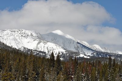
Sacagawea Peak, Mountain peak in Bridger Range, Gallatin County, Montana.

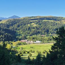
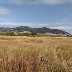
Sacagawea Peak is a mountain summit in the Bridger Range in Gallatin County, Montana, rising to around 9,900 feet (about 3,000 m) along steep granite faces. It sits near the northern end of the range, where the terrain opens up into high exposed ridges above the treeline.

The summit takes its name from Sacagawea, a Shoshone woman who traveled with the Lewis and Clark Expedition in the early 1800s as it crossed the American West. She acted as a guide and interpreter throughout the journey, and her role has kept her name present across the landscape of Montana and beyond.

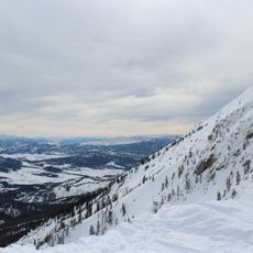
The peak shares its name with a woman who played a central role in one of North America's most important overland journeys. Hikers who reach the top often find themselves looking out over a vast open landscape that makes the name feel fitting for such a high and exposed place.

The trail to the summit starts at Fairy Lake Campground and climbs steeply for most of the way. Weather at this elevation can change fast, so bringing warm and waterproof layers is a good idea regardless of how conditions look at the start.

Snow lingers in some of the steepest chutes on the peak well into summer, sometimes lasting through August. The shape of the terrain shields these pockets from direct sun, which is why skiers occasionally head up there long after the ski resorts have closed for the season.

The community of curious travelers

AroundUs brings together thousands of curated places, local tips, and hidden gems, enriched daily by 60,000 contributors worldwide.

Start exploring
Location
GPS coordinates
45.89556,-110.96889
Latest update
March 3, 2026 13:56
Reviews
Share your experience

No review yet

Discussions
Start a discussion...

No discussion yet

« Sacagawea Peak - Mountain peak in Bridger Range, Gallatin County, Montana » is provided by Around Us (aroundus.com). Images and texts are derived from Wikimedia project under a Creative Commons license. You are allowed to copy, distribute, and modify copies of this page, under the conditions set by the license, as long as this note is clearly visible.

Discover hidden gems everywhere you go!

From secret cafés to breathtaking viewpoints, skip the crowded tourist spots and find places that match your style. Our app makes it easy with voice search, smart filtering, route optimization, and insider tips from travelers worldwide. Download now for the complete mobile experience.

Around Us App Screenshot

A unique approach to discovering new places

Le Figaro

All the places worth exploring

France Info

A tailor-made excursion in just a few clicks

20 Minutes

Around Us
Travel Guide & Maps
Download

Send to your phone

QR Code
1

Open the camera app on your mobile.

2

Point at the QR code with your camera. A notification will appear.

3

Tap the notification to open the link.