Enable Location

We need your location to show you interesting places around you

Discover nearby places

Find interesting locations and hidden gems around you

Precise directions

Get accurate directions and distances to places

Your location is never shared with other users. It's only used when you tap the location button.

College 'M' Steep Trail

Log in to your account

Start exploring — it's free

Trusted by 62,365 travelers worldwide

Continue with Google
Continue with Apple
or

We will send you a code to connect

By continuing, you accept our Terms and Conditions and our Privacy Policy

Check your inbox

We've sent a pincode in your inbox. Please enter the code below.

College 'M' Steep Trail

College 'M' Steep Trail, Mountain hiking trail in Gallatin County, United States.

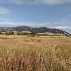
College M Steep Trail is a hiking route in Gallatin County with sections that vary in steepness, crossing dirt and rocky ground. The path offers multiple route options, ranging from shorter challenging segments to longer, easier stretches.

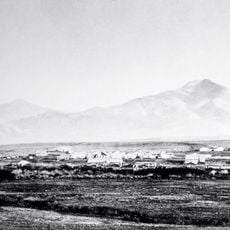
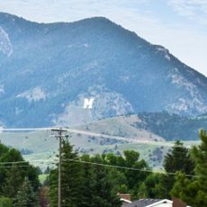
The project dates to 1918 and 1919, when students from Montana State University built and painted the white monument. It was created to be visible from town and has remained a recognizable landmark since then.

The trail is part of a wider network connecting the town to surrounding mountains and is widely used by local residents. The white-painted M monument serves as a visual landmark visible from below, guiding people into the foothills.

The path starts relatively flat and becomes steeper as you go higher, so pacing yourself at the beginning is important. There are marked seating areas with stone benches along the way where you can take breaks.

The stone benches are not merely practical but are specifically positioned to frame views of the valley below. This detail transforms the walk into more than exercise, creating moments to appreciate the surrounding landscape.

The community of curious travelers

AroundUs brings together thousands of curated places, local tips, and hidden gems, enriched daily by 60,000 contributors worldwide.

Start exploring
Location
Address
Bridger Canyon Rd, Bozeman, MT 59715, USA
Phone
GPS coordinates
45.71223,-110.97545
Latest update
December 14, 2025 20:21
« College 'M' Steep Trail - Mountain hiking trail in Gallatin County, United States » is provided by Around Us (aroundus.com). Images and texts are derived from Wikimedia project under a Creative Commons license. You are allowed to copy, distribute, and modify copies of this page, under the conditions set by the license, as long as this note is clearly visible.

Discover hidden gems everywhere you go!

From secret cafés to breathtaking viewpoints, skip the crowded tourist spots and find places that match your style. Our app makes it easy with voice search, smart filtering, route optimization, and insider tips from travelers worldwide. Download now for the complete mobile experience.

Around Us App Screenshot

A unique approach to discovering new places

Le Figaro

All the places worth exploring

France Info

A tailor-made excursion in just a few clicks

20 Minutes

Around Us
Travel Guide & Maps
Download

Send to your phone

QR Code
1

Open the camera app on your mobile.

2

Point at the QR code with your camera. A notification will appear.

3

Tap the notification to open the link.