LaGrange County, Administrative county in northern Indiana, United States.
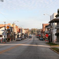
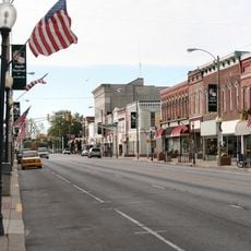
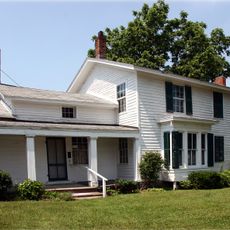
LaGrange County is an administrative county in northern Indiana covering approximately 386 square miles of predominantly agricultural land with rolling topography and numerous lakes. The area is made up of scattered rural communities and small towns nestled within this quiet landscape.
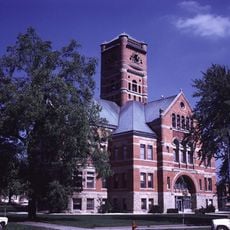
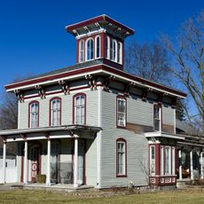
The county was established in 1832 and originally separated from the neighboring Elkhart County, with Lima serving as the first seat of government. This early administrative framework shaped how the region and its communities developed over subsequent generations.
The region is home to the third largest Amish community in the United States, where traditional craftsmanship and lifestyle choices shape daily life. These communities influence local commerce, architecture, and the rhythm of activity in many small towns.
The county seat is located in the town of LaGrange and manages governmental services for approximately 40,000 residents. Most communities are relatively close together, making it easy to explore different areas and discover what each town has to offer.
Horse-drawn buggies and modern vehicles share the same roads, creating an unusual sight that reveals how two different worlds coexist in this region. This everyday scene is one of the most distinctive features visitors notice when traveling through the area.
Location: Indiana
Inception: February 2, 1832
Capital city: LaGrange
Shares border with: St. Joseph County, Branch County, Steuben County, Noble County, Elkhart County, DeKalb County
Website: http://lagrangecounty.org
GPS coordinates: 41.64167,-85.41667
Latest update: December 15, 2025 13:21
Noble County Sheriff's House and Jail
27.4 km
Ahavas Shalom Reform Temple
24.6 km
St. Joseph County Courthouse
32.6 km
Cornish Griffin Round Barn
31.7 km
Wahbememe Burial Site and Monument
26.8 km
LaGrange County Courthouse
349 m
John Badlam Howe Mansion
9.2 km
Jacob Straus House
24.4 km
Ligonier Historic District
24.7 km
Kendallville Downtown Historic District
25.5 km
General Land Office
25.7 km
Art Gallery Building
30.5 km
Stone's Trace
27.8 km
Samuel P. Williams House
8.9 km
Albion Courthouse Square Historic District
27.3 km
Menno Yoder Polygonal Barn
15.4 km
Collins School
31.6 km
Governor John S. Barry House
31.1 km
Star Milling and Electric Company Historic District
12 km
Cromwell Historic District
31.3 km
Maria and Franklin Wiltrout Polygonal Barn
27.4 km
Nottawa Stone School
31 km
Ezra E. and Florence Beardsley House
28.7 km
Morse–Scoville House
30 km
Nettleton-Cond House
30.4 km
Noble County Courthouse
27.4 km
Sturges-Young Center for the Arts
17.8 km
Ligonier Public Library
24.5 kmVisited this place? Tap the stars to rate it and share your experience / photos with the community! Try now! You can cancel it anytime.
Discover hidden gems everywhere you go!
From secret cafés to breathtaking viewpoints, skip the crowded tourist spots and find places that match your style. Our app makes it easy with voice search, smart filtering, route optimization, and insider tips from travelers worldwide. Download now for the complete mobile experience.
A unique approach to discovering new places❞
— Le Figaro
All the places worth exploring❞
— France Info
A tailor-made excursion in just a few clicks❞
— 20 Minutes