Chest opened
+${chestReward.xp} XP
Explorer
NOUVEAU ×${chestReward.collectible.quantity}
tapez pour fermer
Chest locked

Open chests in the app

Around Us is built for your phone — chests unlock when you walk, explore and capture nearby places.

Enable Location

We need your location to show you interesting places around you

Discover nearby places

Find interesting locations and hidden gems around you

Precise directions

Get accurate directions and distances to places

Your location is never shared with other users. It's only used when you tap the location button.

Log in to your account

Start exploring — it's free

Trusted by 72,878 travelers worldwide

Continue with Google
Continue with Apple
or

We will send you a code to connect

By continuing, you accept our Terms and Conditions and our Privacy Policy

Check your inbox

We've sent a pincode in your inbox. Please enter the code below.

Cherry Island
Discussion Reviews Photo
1.2k Popularity

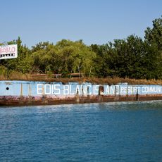
Cherry Island, River island in Detroit River, Michigan, US.

Cherry Island is a small river island located within the Detroit River between Michigan and Canada. The island sits in the waterway that connects the Great Lakes and serves as a natural boundary between the two countries.

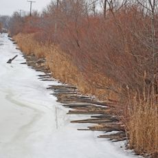
The island saw smuggling activity during Prohibition in the 1920s when alcohol was transported across frozen waters. This era shaped the river as a key route for illegal operations at the time.

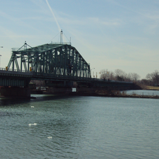
The Detroit River islands, including Cherry Island, form an integral part of the regional waterway system that connects Lake Erie to Lake St. Clair.

The island is surrounded by water and can only be reached by boat, so visitors should check weather conditions and water levels beforehand. The river can have different conditions depending on the season, affecting accessibility.

The island was a known point for smuggling routes during Prohibition, where officers pursued alcohol transports across the ice. These dangerous chases across frozen waters are among the most interesting stories from this era of the river.

The community of curious travelers

AroundUs brings together thousands of curated places, local tips, and hidden gems, enriched daily by 60,000 contributors worldwide.

Start exploring
GPS coordinates
42.08056,-83.19472
Latest update
December 21, 2025 16:05
Around this place
Boblo Island Amusement Park
Canada

Boblo Island Amusement Park

6.6 km
Grosse Ile
United States of America

Grosse Ile

6.2 km
Lake Erie Metropark
United States of America

Lake Erie Metropark

1.7 km
Bois Blanc Island Lighthouse and Blockhouse
Canada

Bois Blanc Island Lighthouse and Blockhouse

6.2 km
Wayne County Bridge
United States of America

Wayne County Bridge

5.5 km
United States of America

Sugar Island

4.3 km
St. James Episcopal Church
United States of America

St. James Episcopal Church

6.5 km
Jefferson Avenue–Huron River and Harbin Drive–Silver Creek Canal Bridges
United States of America

Jefferson Avenue–Huron River and Harbin Drive–Silver Creek Canal Bridges

4.6 km
Calf Island
United States of America

Calf Island

2.8 km
Gibraltar Road–Waterway Canal Bridge
United States of America

Gibraltar Road–Waterway Canal Bridge

1.6 km
United States of America

Fox Island

5.2 km
East River Road–North Hickory Canal Bridge
United States of America

East River Road–North Hickory Canal Bridge

4 km
South Pointe Drive–Frenchman's Creek Bridge
United States of America

South Pointe Drive–Frenchman's Creek Bridge

3.1 km
Bois Blanc Island Lighthouse
Canada

Bois Blanc Island Lighthouse

6.3 km
Canada

White Sands

6.1 km
United States of America

Grosse Ile Golf & Country Club

5.3 km
United States of America

Lake Erie Metropark Golf Course

2.6 km
Hull's Trace North Huron River Corduroy Segment
United States of America

Hull's Trace North Huron River Corduroy Segment

4 km
United States of America

Water's Edge Golf Course

5.3 km
United States of America

Work of art, sculpture

3.9 km
United States of America

Statue, Work of art

4.4 km
United States of America

Wyman's Canal Overlook

517 m
United States of America

Marina Point Observation Deck

3.1 km
United States of America

Sanger's Lagoon Overlook

378 m
United States of America

Riley Creek Overlook

690 m
United States of America

Wildlife Observation Deck

3.7 km
United States of America

Scenic viewpoint

3.5 km
United States of America

Scenic viewpoint

3.8 km
Show the full map
Reviews
Share your experience

No review yet

Discussions
Start a discussion...

No discussion yet

« Cherry Island - River island in Detroit River, Michigan, US » is provided by Around Us (aroundus.com). Images and texts are derived from Wikimedia project under a Creative Commons license. You are allowed to copy, distribute, and modify copies of this page, under the conditions set by the license, as long as this note is clearly visible.

Discover hidden gems everywhere you go!

From secret cafés to breathtaking viewpoints, skip the crowded tourist spots and find places that match your style. Our app makes it easy with voice search, smart filtering, route optimization, and insider tips from travelers worldwide. Download now for the complete mobile experience.

Around Us App Screenshot

A unique approach to discovering new places

Le Figaro

All the places worth exploring

France Info

A tailor-made excursion in just a few clicks

20 Minutes

Around Us
Travel Guide & Maps
Download

Send to your phone

QR Code
1

Open the camera app on your mobile.

2

Point at the QR code with your camera. A notification will appear.

3

Tap the notification to open the link.