Song Hồ, commune in Thuận Thành district, Bắc Ninh province, Vietnam
Location: Thuận Thành
Elevation above the sea: 6 m
GPS coordinates: 21.05806,106.07611
Latest update: November 16, 2025 02:40

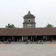
Dâu pagoda
4.3 km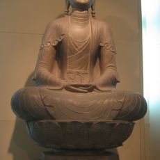
Phật Tích Temple
6.9 km
Bút Tháp Temple
5.6 km
Ham Long Buddhist temple
10.2 km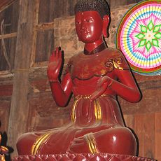
Chùa Keo temple
9.5 km
Đình Yên Việt
9 km
Buda de Phật Tích
6.7 km
Estampes
1.1 km
Làng gò đúc đồng Đại Bái
7.3 km
Chùa Dâu
4.4 km
Đền Gióng Phù Đổng
11.9 km
Làng giấy Dương Ổ
12.4 km
NUTRECO Company Limited.
9.6 km
Huyện lục ye
9.8 km
Kinh Duong Vuong Bridge
3.8 km
Tượng Đài Nguyễn Văn Cừ
12.3 km
Lê Văn Thịnh temple
9.6 km
Tượng Đài Nguyễn Văn Cừ
12.3 km
Tượng Bồ Tát
7.5 km
Bơm Cát
7.5 km
Rùa
8.7 km
Đài Tưởng Niệm Liệt Sĩ Xã Đại Đồng
7.4 km
Đài Tưởng Niệm Liệt Sĩ Việt Hưng
8 km
Pháo Đồng
7.7 km
Wayside shrine, Buddhism
7.7 km
Wayside shrine, Buddhism
7.7 km
Wayside shrine, Buddhism
7.7 km
Wayside shrine, Buddhism
6.6 kmReviews
Visited this place? Tap the stars to rate it and share your experience / photos with the community! Try now! You can cancel it anytime.
Discover hidden gems everywhere you go!
From secret cafés to breathtaking viewpoints, skip the crowded tourist spots and find places that match your style. Our app makes it easy with voice search, smart filtering, route optimization, and insider tips from travelers worldwide. Download now for the complete mobile experience.

A unique approach to discovering new places❞
— Le Figaro
All the places worth exploring❞
— France Info
A tailor-made excursion in just a few clicks❞
— 20 Minutes