Aves ditch

Log in to your account

AroundUs is a community-driven map of interesting places, built by curious explorers like you. It grows with every review, story, and photo you share.
Connect to save your favorite spots, contribute locations, and create personalized routes.
By continuing, you accept our Terms and Conditions and our Privacy Policy

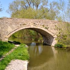
Aves ditch, Iron Age earthwork in Oxfordshire, England
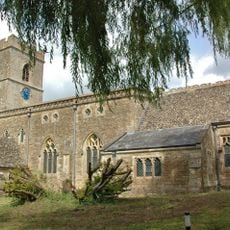
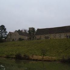
Aves Ditch extends for three miles across Oxfordshire, featuring a linear earthwork structure with a ditch and bank formation marking territorial divisions.

Archaeological excavations revealed that Aves Ditch dates back to the Iron Age period and was later reused during Anglo-Saxon times, as evidenced by discovered remains.

The earthwork structure served as a boundary marker between two Iron Age tribes, the Dobunni and Catuvellauni, reflecting territorial organization in pre-Roman Britain.

Visitors can access Aves Ditch through walking trails in Oxfordshire, where the structure currently marks the boundary between Lower Heyford and Middleton Stoney parishes.

The ditch contains sediment layers that provide information about ancient land management techniques and human interaction with the environment over multiple centuries.

GPS coordinates: 51.90400,-1.26100

Latest update: March 4, 2025 19:07

Around this place
Show the full map
Rousham House
United Kingdom

Rousham House

3.2 km
Middleton Park, Oxfordshire
United Kingdom

Middleton Park, Oxfordshire

1.6 km
Church of St James, Rousham
United Kingdom

Church of St James, Rousham

3.1 km
Church of St Mary
United Kingdom

Church of St Mary

3 km
Church of All Saints
United Kingdom

Church of All Saints

2.2 km
Church of St Mary
United Kingdom

Church of St Mary

3.1 km
The Bell Inn
United Kingdom

The Bell Inn

2.9 km
Bridge At Junction With Station Road, Plus Approach Walls
United Kingdom

Bridge At Junction With Station Road, Plus Approach Walls

3.1 km
Statue of Dying Gaul Approximately 5 Metres South West of Balustrade of Praeneste
United Kingdom

Statue of Dying Gaul Approximately 5 Metres South West of Balustrade of Praeneste

3.4 km
Statue of Lion and Horse Approxiamtely 85 Metres North of Rousham Park and at North End of Bowling Green
United Kingdom

Statue of Lion and Horse Approxiamtely 85 Metres North of Rousham Park and at North End of Bowling Green

3.3 km
Bridge 400 Metres North Of Dashwood Lock
United Kingdom

Bridge 400 Metres North Of Dashwood Lock

2.4 km
Statue of Apollo at End of Long Walk and Approximately 12 Metres South East of the Temple of Echo
United Kingdom

Statue of Apollo at End of Long Walk and Approximately 12 Metres South East of the Temple of Echo

3.5 km
Kirtlington Park
United Kingdom

Kirtlington Park

3.3 km
The Dower House
United Kingdom

The Dower House

3 km
Upper Cascade Including Statues Of Venus And Swans In Venus Vale
United Kingdom

Upper Cascade Including Statues Of Venus And Swans In Venus Vale

3.5 km
Cowhouse Approximately 410 Metres South Of Rousham Park
United Kingdom

Cowhouse Approximately 410 Metres South Of Rousham Park

3.1 km
New College Barn
United Kingdom

New College Barn

3.1 km
Urn Approximately 3 Metres From North East Corner Of Praeneste
United Kingdom

Urn Approximately 3 Metres From North East Corner Of Praeneste

3.4 km
Manor Farmhouse
United Kingdom

Manor Farmhouse

3.1 km
Granary Approximately 30 Metres South East Of Manor Farmhouse
United Kingdom

Granary Approximately 30 Metres South East Of Manor Farmhouse

3.1 km
Lower Cascade In Venus' Vale
United Kingdom

Lower Cascade In Venus' Vale

3.5 km
Praeneste
United Kingdom

Praeneste

3.4 km
Dovecote at Rousham House
United Kingdom

Dovecote at Rousham House

3.2 km
Temple Of Echo
United Kingdom

Temple Of Echo

3.5 km
Urn Approximately 3 Metres From South East Corner Of Praeneste
United Kingdom

Urn Approximately 3 Metres From South East Corner Of Praeneste

3.4 km
Oxford Canal Northbrook Bridge (That Part In Kirtlington Civil Parish)
United Kingdom

Oxford Canal Northbrook Bridge (That Part In Kirtlington Civil Parish)

2.3 km
The Pyramid House
United Kingdom

The Pyramid House

3.2 km
Milestone, Old Covert, N of Oxford Lodge
United Kingdom

Milestone, Old Covert, N of Oxford Lodge

2.5 km
Show the full map

Reviews

Visited this place? Tap the stars to rate it and share your experience / photos with the community! Try now! You can cancel it anytime.

« Aves ditch - Iron Age earthwork in Oxfordshire, England » is provided by Around Us (aroundus.com). Images and texts are derived from Wikimedia project under a Creative Commons license. You are allowed to copy, distribute, and modify copies of this page, under the conditions set by the license, as long as this note is clearly visible.

Discover hidden gems everywhere you go!

From secret cafés to breathtaking viewpoints, skip the crowded tourist spots and find places that match your style. Our app makes it easy with voice search, smart filtering, route optimization, and insider tips from travelers worldwide. Download now for the complete mobile experience.

Around Us App Screenshot

A unique approach to discovering new places

Le Figaro

All the places worth exploring

France Info

A tailor-made excursion in just a few clicks

20 Minutes