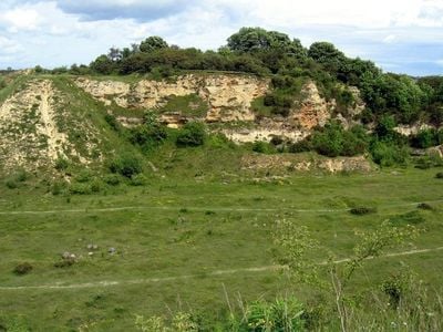
Bishop Middleham Quarry, Nature reserve in Durham, England
Bishop Middleham Quarry is a former limestone extraction site in northeast England spanning about 9 hectares with steep cliff faces and marked trails through varied habitats. The landscape displays different vegetation zones ranging from open grasslands to wooded areas that have developed on the abandoned quarry floor and walls.
Quarrying operations stopped in 1934, after which natural plants gradually reclaimed the site over decades. In 1968 the location received designation as an area of special scientific interest because of its natural value.
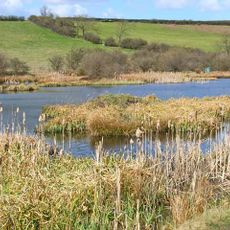
The site hosts distinctive plant communities adapted to magnesian limestone, drawing researchers and nature enthusiasts who study these specialized species found nowhere else in comparable abundance. People visit to observe and appreciate grasslands that thrive in this geological setting.
Access is via public footpaths and a kissing gate at the entrance, with parking available on a roadside verge opposite the site. The trails vary in difficulty, so wear sturdy footwear and be prepared for changing weather conditions.
In 2002 European bee-eaters bred here and successfully raised two chicks, marking only the third known breeding attempt of this species in Britain. This bird normally lives much further south, making this sighting particularly notable.
The community of curious travelers
AroundUs brings together thousands of curated places, local tips, and hidden gems, enriched daily by 60,000 contributors worldwide.