Devil's Dyke, Hertfordshire, Ancient defensive ditch in Wheathampstead, England.
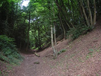
Devil's Dyke in Wheathampstead is a prehistoric earthwork in Hertfordshire, England, formed by a long ditch cut deep into the ground. The ditch runs through woodland and is protected today as a scheduled monument.
The earthwork was built around 54 BC by the Catuvellauni, a tribe who controlled much of southern Britain before the Roman invasion. It formed part of a larger fortified settlement that Julius Caesar is said to have attacked during his second campaign in Britain.
In English folklore, ancient ditches too large to explain were often said to have been dug by the Devil, which is how this site got its name. Today the path along the bottom of the ditch passes through old woodland that locals use for walks year round.
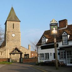
The site is within walking distance of Wheathampstead village, and information boards on location explain what you are looking at. When the ground is wet, the slopes become slippery, so sturdy footwear is a good idea.
The northern end of the ditch features hornbeam trees that have been coppiced for generations, which gives them an unusual multi-stemmed shape you do not often see in managed woodland. In spring, bluebells grow along the slopes of the ditch, adding color to the floor of the old earthwork.
The community of curious travelers
AroundUs brings together thousands of curated places, local tips, and hidden gems, enriched daily by 60,000 contributors worldwide.