Musbury Castle, Iron Age contour fort in Devon, England
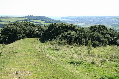
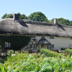
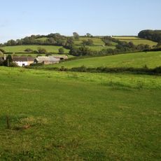
Musbury Castle is an Iron Age contour fort located on a hilltop in Devon, standing 175 meters above sea level with commanding views over the Axe valley. The fortification sits within rural landscape and looks toward the South Devon coast near Seaton.
The fortification developed in the Iron Age as part of a defensive network protecting Dorset from Devon-based tribes. Archaeological discoveries in 1832 uncovered sling stones at the site, confirming its strategic role in this regional conflict.
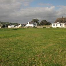
The name Musbury first appeared in the Domesday Book of 1086 as Musberia, possibly derived from Old English terms referring to a fortification associated with mice. Visitors today can trace this medieval connection while walking through the same landscape that local people have inhabited for centuries.
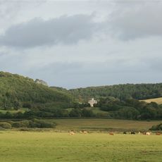
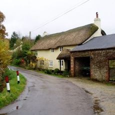
The site is accessible via footpaths that cross the surrounding rural landscape, making it easy for walkers to reach. Visitors should expect variable weather and wear appropriate footwear, as terrain can be uneven depending on the season.
The fort was part of a broader defensive chain that stretched across multiple hills and could monitor enemy movements from a distance. This interconnected strategy reveals how Iron Age communities organized territorial protection across the landscape.
Location: Devon
Location: Musbury
Website: https://nationaltrust.org.uk/shute-barton/features/musbury-hill-fort
GPS coordinates: 50.74190,-3.01700
Latest update: December 14, 2025 14:41
Colcombe Castle
3.4 km
Great House
3.7 km
Stedcombe House
2.8 km
St Mary at the Cross, Whitford
2.9 km
Hawkesdown Hill
3.3 km
Church of St Michael
3.8 km
Church of St Andrew, Colyton
3.7 km
Church of St Michael
908 m
Church of St Mary
1.8 km
Old Church House
3.8 km
Wheelwright Inn
3.5 km
Rose Cottage
2.9 km
Pear Tree Cottage
3.3 km
Colyton Library
3.7 km
Cob Cottage Little Thatch
1.3 km
North Lodge And Gate Piers At All Hallows School
3.1 km
The Foundry
3.7 km
Musbury Farm House
956 m
Woodman's Stoop Including Adjoining Barn To South West
3.8 km
Mile Post North Of North Lodge
3.1 km
Rose Farmhouse And Grove Lea
2.8 km
6, Vicarage Street
3.8 km
Lower Farmhouse
1.2 km
Higher Bruckland Farmhouse Including Adjoining Outbuilding To South East
828 m
Ship House
3.4 km
Lower Bruckland Farm House Including Outbuilding Adjoining North East
1.5 km
Milestone, Colyford, on Swan Hill, opp. Memorial Hall
3.8 km
Milestone, Axminster Road, by Mountfield Lodge, on the old section of road through the village
1.1 kmVisited this place? Tap the stars to rate it and share your experience / photos with the community! Try now! You can cancel it anytime.
Discover hidden gems everywhere you go!
From secret cafés to breathtaking viewpoints, skip the crowded tourist spots and find places that match your style. Our app makes it easy with voice search, smart filtering, route optimization, and insider tips from travelers worldwide. Download now for the complete mobile experience.
A unique approach to discovering new places❞
— Le Figaro
All the places worth exploring❞
— France Info
A tailor-made excursion in just a few clicks❞
— 20 Minutes