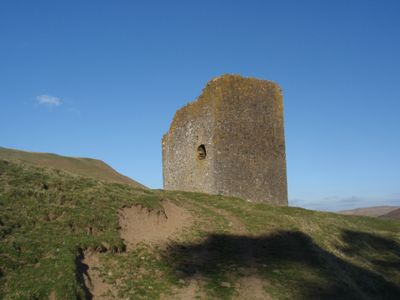
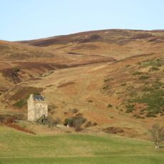
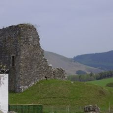
Dryhope Tower, Medieval peel tower in Scottish Borders, United Kingdom.
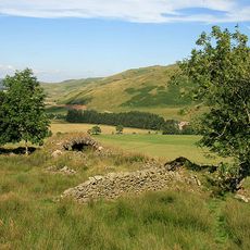
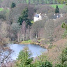
Dryhope Tower is a four-level stone fortification with two vaulted floors and thick defensive walls containing gun loops for protection. The ruin stands near St Mary's Loch and displays the typical construction of these medieval defensive structures.
The tower was built in 1535 under Scottish Parliament legislation as a residence for the Scotts of Dryhope. Partial destruction in 1592 left it in the ruined state visible today.
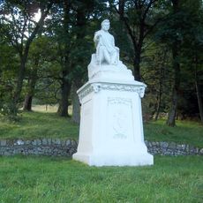
The structure connects to Mary Scott, known as the Flower of Yarrow, whose life story inspired regional ballads that remain part of local heritage. Her legend continues to shape how people view this place today.
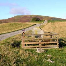
The ruins are accessible through the Philiphaugh Estate, with stabilization work making exploration safer. Visitors should wear proper footwear for the uneven ground and exposed stone surfaces.
Signal fires burned from iron baskets mounted on the tower summit to communicate with other fortifications across the region. This fire-based system formed part of an early communication network that connected border strongholds.
Location: Scottish Borders
GPS coordinates: 55.51080,-3.16168
Latest update: December 12, 2025 14:23
The Glen
8.9 km
Traquair House
12.5 km
St Mary's Loch
2.8 km
Broad Law
12.1 km
Grey Mare's Tail
12.9 km
Kirkhope Tower
11.1 km
Castlehill Tower
12 km
Glenternie
13.1 km
Tushielaw Tower
8.2 km
Yarrow Stone
8.5 km
Glebe Stone,standing stone
9 km
Yarrow Parish Church, Churchyard
9.5 km
Ettrick Shepherd Monument
5.1 km
Yarrow Parish Church
9.5 km
Innerleithen, High Street, St James R.c. Church
13.4 km
Peebles, Haystoun House And Adjoining Courtyard West Range
13.6 km
Cappercleuch, Aa Sentry Box No 723
3.2 km
Innerleithen, 91 High Street, St James' R.c. Church, School
13.4 km
Yarrow Bridge
9.5 km
Howford House
12.5 km
Tweed Bridge, Innerleithen
13.1 km
91 High Street And St James Hall (Formerly St James Rc School And Schoolhouse) Including Boundary Walls
13.4 km
Former Congregational Chapel, Alpinebikes, Peebles Road
13.3 km
Innerleithen, High Street, St James' R.c. Church, Presbytery
13.4 km
Chester Hill, Hundleshope
11.7 km
Caerlee
13.3 km
St Ronan's View, 40- 48 (Even Nos) High Street
13.5 km
Tiendside, St Ronan's Terrace
13.6 kmVisited this place? Tap the stars to rate it and share your experience / photos with the community! Try now! You can cancel it anytime.
Discover hidden gems everywhere you go!
From secret cafés to breathtaking viewpoints, skip the crowded tourist spots and find places that match your style. Our app makes it easy with voice search, smart filtering, route optimization, and insider tips from travelers worldwide. Download now for the complete mobile experience.
A unique approach to discovering new places❞
— Le Figaro
All the places worth exploring❞
— France Info
A tailor-made excursion in just a few clicks❞
— 20 Minutes