The Pumping Station, Whitacre Waterworks

Log in to your account

AroundUs is a community-driven map of interesting places, built by curious explorers like you. It grows with every review, story, and photo you share.
Connect to save your favorite spots, contribute locations, and create personalized routes.
Continue with Google
Continue with Apple
Continue with X
Continue with Facebook
Continue with email
By continuing, you accept our Terms and Conditions and our Privacy Policy
Create an account

The Pumping Station, Whitacre Waterworks

Add to collection
Map
Suggest a change
Share

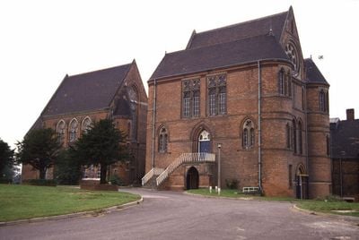
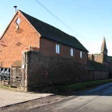
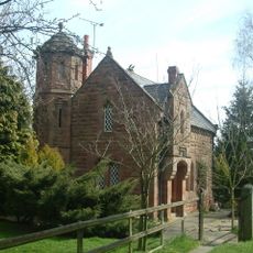
The Pumping Station, Whitacre Waterworks, Victorian water pumping station in Shustoke, England

The Pumping Station is a red brick building with stone trim, gothic windows, and a prominent central gabled section with tall rooflines. The structure features cylindrical corner towers and decorative clay tile work that transforms an industrial facility into an architecturally refined structure.

Built in 1883, the facility initially supplied water to Birmingham and later expanded its service to Coventry, Nuneaton, and Bedworth. This growth pattern reflects the rapid industrial expansion across the Midlands during the late 1800s.

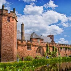
The name and architectural choices reflect how essential clean water was to the region's industrial growth during Victorian times. The building demonstrates the pride that communities took in providing this vital service.

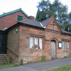
The building is currently inaccessible and stands abandoned behind a modern water treatment facility. You can view the exterior architecture from the surrounding grounds, though interior access is not available.

One of the original James Watt beam engines that powered this station is now on display at Birmingham's ThinkTank Museum. This engine represents the steam technology that originally drove the entire operation.

Location: Shustoke

Inception: 1883

GPS coordinates: 52.51863,-1.68321

Latest update: December 14, 2025 18:10

Photos
Around this place
Maxstoke Castle
United Kingdom

Maxstoke Castle

2.3 km
Blyth Hall
United Kingdom

Blyth Hall

1.3 km
Church of St Peter and St Paul, Coleshill
United Kingdom

Church of St Peter and St Paul, Coleshill

2.6 km
Church of St Nicholas and St Peter ad Vincula, Curdworth
United Kingdom

Church of St Nicholas and St Peter ad Vincula, Curdworth

4.1 km
St Peter and St Paul's Church, Water Orton
United Kingdom

St Peter and St Paul's Church, Water Orton

3.9 km
Church of St Leonard
United Kingdom

Church of St Leonard

3.9 km
Church of St Cuthbert, Shustoke
United Kingdom

Church of St Cuthbert, Shustoke

2.7 km
Church of St Michael and All Angels
United Kingdom

Church of St Michael and All Angels

4.8 km
Church of St Giles
United Kingdom

Church of St Giles

2.2 km
Church of St John the Baptist
United Kingdom

Church of St John the Baptist

1.9 km
The Bulls Head Inn
United Kingdom

The Bulls Head Inn

3.2 km
Remains of Tower and Walls of Monastic Church Approximately 250 Metres South of Priory Farmhouse
United Kingdom

Remains of Tower and Walls of Monastic Church Approximately 250 Metres South of Priory Farmhouse

4.9 km
Blyth Bridge (That Part In Coleshill Civil Parish)
United Kingdom

Blyth Bridge (That Part In Coleshill Civil Parish)

1.5 km
Cole Bridge
United Kingdom

Cole Bridge

2.4 km
The Old Rectory
United Kingdom

The Old Rectory

4.8 km
Water Orton Bridge
United Kingdom

Water Orton Bridge

4.2 km
Coleshill War Memorial, Warwickshire
United Kingdom

Coleshill War Memorial, Warwickshire

2.6 km
Churchyard Cross At Church Of St Leonard
United Kingdom

Churchyard Cross At Church Of St Leonard

3.9 km
Outer Gatehouse and Attached Precinct Walls and Barn 200 Metres North of Priory Farmhouse
United Kingdom

Outer Gatehouse and Attached Precinct Walls and Barn 200 Metres North of Priory Farmhouse

4.7 km
Priory Farmhouse
United Kingdom

Priory Farmhouse

4.8 km
Churchyard cross, St Michael's churchyard
United Kingdom

Churchyard cross, St Michael's churchyard

4.8 km
Precinct Wall, 60 Metres Northwest of Old Rectory
United Kingdom

Precinct Wall, 60 Metres Northwest of Old Rectory

4.7 km
Monwode House Farmhouse
United Kingdom

Monwode House Farmhouse

4.9 km
Blythe Lodge
United Kingdom

Blythe Lodge

1.5 km
Precinct Wall, East of Outer Gatehouse and Bounding Churchyard of St Michael and All Saints on the West
United Kingdom

Precinct Wall, East of Outer Gatehouse and Bounding Churchyard of St Michael and All Saints on the West

4.8 km
Manor House
United Kingdom

Manor House

4.6 km
Village Hall
United Kingdom

Village Hall

3.8 km
Blyth Hall Packhorse Bridge
United Kingdom

Blyth Hall Packhorse Bridge

542 m
Show the full map
Reviews

Visited this place? Tap the stars to rate it and share your experience / photos with the community! Try now! You can cancel it anytime.

« The Pumping Station, Whitacre Waterworks - Victorian water pumping station in Shustoke, England » is provided by Around Us (aroundus.com). Images and texts are derived from Wikimedia project under a Creative Commons license. You are allowed to copy, distribute, and modify copies of this page, under the conditions set by the license, as long as this note is clearly visible.

Discover hidden gems everywhere you go!

From secret cafés to breathtaking viewpoints, skip the crowded tourist spots and find places that match your style. Our app makes it easy with voice search, smart filtering, route optimization, and insider tips from travelers worldwide. Download now for the complete mobile experience.

Around Us App Screenshot

A unique approach to discovering new places

Le Figaro

All the places worth exploring

France Info

A tailor-made excursion in just a few clicks

20 Minutes